 |
|
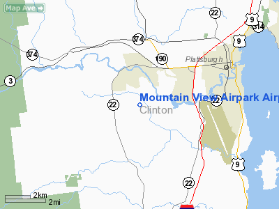
Mountain View Airpark Airport |
Location & QuickFacts
| FAA Information Effective: | 2008-09-25 |
| Airport Identifier: | 4NY0 |
| Airport Status: | Operational |
| Longitude/Latitude: | 073-32-46.4920W/44-40-08.1550N
-73.546248/44.668932 (Estimated) |
| Elevation: | 500 ft / 152.40 m (Estimated) |
| Land: | 54 acres |
| From nearest city: | 3 nautical miles W of Beekmantown, NY |
| Location: | Clinton County, NY |
| Magnetic Variation: | 15W (1985) |
Owner & Manager
| Ownership: | Privately owned |
| Owner: | Gary Montpelier |
| Address: | Daquette Rd
W. Chazy, NY 12992 |
| Phone number: | 518-563-2149 |
| Manager: | Gary Montpelier |
| Address: | Daquette Rd
W. Chazy, NY 12992 |
| Phone number: | 518-563-2149 |
Airport Operations and Facilities
| Airport Use: | Private |
| Wind indicator: | Yes |
| Segmented Circle: | No |
| Control Tower: | No |
| Sectional chart: | Montreal |
| Region: | AEA - Eastern |
| Boundary ARTCC: | ZBW - Boston |
| Tie-in FSS: | BTV - Burlington |
| FSS on Airport: | No |
| FSS Toll Free: | 1-800-WX-BRIEF |
Runway Information
Runway 02/20
| Dimension: | 1800 x 75 ft / 548.6 x 22.9 m |
| Surface: | TURF, |
| |
Runway 02 |
Runway 20 |
| Traffic Pattern: | Left | Right |
|
Radio Navigation Aids
| ID |
Type |
Name |
Ch |
Freq |
Var |
Dist |
| MPV | FAN MARKER | Brook | | | | 43.5 nm |
| VKN | NDB | Mount Mansfield | | 268.00 | 16W | 40.3 nm |
| JRV | NDB | Morrisville/stowe | | 375.00 | 16W | 41.4 nm |
| U | NDB | Uniform | | 201.00 | 15W | 48.2 nm |
| JL | NDB | Cote St Luc | | 370.00 | 16W | 48.2 nm |
| UL | NDB | Montreal | | 248.00 | 16W | 49.2 nm |
| SLK | VOR/DME | Saranac Lake | 029X | 109.20 | 14W | 33.0 nm |
| PLB | VORTAC | Plattsburgh | 116X | 116.90 | 15W | 1.4 nm |
| BTV | VORTAC | Burlington | 122X | 117.50 | 15W | 22.6 nm |
| YJN | VORTAC | St Jean | 105X | 115.80 | 16W | 36.6 nm |
| BTV | VOT | Burlington Intl | | 109.00 | | 20.9 nm |
Remarks
- PROVIDED PRIOR TO CONDUCTING OPNS, YOU CONTACT OWNER OF VASILE FIELD TO AVOID CONFLICT OF TFC PATTERNS; ALSO COORDINATE WITH BURLINGTON VT ATCT FOR PROCEDURES TO AVOID CONFLICT WITH IFR TFC AT CLINTON CO. ARPT.
Images and information placed above are from
http://www.airport-data.com/airport/4NY0/
We thank them for the data!
| General Info
|
| Country |
United States
|
| State |
NEW YORK
|
| FAA ID |
4NY0
|
| Latitude |
44-40-08.155N
|
| Longitude |
073-32-46.492W
|
| Elevation |
500 feet
|
| Near City |
BEEKMANTOWN
|
We don't guarantee the information is fresh and accurate. The data may
be wrong or outdated.
For more up-to-date information please refer to other sources.
|
|


