 |
|
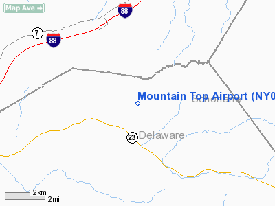
Location & QuickFacts
| FAA Information Effective: | 2008-09-25 |
| Airport Identifier: | NY02 |
| Airport Status: | Operational |
| Longitude/Latitude: | 074-46-48.5550W/42-29-14.2790N
-74.780154/42.487300 (Estimated) |
| Elevation: | 1960 ft / 597.41 m (Estimated) |
| Land: | 0 acres |
| From nearest city: | 3 nautical miles NE of Davenport, NY |
| Location: | Delaware County, NY |
| Magnetic Variation: | 13W (1985) |
Owner & Manager
| Ownership: | Privately owned |
| Owner: | Mountain Top Airport Corp |
| Address: | Zimmerman Road
Davenport, NY 13750 |
| Phone number: | 607-278-5430 |
| Manager: | Alan Schoonmaker |
| Address: | Po Box 28
Davenport, NY 13750 |
| Phone number: | 607-278-5430 |
Airport Operations and Facilities
| Airport Use: | Private |
| Wind indicator: | No |
| Segmented Circle: | No |
| Control Tower: | No |
| Landing fee charge: | No |
| Sectional chart: | New York |
| Region: | AEA - Eastern |
| Boundary ARTCC: | ZBW - Boston |
| Tie-in FSS: | BUF - Buffalo |
| FSS on Airport: | No |
| FSS Toll Free: | 1-800-WX-BRIEF |
Airport Communications
Airport Services
| Airframe Repair: | NONE |
| Power Plant Repair: | NONE |
| Bottled Oxygen: | NONE |
| Bulk Oxygen: | NONE |
Runway Information
Runway 06/24
| Dimension: | 2180 x 150 ft / 664.5 x 45.7 m |
| Surface: | TURF, |
| |
Runway 06 |
Runway 24 |
| Traffic Pattern: | Left | Left |
| Runway End Identifier: | No | No |
| Centerline Lights: | No | No |
| Touchdown Lights: | No | No |
|
Radio Navigation Aids
| ID |
Type |
Name |
Ch |
Freq |
Var |
Dist |
| JJH | NDB | Johnstown | | 523.00 | 14W | 36.6 nm |
| CJY | NDB | Clay | | 275.00 | 12W | 40.1 nm |
| HEU | NDB | Hunter | | 356.00 | 14W | 43.4 nm |
| MS | NDB | Monga | | 359.00 | 12W | 43.5 nm |
| PFH | NDB | Philmont | | 272.00 | 13W | 49.0 nm |
| DNY | VOR/DME | De Lancey | 058X | 112.10 | 11W | 20.2 nm |
| RKA | VOR/DME | Rockdale | 073X | 112.60 | 11W | 20.4 nm |
| HNK | VOR/DME | Hancock | 115X | 116.80 | 11W | 34.9 nm |
| UCA | VORTAC | Utica | 049X | 111.20 | 12W | 36.6 nm |
| ALB | VORTAC | Albany | 100X | 115.30 | 13W | 46.0 nm |
| GGT | VORTAC | Georgetown | 125X | 117.80 | 11W | 49.7 nm |
| ALB | VOT | Albany County | | 108.20 | | 45.1 nm |
Remarks
- VFR WEATHER CONDITIONS; PRIOR TO OPENING, CTC ALBANY GADO (518-869-8482) AND REQUEST AN ON-SITE INSPECTION.
Images and information placed above are from
http://www.airport-data.com/airport/NY02/
We thank them for the data!
| General Info
|
| Country |
United States
|
| State |
NEW YORK
|
| FAA ID |
NY02
|
| Latitude |
42-29-14.279N
|
| Longitude |
074-46-48.555W
|
| Elevation |
1960 feet
|
| Near City |
DAVENPORT
|
We don't guarantee the information is fresh and accurate. The data may
be wrong or outdated.
For more up-to-date information please refer to other sources.
|
|


