 |
|
Location & QuickFacts
| FAA Information Effective: | 2008-09-25 |
| Airport Identifier: | 4N2 |
| Airport Status: | Operational |
| Longitude/Latitude: | 077-16-31.9300W/42-42-34.2300N
-77.275536/42.709508 (Estimated) |
| Elevation: | 735 ft / 224.03 m (Estimated) |
| Land: | 56 acres |
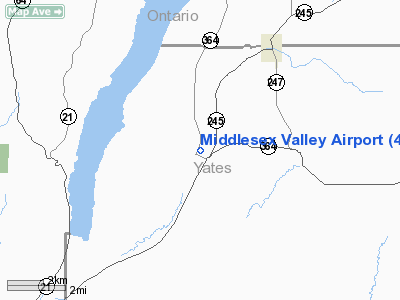
| From nearest city: | 1 nautical miles NW of Middlesex, NY |
| Location: | Yates County, NY |
| Magnetic Variation: | 12W (1995) |
Owner & Manager
| Ownership: | Privately owned |
| Owner: | Robert Mincer |
| Address: | 1078 Lincoln Ave
Middlesex, NY 14507 |
| Phone number: | 585-554-4024 |
| Manager: | Robert Mincer |
| Address: | 1078 Lincoln Ave
Middlesex, NY 14507 |
| Phone number: | 585-554-4024 |
Airport Operations and Facilities
| Airport Use: | Open to public |
| Wind indicator: | Yes |
| Segmented Circle: | No |
| Control Tower: | No |
| Sectional chart: | Lake Huron |
| Region: | AEA - Eastern |
| Boundary ARTCC: | ZOB - Cleveland |
| Tie-in FSS: | BUF - Buffalo |
| FSS on Airport: | No |
| FSS Toll Free: | 1-800-WX-BRIEF |
| NOTAMs Facility: | BUF (NOTAM-d service avaliable) |
Airport Communications
| CTAF: | 122.700 |
| Unicom: | 122.700 |
Airport Services
| Fuel available: | 80 MOGAS |
| Airframe Repair: | MINOR |
| Power Plant Repair: | MINOR |
Runway Information
Runway 03/21
| Dimension: | 2130 x 175 ft / 649.2 x 53.3 m |
| Surface: | TURF, Good Condition |
| |
Runway 03 |
Runway 21 |
| Traffic Pattern: | Left | Left |
| Obstruction: | 26 ft trees, 9.0 ft from runway, 109 ft right of centerline | 50 ft trees, 850.0 ft from runway, 155 ft left of centerline, 17:1 slope to clear |
|
Radio Navigation Aids
| ID |
Type |
Name |
Ch |
Freq |
Var |
Dist |
| PYA | NDB | Penn Yan | | 260.00 | 12W | 10.5 nm |
| AVN | NDB | Avon | | 344.00 | 09W | 28.3 nm |
| ALP | NDB | Alpine | | 245.00 | 12W | 36.3 nm |
| EL | NDB | Halos | | 269.00 | 09W | 45.9 nm |
| GEE | VOR/DME | Geneseo | 019X | 108.20 | 09W | 21.5 nm |
| ITH | VOR/DME | Ithaca | 055X | 111.80 | 10W | 38.3 nm |
| ULW | VOR/DME | Elmira | 033Y | 109.65 | 12W | 38.6 nm |
| ROC | VORTAC | Rochester | 037X | 110.00 | 09W | 30.3 nm |
| ELZ | VORTAC | Wellsville | 051X | 111.40 | 09W | 49.2 nm |
Remarks
- RY 03/21 +4 FT FENCE LCTD ALONG EAST RY EDGE.
- +4 FT HIGH FENCE LCTD ALG E EDGE OF RY, 88 FT FM CNTRLN.
- PROVIDED VFR USE.
Images and information placed above are from
http://www.airport-data.com/airport/4N2/
We thank them for the data!
| General Info
|
| Country |
United States
|
| State |
NEW YORK
|
| FAA ID |
4N2
|
| Latitude |
42-42-34.230N
|
| Longitude |
077-16-31.930W
|
| Elevation |
735 feet
|
| Near City |
MIDDLESEX
|
We don't guarantee the information is fresh and accurate. The data may
be wrong or outdated.
For more up-to-date information please refer to other sources.
|
|


