 |
|
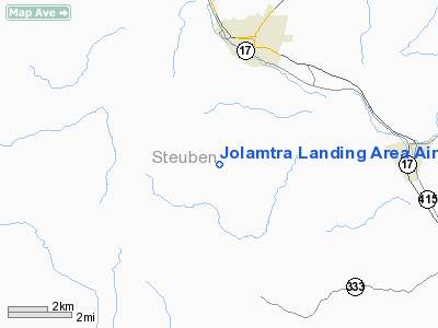
Jolamtra Landing Area Airport |
Location & QuickFacts
| FAA Information Effective: | 2008-09-25 |
| Airport Identifier: | 23NY |
| Airport Status: | Operational |
| Longitude/Latitude: | 077-20-23.9290W/42-16-47.2610N
-77.339980/42.279795 (Estimated) |
| Elevation: | 1700 ft / 518.16 m (Estimated) |
| Land: | 0 acres |
| From nearest city: | 3 nautical miles S of Bath, NY |
| Location: | Steuben County, NY |
| Magnetic Variation: | 11W (1985) |
Owner & Manager
| Ownership: | Privately owned |
| Owner: | Herbert Townsend |
| Address: | 5752 Wind Fall Rd.
Bath, NY 14810 |
| Phone number: | 607-776-6088 |
| Manager: | Herbert Townsend |
| Address: | 5752 Wind Fall Rd.
Bath, NY 14810 |
| Phone number: | 607-776-6088 |
Airport Operations and Facilities
| Airport Use: | Private |
| Wind indicator: | Yes |
| Segmented Circle: | No |
| Control Tower: | No |
| Landing fee charge: | No |
| Sectional chart: | Detroit |
| Region: | AEA - Eastern |
| Boundary ARTCC: | ZOB - Cleveland |
| Tie-in FSS: | BUF - Buffalo |
| FSS on Airport: | No |
| FSS Toll Free: | 1-800-WX-BRIEF |
Airport Services
| Fuel available: | 80 |
| Airframe Repair: | NONE |
| Power Plant Repair: | NONE |
Runway Information
Runway 04/22
| Dimension: | 1900 x 100 ft / 579.1 x 30.5 m |
| Surface: | TURF, |
| |
Runway 04 |
Runway 22 |
| Traffic Pattern: | Left | Left |
|
Runway 10/28
| Dimension: | 1500 x 75 ft / 457.2 x 22.9 m |
| Surface: | TURF, |
| |
Runway 10 |
Runway 28 |
| Traffic Pattern: | Left | Left |
|
Radio Navigation Aids
| ID |
Type |
Name |
Ch |
Freq |
Var |
Dist |
| PYA | NDB | Penn Yan | | 260.00 | 12W | 25.3 nm |
| ALP | NDB | Alpine | | 245.00 | 12W | 25.7 nm |
| EL | NDB | Halos | | 269.00 | 09W | 27.6 nm |
| LYS | NDB | Olean | | 360.00 | 09W | 44.2 nm |
| AVN | NDB | Avon | | 344.00 | 09W | 47.8 nm |
| ULW | VOR/DME | Elmira | 033Y | 109.65 | 12W | 17.9 nm |
| SFK | VOR/DME | Stonyfork | 023X | 108.60 | 08W | 35.3 nm |
| GEE | VOR/DME | Geneseo | 019X | 108.20 | 09W | 37.6 nm |
| ITH | VOR/DME | Ithaca | 055X | 111.80 | 10W | 41.2 nm |
| ELZ | VORTAC | Wellsville | 051X | 111.40 | 09W | 31.5 nm |
Images and information placed above are from
http://www.airport-data.com/airport/23NY/
We thank them for the data!
| General Info
|
| Country |
United States
|
| State |
NEW YORK
|
| FAA ID |
23NY
|
| Latitude |
42-16-47.261N
|
| Longitude |
077-20-23.929W
|
| Elevation |
1700 feet
|
| Near City |
BATH
|
We don't guarantee the information is fresh and accurate. The data may
be wrong or outdated.
For more up-to-date information please refer to other sources.
|
|


