 |
|
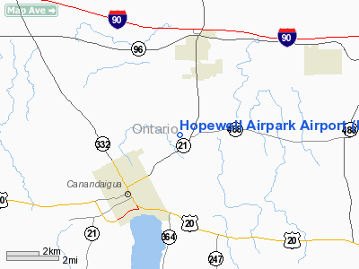
Location & QuickFacts
| FAA Information Effective: | 2008-09-25 |
| Airport Identifier: | D43 |
| Airport Status: | Operational |
| Longitude/Latitude: | 077-14-34.0000W/42-55-10.2300N
-77.242778/42.919508 (Estimated) |
| Elevation: | 730 ft / 222.50 m (Estimated) |
| Land: | 80 acres |
| From nearest city: | 3 nautical miles NE of Canandaigua, NY |
| Location: | Ontario County, NY |
| Magnetic Variation: | 11W (1985) |
Owner & Manager
| Ownership: | Privately owned |
| Owner: | Hopewell Airpark, Inc. |
| Address: | Schutt Road
Canandaigua, NY 14424 |
| Phone number: | 585-554-6112 |
| Manager: | Paul Moore |
| Address: | 5951 South Vine Valley Road
Middlesesx, NY 14507 |
Airport Operations and Facilities
| Airport Use: | Open to public |
| Wind indicator: | Yes |
| Segmented Circle: | No |
| Control Tower: | No |
| Lighting Schedule: | PHONE REQ
FOR LIRL RY 07/25 PPR 2 HRS IN ADVANCE CALL 585-554-6112. |
| Landing fee charge: | No |
| Sectional chart: | Detroit |
| Region: | AEA - Eastern |
| Traffic Pattern Alt: | 1500 ft |
| Boundary ARTCC: | ZOB - Cleveland |
| Tie-in FSS: | BUF - Buffalo |
| FSS on Airport: | No |
| FSS Toll Free: | 1-800-WX-BRIEF |
| NOTAMs Facility: | BUF (NOTAM-d service avaliable) |
Airport Communications
| CTAF: | 122.800 |
| Unicom: | 122.800 |
Airport Services
| Airframe Repair: | MINOR |
| Power Plant Repair: | MINOR |
| Bottled Oxygen: | NONE |
| Bulk Oxygen: | NONE |
Runway Information
Runway 01/19
| Dimension: | 1495 x 65 ft / 455.7 x 19.8 m |
| Surface: | TURF, Good Condition |
| |
Runway 01 |
Runway 19 |
| Traffic Pattern: | Left | Left |
| Obstruction: | 10 ft bush, 35 ft right of centerline | 18 ft trees, 0.0 ft from runway, 45L/ ft right of centerline |
|
Runway 07/25
| Dimension: | 1425 x 80 ft / 434.3 x 24.4 m |
| Surface: | TURF, Good Condition |
| Edge Lights: | Non-standard lighting system
RY 07/25 LIRL LGTD PAINTED WHITE CONES. |
| |
Runway 07 |
Runway 25 |
| Traffic Pattern: | Left | Left |
| Obstruction: | 46 ft trees, 566.0 ft from runway, 120 ft right of centerline, 12:1 slope to clear | 15 ft road, 34.0 ft from runway, 2:1 slope to clear |
|
Radio Navigation Aids
| ID |
Type |
Name |
Ch |
Freq |
Var |
Dist |
| PYA | NDB | Penn Yan | | 260.00 | 12W | 18.5 nm |
| AVN | NDB | Avon | | 344.00 | 09W | 23.8 nm |
| ALP | NDB | Alpine | | 245.00 | 12W | 46.1 nm |
| GEE | VOR/DME | Geneseo | 019X | 108.20 | 09W | 22.2 nm |
| ITH | VOR/DME | Ithaca | 055X | 111.80 | 10W | 43.0 nm |
| ROC | VORTAC | Rochester | 037X | 110.00 | 09W | 22.5 nm |
| SYR | VORTAC | Syracuse | 117X | 117.00 | 11W | 47.9 nm |
Remarks
- RY 07/25 FARM EQUIPMENT CROSSING APPROACH.
- RY 01/19 HAS +15 FT TREE LINE 80 FT FM CNTRLN WEST SIDE OF RY.
- RY 25 HAS +15 FT ROAD, 34 FT FM THLD.
- EXISTED PRIOR TO 5/15/59
Images and information placed above are from
http://www.airport-data.com/airport/D43/
We thank them for the data!
| General Info
|
| Country |
United States
|
| State |
NEW YORK
|
| FAA ID |
D43
|
| Latitude |
42-55-10.230N
|
| Longitude |
077-14-34.000W
|
| Elevation |
730 feet
|
| Near City |
CANANDAIGUA
|
We don't guarantee the information is fresh and accurate. The data may
be wrong or outdated.
For more up-to-date information please refer to other sources.
|
|


