 |
|
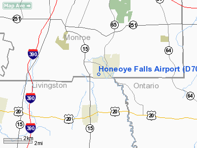
Location & QuickFacts
| FAA Information Effective: | 2008-09-25 |
| Airport Identifier: | D70 |
| Airport Status: | Closed Permanently |
| Longitude/Latitude: | 077-35-58.9940W/42-56-50.2270N
-77.599721/42.947285 (Estimated) |
| Elevation: | 683 ft / 208.18 m (Surveyed) |
| Land: | 10 acres |
| From nearest city: | 1 nautical miles SW of Honeoye Falls, NY |
| Location: | Monroe County, NY |
| Magnetic Variation: | 11W (1985) |
Owner & Manager
| Ownership: | Privately owned |
| Owner: | Estate Of Everett Lewis
CONTACT IS JUDY LEWIS |
| Address: | 6 Creekside Dr.
Honeoye Falls, NY 14472 |
| Phone number: | 585-624-2282 |
| Manager: | William Delmore |
| Address: | 3718 Route 96 #10
Shortsville, NY 14548 |
| Phone number: | 585-624-2796 |
Airport Operations and Facilities
| Airport Use: | Open to public |
| Wind indicator: | Yes |
| Segmented Circle: | No |
| Control Tower: | No |
| Landing fee charge: | No |
| Sectional chart: | Detroit |
| Region: | AEA - Eastern |
| Boundary ARTCC: | ZOB - Cleveland |
| Tie-in FSS: | BUF - Buffalo |
| FSS on Airport: | No |
| FSS Toll Free: | 1-800-WX-BRIEF |
| NOTAMs Facility: | BUF (NOTAM-d service avaliable) |
Airport Communications
Airport Services
| Bottled Oxygen: | NONE |
| Bulk Oxygen: | NONE |
Runway Information
Runway 01/19
| Dimension: | 1685 x 90 ft / 513.6 x 27.4 m
REMEASURED ADDED 45' TO NORTH END |
| Surface: | TURF, Good Condition |
| |
Runway 01 |
Runway 19 |
| Traffic Pattern: | Left | Left |
| Obstruction: | 40 ft trees, 16.0 ft from runway, 58 ft left of centerline | 63 ft bldg, 141.0 ft from runway, 91 ft left of centerline, 2:1 slope to clear |
|
Radio Navigation Aids
| ID |
Type |
Name |
Ch |
Freq |
Var |
Dist |
| AVN | NDB | Avon | | 344.00 | 09W | 8.4 nm |
| PYA | NDB | Penn Yan | | 260.00 | 12W | 30.1 nm |
| GEE | VOR/DME | Geneseo | 019X | 108.20 | 09W | 9.0 nm |
| BUF | VOR/DME | Buffalo | 111X | 116.40 | 08W | 46.1 nm |
| ROC | VORTAC | Rochester | 037X | 110.00 | 09W | 10.9 nm |
| BUF | VOT | Buffalo | | 109.00 | | 49.9 nm |
Remarks
- RY 01/19 40-60 FT TREES LINE BOTH RY EDGES 45 FT FM RY CNTRLN.
- RWY 19: +17' BLDG. LOCATED 40' FROM THRESHOLD ON CENTERLINE;+76' TREE, 102' FRM RWY, 33' LEFT
- (ARPT STATUS) ARPT CLSD PERMLY.
- EXISTED PRIOR TO 1959.
Images and information placed above are from
http://www.airport-data.com/airport/D70/
We thank them for the data!
| General Info
|
| Country |
United States
|
| State |
NEW YORK
|
| FAA ID |
D70
|
| Latitude |
42-56-50.227N
|
| Longitude |
077-35-58.994W
|
| Elevation |
683 feet
|
| Near City |
HONEOYE FALLS
|
We don't guarantee the information is fresh and accurate. The data may
be wrong or outdated.
For more up-to-date information please refer to other sources.
|
|


