 |
|
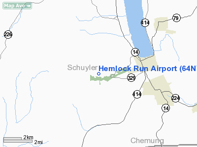
Location & QuickFacts
| FAA Information Effective: | 2008-09-25 |
| Airport Identifier: | 64NY |
| Airport Status: | Operational |
| Longitude/Latitude: | 076-55-51.8600W/42-22-02.2600N
-76.931072/42.367294 (Estimated) |
| Elevation: | 1300 ft / 396.24 m () |
| Land: | 0 acres |
| From nearest city: | 3 nautical miles W of Watkins Glen, NY |
| Location: | Albany County, NY |
| Magnetic Variation: | 12W (2000) |
Owner & Manager
| Ownership: | Privately owned |
| Owner: | Joesph A Greist |
| Address: | 2751 Ellison Rd
Watkins Glen, NY 14891 |
| Phone number: | 607-962-2438 |
| Manager: | Joesph A Greist |
| Address: | 2751 Ellison Rd
Watkins Glen, NY 14891 |
| Phone number: | 607-962-2438 |
Airport Operations and Facilities
| Airport Use: | Private |
| Segmented Circle: | No |
| Control Tower: | No |
| Sectional chart: | New York |
| Region: | AEA - Eastern |
| Boundary ARTCC: | ZNY - New York |
| Tie-in FSS: | BUF - Buffalo |
| FSS Toll Free: | 1-800-WX-BRIEF |
Runway Information
Runway 13/31
| Dimension: | 1900 x 150 ft / 579.1 x 45.7 m |
| Surface: | TURF, |
| |
Runway 13 |
Runway 31 |
| Traffic Pattern: | Left | Left |
|
Runway 18/36
| Dimension: | 1320 x 150 ft / 402.3 x 45.7 m |
| Surface: | TURF, |
| |
Runway 18 |
Runway 36 |
| Traffic Pattern: | Left | Left |
|
Helipad H1
| Dimension: | 50 x 50 ft / 15.2 x 15.2 m |
| Surface: | TURF, |
| |
Runway H1 |
Runway |
| Traffic Pattern: | Left | Left |
|
Radio Navigation Aids
| ID |
Type |
Name |
Ch |
Freq |
Var |
Dist |
| ALP | NDB | Alpine | | 245.00 | 12W | 10.7 nm |
| PYA | NDB | Penn Yan | | 260.00 | 12W | 17.5 nm |
| EL | NDB | Halos | | 269.00 | 09W | 46.4 nm |
| ULW | VOR/DME | Elmira | 033Y | 109.65 | 12W | 16.9 nm |
| ITH | VOR/DME | Ithaca | 055X | 111.80 | 10W | 22.3 nm |
| GEE | VOR/DME | Geneseo | 019X | 108.20 | 09W | 45.2 nm |
| SFK | VOR/DME | Stonyfork | 023X | 108.60 | 08W | 45.9 nm |
| CFB | VORTAC | Binghamton | 059X | 112.20 | 10W | 37.5 nm |
Remarks
- PRVDD VFR, NO IFR OPNS, CLEAR 20:1 APCH/DEP PATH ON RYS; CLEAR 8:1 INGRESS/EGRESS & CLEAR MKGS FOR H1. WIND INDICATOR BE INSTALLED.
Images and information placed above are from
http://www.airport-data.com/airport/64NY/
We thank them for the data!
| General Info
|
| Country |
United States
|
| State |
NEW YORK
|
| FAA ID |
64NY
|
| Latitude |
42-22-02.260N
|
| Longitude |
076-55-51.860W
|
| Elevation |
1300 feet
|
| Near City |
WATKINS GLEN
|
We don't guarantee the information is fresh and accurate. The data may
be wrong or outdated.
For more up-to-date information please refer to other sources.
|
|


