 |
|
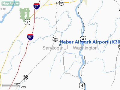
Location & QuickFacts
| FAA Information Effective: | 2008-09-25 |
| Airport Identifier: | K30 |
| Airport Status: | Operational |
| Longitude/Latitude: | 073-37-59.4200W/43-11-00.2660N
-73.633172/43.183407 (Estimated) |
| Elevation: | 230 ft / 70.10 m (Estimated) |
| Land: | 20 acres |
| From nearest city: | 2 nautical miles SE of Gansevoort, NY |
| Location: | Saratoga County, NY |
| Magnetic Variation: | 14W (1985) |
Owner & Manager
| Ownership: | Privately owned |
| Owner: | Heber Airpark Inc |
| Address: | 288 Brownville Rd
Gansevoort, NY 12831 |
| Phone number: | 518-793-8983 |
| Manager: | James Heber |
| Address: | 286 Brownville Rd
Gansevoort, NY 12831 |
| Phone number: | 518-793-8983 |
Airport Operations and Facilities
| Airport Use: | Open to public |
| Wind indicator: | Yes |
| Segmented Circle: | Yes |
| Control Tower: | No |
| Lighting Schedule: | RDO-CTL
ACTVT MIRL RY 06/24 - CTAF. |
| Sectional chart: | New York |
| Region: | AEA - Eastern |
| Boundary ARTCC: | ZBW - Boston |
| Tie-in FSS: | BTV - Burlington |
| FSS on Airport: | No |
| FSS Toll Free: | 1-800-WX-BRIEF |
| NOTAMs Facility: | BTV (NOTAM-d service avaliable) |
Airport Communications
Airport Services
Runway Information
Runway 06/24
| Dimension: | 2200 x 24 ft / 670.6 x 7.3 m |
| Surface: | ASPH, Good Condition
LIGHT COLORED FULL WIDTH CONCRETE PAVEMENT SECTION 144' FROM RY 24 THRESHOLD, 20' LONG. |
| Edge Lights: | Non-standard lighting system
RY 06/24 NSTD MIRL DUE TO SPACING, 33 FT FM RY EDGE ON 3 FT WOOD POSTS. |
| |
Runway 06 |
Runway 24 |
| Traffic Pattern: | Right | Left |
| Markings: | Nonstandard, Good Condition
06/24 NSTD DSPLCD THLD; NO BAR. | Nonstandard, Good Condition |
| Displaced threshold: | 200.00 ft | 0.00 ft |
| Obstruction: | 15 ft road, 200.0 ft from runway, 50 ft left of centerline
RY 06 APCH RATIO 1:1 TO DSPLCD THLD. | 60 ft trees, 800.0 ft from runway, 150 ft left of centerline, 10:1 slope to clear
RY 24: +6' BRUSH AT 10' FROM THRESHOLD. |
|
Radio Navigation Aids
| ID |
Type |
Name |
Ch |
Freq |
Var |
Dist |
| R | FAN MARKER | Chitt | | | 14W | 39.6 nm |
| PSF | FAN MARKER | Abyss | | | 13W | 47.5 nm |
| HEU | NDB | Hunter | | 356.00 | 14W | 23.9 nm |
| JJH | NDB | Johnstown | | 523.00 | 14W | 32.6 nm |
| VWD | NDB | Mount Snow | | 224.00 | 15W | 37.1 nm |
| DYO | NDB | Smuto | | 221.00 | 15W | 43.1 nm |
| SXD | NDB | Springfield | | 265.00 | 15W | 46.1 nm |
| DXT | NDB | Dalton | | 370.00 | 15W | 47.4 nm |
| CAM | VOR/DME | Cambridge | 097X | 115.00 | 14W | 17.0 nm |
| RUT | VOR/DME | Rutland | 47X | 111.00 | 15W | 36.3 nm |
| GFL | VORTAC | Glens Falls | 039X | 110.20 | 14W | 9.6 nm |
| ALB | VORTAC | Albany | 100X | 115.30 | 13W | 27.3 nm |
| ALB | VOT | Albany County | | 108.20 | | 27.8 nm |
Remarks
- BIRDS & WILDLIFE ON & INVOF ARPT.
- GOLF COURSE ADJ TO RY BOTH SIDES.
- RY 24 UPHILL GRADE EXCEEDS 2%.
- 25 FT DROPOFF 10 FT FM RY 24 THLD.
- PRVDD YOU TAKE STEPS TO ENSURE ALL PILOTS USING ARPT ARE AWARE OF CONFLICTING TFC PATTERNS BETWEEN YOUR ARPT & SHAW ARPT. TFC PATTERNS AT HEBER SHOULD BE FLOWN TO THE S OF THE ARPT; THOSE AT SHAW SHOULD FLY PATTERNS E; LOA BETWEEN YOU & SHAW ARPT SHOULD BE SIGNED & FORWARDED TO AEA.
Images and information placed above are from
http://www.airport-data.com/airport/K30/
We thank them for the data!
| General Info
|
| Country |
United States
|
| State |
NEW YORK
|
| FAA ID |
K30
|
| Latitude |
43-11-00.266N
|
| Longitude |
073-37-59.420W
|
| Elevation |
230 feet
|
| Near City |
GANSEVOORT
|
We don't guarantee the information is fresh and accurate. The data may
be wrong or outdated.
For more up-to-date information please refer to other sources.
|
|


