 |
|
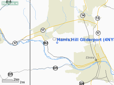
Harris Hill Gliderport Airport |
Location & QuickFacts
| FAA Information Effective: | 2008-09-25 |
| Airport Identifier: | 4NY8 |
| Airport Status: | Operational |
| Longitude/Latitude: | 076-54-03.8580W/42-07-15.2670N
-76.901072/42.120908 (Estimated) |
| Elevation: | 1709 ft / 520.90 m (Surveyed) |
| Land: | 0 acres |
| From nearest city: | 3 nautical miles NW of Elmira, NY |
| Location: | Chemung County, NY |
| Magnetic Variation: | 11W (1985) |
Owner & Manager
| Ownership: | Publicly owned |
| Owner: | Chemung County |
| Address: |
Elmira, NY 14903 |
| Phone number: | 607-737-2811 |
| Manager: | Harris Hill Soaring Corp |
| Address: | Rd 2 607 Post Creek Rd.
Beaver Dams, NY 14812 |
| Phone number: | 607-734-0641 |
Airport Operations and Facilities
| Airport Use: | Private |
| Wind indicator: | Yes |
| Segmented Circle: | No |
| Control Tower: | No |
| Landing fee charge: | No |
| Sectional chart: | New York |
| Region: | AEA - Eastern |
| Boundary ARTCC: | ZNY - New York |
| Tie-in FSS: | BUF - Buffalo |
| FSS on Airport: | No |
| FSS Toll Free: | 1-800-WX-BRIEF |
Airport Services
| Airframe Repair: | NONE |
| Power Plant Repair: | NONE |
Runway Information
Runway 16/34
| Dimension: | 1115 x 150 ft / 339.9 x 45.7 m
TWO PARALLEL ASPH STRIPS 1115X50 USED FOR TOWPLANES LND. 1115X150 EAST USED FOR TKOF. |
| Surface: | ASPH, |
| |
Runway 16 |
Runway 34 |
| Traffic Pattern: | Left | Right |
| Runway End Identifier: | No | No |
| Centerline Lights: | No | No |
| Touchdown Lights: | No | No |
|
Radio Navigation Aids
| ID |
Type |
Name |
Ch |
Freq |
Var |
Dist |
| ALP | NDB | Alpine | | 245.00 | 12W | 9.3 nm |
| PYA | NDB | Penn Yan | | 260.00 | 12W | 32.2 nm |
| EL | NDB | Halos | | 269.00 | 09W | 45.2 nm |
| ULW | VOR/DME | Elmira | 033Y | 109.65 | 12W | 5.7 nm |
| ITH | VOR/DME | Ithaca | 055X | 111.80 | 10W | 29.8 nm |
| SFK | VOR/DME | Stonyfork | 023X | 108.60 | 08W | 34.5 nm |
| FQM | VOR/DME | Williamsport | 091X | 114.40 | 09W | 47.4 nm |
| CFB | VORTAC | Binghamton | 059X | 112.20 | 10W | 34.1 nm |
| ELZ | VORTAC | Wellsville | 051X | 111.40 | 09W | 49.0 nm |
Remarks
- FREQUENT TURBULENCE, STONG WEST XWIND & SEVERE WIND GRADIENT CONDS ALL RWYS; GLIDERPORT ON HILLTOP 750 FEET ABOVE VALLEY.
- CONSIDERABLE SAILPLANE TFC IN AREA. GLIDERPORT IN CHEMUNG CO ARPT CTL ZONE. PMSN TO LND ONLY W PRIOR APVL OF MGR.
-
- EXISTED PRIOR TO 1959.
Images and information placed above are from
http://www.airport-data.com/airport/4NY8/
We thank them for the data!
| General Info
|
| Country |
United States
|
| State |
NEW YORK
|
| FAA ID |
4NY8
|
| Latitude |
42-07-15.267N
|
| Longitude |
076-54-03.858W
|
| Elevation |
1709 feet
|
| Near City |
ELMIRA
|
We don't guarantee the information is fresh and accurate. The data may
be wrong or outdated.
For more up-to-date information please refer to other sources.
|
|


