|
|
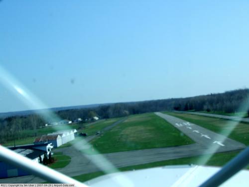 |
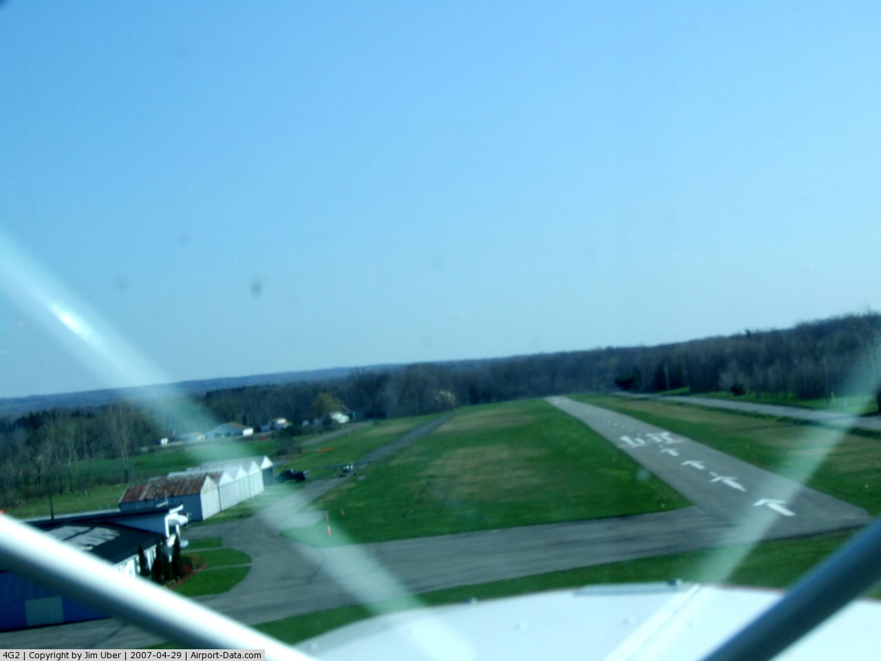
(Click on the photo to enlarge) |
Location & QuickFacts
| FAA Information Effective: | 2008-09-25 |
| Airport Identifier: | 4G2 |
| Airport Status: | Operational |
| Longitude/Latitude: | 078-54-53.1250W/42-42-03.2130N
-78.914757/42.700892 (Estimated) |
| Elevation: | 751 ft / 228.90 m (Surveyed) |
| Land: | 26 acres |
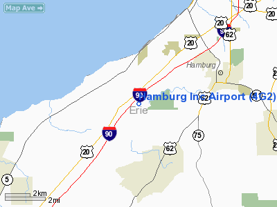
| From nearest city: | 4 nautical miles W of Hamburg, NY |
| Location: | Erie County, NY |
| Magnetic Variation: | 10W (1985) |
Owner & Manager
| Ownership: | Privately owned |
| Owner: | Hamburg Arpt Inc |
| Address: | 6765 Heltz Road
Lakeview, NY 14085 |
| Phone number: | 716-627-2440 |
| Manager: | Rod & Larry Walsh |
| Address: | Heltz Road
Lakeview, NY 14085 |
| Phone number: | 716-627-2440 |
Airport Operations and Facilities
| Airport Use: | Open to public |
| Wind indicator: | Yes |
| Segmented Circle: | No |
| Control Tower: | No |
| Lighting Schedule: | DUSK-DAWN
LIGHTS ON TIMER (DUSK TO DAWN)AND CAN ALSO BE LIGHTED BY CTAF 24/7 |
| Landing fee charge: | No |
| Sectional chart: | Detroit |
| Region: | AEA - Eastern |
| Boundary ARTCC: | ZOB - Cleveland |
| Tie-in FSS: | BUF - Buffalo |
| FSS on Airport: | No |
| FSS Toll Free: | 1-800-WX-BRIEF |
| NOTAMs Facility: | BUF (NOTAM-d service avaliable) |
Airport Communications
| CTAF: | 122.800 |
| Unicom: | 122.800 |
Airport Services
| Fuel available: | 100
SELF SERVE FUEL |
Runway Information
Runway 01/19
| Dimension: | 2465 x 30 ft / 751.3 x 9.1 m |
| Surface: | ASPH, Good Condition |
| Edge Lights: | Non-standard lighting system
NSTD LIRL DUE TO PLACEMENT. |
| |
Runway 01 |
Runway 19 |
| Traffic Pattern: | Left | Left |
| Markings: | Basic, Fair Condition | Basic, Fair Condition |
| Displaced threshold: | 462.00 ft | 456.00 ft |
| Obstruction: | 61 ft trees, 696.0 ft from runway, 8:1 slope to clear
0:1 SLOPE FROM DISPLACED THRESHOLD
RWY 01:+15' ROAD, PARALLEL TO RWY (0'FRM THRLD), 80' LT.;+15' ROAD TRANS. TO RWY, 88' FRM THLD.;+11' TREE, 47' PAST THLD, 24' RT.;+16' TREE, 120' FRM THLD, 50'RT.;+28' TREE, 131' FRM THLD, 63' LT. | 15 ft road, 200.0 ft from runway, 50 ft left of centerline
0:1 SLOPE FROM DISPLACED THRESHOLD
RWY 19:+15' ROAD, 105' FRM THLD AT CNTRLN;+15'ROAD, 0' FRM THRLD, 80' RT.;+12 FT BRUSH,110' FRM THLD 63' RT;+35' TREE AT THLD, 117' RT; +4' GAS PUMPS, 143' FRM THLD, 116' LT;+7' PLINE, 199' FRM THLD 125' LT.;+13' HGR., 0' FRM THLD, 149' LT. |
|
Radio Navigation Aids
| ID |
Type |
Name |
Ch |
Freq |
Var |
Dist |
| SN | NDB | St Catherines | | 408.00 | 01E | 30.7 nm |
| LYS | NDB | Olean | | 360.00 | 09W | 35.9 nm |
| IAG | TACAN | Niagara Falls | 047X | | 10W | 24.8 nm |
| BUF | VOR/DME | Buffalo | 111X | 116.40 | 08W | 18.1 nm |
| JHW | VOR/DME | Jamestown | 094X | 114.70 | 07W | 32.1 nm |
| DKK | VORTAC | Dunkirk | 109X | 116.20 | 07W | 20.3 nm |
| BUF | VOT | Buffalo | | 109.00 | | 16.4 nm |
Remarks
- PLINES 120'W OF RWY PARALLEL TO HELTZ RD; RWY 19 PLINES 1350' FROM END OF RWY & EXTENDS ALONG E SIDE OF HELTZ RD.
- TIE DOWN AREA AVAILABLE AT END OF RWY 19.
- ULTRA-LGT ACFT ON & INVOF ARPT.
- RWY 19 +36' TREE, 40' FRM THRLD, 120' RT
- RWY 01 :+26' POLE, 139' FRM THLD, 94' LT.;+30' POLE,143' FRM THLD, 121' LT.;+33' POLE, 79' FRM THLD, 120' LT., +60' TREES PENETRATE LT. LATRL, TRANS. SURF., 156' LT.;+22' TREES, PARALLEL TO RWY, 110' LT.;+40'-70' TREES PENETRATE LT. LATRL. TRANS. SURF.,130'-180' LT.
- EXISTED PRIOR TO 1959.
Images and information placed above are from
http://www.airport-data.com/airport/4G2/
We thank them for the data!
| General Info
|
| Country |
United States
|
| State |
NEW YORK
|
| FAA ID |
4G2
|
| Latitude |
42-42-03.213N
|
| Longitude |
078-54-53.125W
|
| Elevation |
751 feet
|
| Near City |
HAMBURG
|
We don't guarantee the information is fresh and accurate. The data may
be wrong or outdated.
For more up-to-date information please refer to other sources.
|
|