 |
|
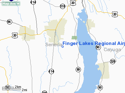
Finger Lakes Rgnl Airport |
Location & QuickFacts
| FAA Information Effective: | 2008-09-25 |
| Airport Identifier: | 0G7 |
| Airport Status: | Operational |
| Longitude/Latitude: | 076-46-51.9000W/42-53-00.6000N
-76.781083/42.883500 (Estimated) |
| Elevation: | 492 ft / 149.96 m (Surveyed) |
| Land: | 110 acres |
| From nearest city: | 2 nautical miles SE of Seneca Falls, NY |
| Location: | Seneca County, NY |
| Magnetic Variation: | 12W (1985) |
Owner & Manager
| Ownership: | Publicly owned |
| Owner: | Seneca County |
| Address: | 1 Depronio Dr
Waterloo, NY 13165 |
| Phone number: | 315-539-5655 |
| Manager: | Milt Von Hahmann |
| Address: | 2727 Martin Rd
Seneca Falls, NY 13148 |
| Phone number: | 315-568-0110 |
Airport Operations and Facilities
| Airport Use: | Open to public |
| Wind indicator: | Yes |
| Segmented Circle: | Yes |
| Control Tower: | No |
| Lighting Schedule: | DUSK-DAWN
ACTVT MIRL & REIL RY 01/19 - CTAF. |
| Beacon Color: | Clear-Green (lighted land airport) |
| Landing fee charge: | Yes
$15 LANDING FEE FOR JETS AND TURBO PROPS |
| Sectional chart: | New York |
| Region: | AEA - Eastern |
| Boundary ARTCC: | ZOB - Cleveland |
| Responsible ARTCC: | ZBW - Boston |
| Tie-in FSS: | BUF - Buffalo |
| FSS on Airport: | No |
| FSS Toll Free: | 1-800-WX-BRIEF |
| NOTAMs Facility: | BUF (NOTAM-d service avaliable) |
| Federal Agreements: | NGY |
Airport Communications
| CTAF: | 122.800 |
| Unicom: | 122.800 |
Airport Services
| Fuel available: | 100LLA |
| Airframe Repair: | MAJOR |
| Power Plant Repair: | MAJOR |
| Bottled Oxygen: | NONE |
| Bulk Oxygen: | NONE |
Runway Information
Runway 01/19
| Dimension: | 3786 x 75 ft / 1154.0 x 22.9 m |
| Surface: | ASPH, Good Condition |
| Weight Limit: | Single wheel: 12500 lbs. |
| Edge Lights: | Medium |
| |
Runway 01 |
Runway 19 |
| Longitude: | 076-46-53.7276W | 076-46-57.8151W |
| Latitude: | 42-52-40.5439N | 42-53-17.8141N |
| Elevation: | 491.00 ft | 484.00 ft |
| Alignment: | 127 | 127 |
| Traffic Pattern: | Left | Left |
| Markings: | Non-precision instrument, Good Condition | Basic, Good Condition |
| Crossing Height: | 40.00 ft | 40.00 ft |
| VASI: | 2-light PAPI on left side
PAPI RY 01 OTS INDEFLY. | 2-light PAPI on left side
PAPI RY 19 OTS INDEFLY. |
| Visual Glide Angle: | 3.00° | 3.00° |
| Runway End Identifier: | Yes
REIL RY 01 OTS INDEFLY. | Yes
REIL RY19 OTS INDEFLY. |
| Obstruction: | 3 ft gnd, 200.0 ft from runway, 100 ft right of centerline
3 FT TERRAIN AT 100 FT RIGHT. | 12 ft road, 451.0 ft from runway, 20:1 slope to clear |
|
Runway 10/28
| Dimension: | 1850 x 60 ft / 563.9 x 18.3 m |
| Surface: | TURF, Good Condition |
| |
Runway 10 |
Runway 28 |
| Longitude: | 076-46-56.3300W | 076-46-31.5300W |
| Latitude: | 42-53-04.0400N | 42-53-02.7400N |
| Elevation: | 491.00 ft | 468.00 ft |
| Alignment: | 94 | 127 |
| Traffic Pattern: | Left | Left |
| Runway End Identifier: | No | No |
| Obstruction: | 33 ft trees, 416.0 ft from runway, 185 ft right of centerline, 12:1 slope to clear | 41 ft trees, 88.0 ft from runway, 82 ft right of centerline, 2:1 slope to clear |
|
Radio Navigation Aids
| ID |
Type |
Name |
Ch |
Freq |
Var |
Dist |
| PYA | NDB | Penn Yan | | 260.00 | 12W | 18.8 nm |
| ALP | NDB | Alpine | | 245.00 | 12W | 38.8 nm |
| AVN | NDB | Avon | | 344.00 | 09W | 44.1 nm |
| ITH | VOR/DME | Ithaca | 055X | 111.80 | 10W | 27.3 nm |
| GEE | VOR/DME | Geneseo | 019X | 108.20 | 09W | 42.0 nm |
| ULW | VOR/DME | Elmira | 033Y | 109.65 | 12W | 48.7 nm |
| SYR | VORTAC | Syracuse | 117X | 117.00 | 11W | 30.3 nm |
| ROC | VORTAC | Rochester | 037X | 110.00 | 09W | 41.7 nm |
| GGT | VORTAC | Georgetown | 125X | 117.80 | 11W | 42.4 nm |
Remarks
- RY 28: +17 FT ROAD, 50 FT FRM RY BEG, OB.
- EXISTED PRIOR TO 1959.
Images and information placed above are from
http://www.airport-data.com/airport/0G7/
We thank them for the data!
| General Info
|
| Country |
United States
|
| State |
NEW YORK
|
| FAA ID |
0G7
|
| Latitude |
42-53-01.130N
|
| Longitude |
076-46-51.949W
|
| Elevation |
492 feet
|
| Near City |
SENECA FALLS
|
We don't guarantee the information is fresh and accurate. The data may
be wrong or outdated.
For more up-to-date information please refer to other sources.
|
|


