 |
|
Location & QuickFacts
| FAA Information Effective: | 2008-09-25 |
| Airport Identifier: | NY25 |
| Airport Status: | Operational |
| Longitude/Latitude: | 075-00-58.5820W/42-27-00.2860N
-75.016273/42.450079 (Estimated) |
| Elevation: | 1110 ft / 338.33 m (Estimated) |
| Land: | 20 acres |
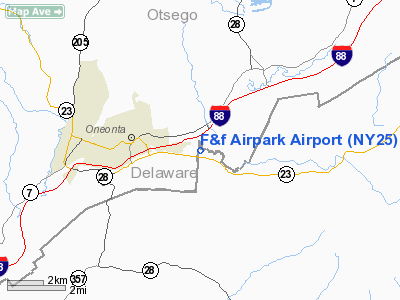
| From nearest city: | 3 nautical miles E of Oneonta, NY |
| Location: | Otsego County, NY |
| Magnetic Variation: | 13W (1985) |
Owner & Manager
| Ownership: | Privately owned |
| Owner: | Albert J. Fortin |
| Address: | Rd 4, Box 488
Oneonta, NY 13820 |
| Phone number: | 607-432-8990 |
| Manager: | Albert J. Fortin |
| Address: | Rd 4, Box 488
Oneonta, NY 13820 |
| Phone number: | 607-432-8990 |
Airport Operations and Facilities
| Airport Use: | Private |
| Wind indicator: | Yes |
| Segmented Circle: | No |
| Control Tower: | No |
| Landing fee charge: | No |
| Sectional chart: | New York |
| Region: | AEA - Eastern |
| Boundary ARTCC: | ZBW - Boston |
| Tie-in FSS: | BUF - Buffalo |
| FSS on Airport: | No |
| FSS Toll Free: | 1-800-WX-BRIEF |
Airport Services
| Airframe Repair: | NONE |
| Power Plant Repair: | NONE |
| Bottled Oxygen: | NONE |
| Bulk Oxygen: | NONE |
Runway Information
Runway 13/31
| Dimension: | 2400 x 125 ft / 731.5 x 38.1 m |
| Surface: | TURF, |
| |
Runway 13 |
Runway 31 |
| Traffic Pattern: | Right | Left |
| Obstruction: | 53 ft trees, 160.0 ft from runway, 130 ft right of centerline, 3:1 slope to clear | 55 ft knoll wood, 240.0 ft from runway, 60 ft right of centerline, 4:1 slope to clear |
|
Radio Navigation Aids
| ID |
Type |
Name |
Ch |
Freq |
Var |
Dist |
| CJY | NDB | Clay | | 275.00 | 12W | 37.8 nm |
| MS | NDB | Monga | | 359.00 | 12W | 41.7 nm |
| JJH | NDB | Johnstown | | 523.00 | 14W | 44.7 nm |
| RKA | VOR/DME | Rockdale | 073X | 112.60 | 11W | 9.9 nm |
| DNY | VOR/DME | De Lancey | 058X | 112.10 | 11W | 16.5 nm |
| HNK | VOR/DME | Hancock | 115X | 116.80 | 11W | 26.8 nm |
| UCA | VORTAC | Utica | 049X | 111.20 | 12W | 35.3 nm |
| GGT | VORTAC | Georgetown | 125X | 117.80 | 11W | 41.2 nm |
Remarks
- DEER ON & INVOF ARPT.
- NON COMPLIANCE WITH FAR 157.
Images and information placed above are from
http://www.airport-data.com/airport/NY25/
We thank them for the data!
| General Info
|
| Country |
United States
|
| State |
NEW YORK
|
| FAA ID |
NY25
|
| Latitude |
42-27-00.286N
|
| Longitude |
075-00-58.582W
|
| Elevation |
1110 feet
|
| Near City |
ONEONTA
|
We don't guarantee the information is fresh and accurate. The data may
be wrong or outdated.
For more up-to-date information please refer to other sources.
|
|


