 |
|
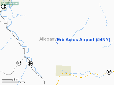
Location & QuickFacts
| FAA Information Effective: | 2008-09-25 |
| Airport Identifier: | 54NY |
| Airport Status: | Operational |
| Longitude/Latitude: | 078-02-07.0200W/42-21-18.2400N
-78.035283/42.355067 (Estimated) |
| Elevation: | 1940 ft / 591.31 m () |
| Land: | 0 acres |
| From nearest city: | 4 nautical miles N of Angelica, NY |
| Location: | Allegany County, NY |
| Magnetic Variation: | 11W (2000) |
Owner & Manager
| Ownership: | Privately owned |
| Owner: | Robert M Erb |
| Address: | 60 Langpap Rd
Honeoye Falls, NY 14472 |
| Phone number: | 716-624-2789 |
| Manager: | Robert M Erb |
| Address: | 60 Langpap Rd
Honeoye Falls, NY 14472 |
| Phone number: | 716-624-2789 |
Airport Operations and Facilities
| Airport Use: | Private |
| Wind indicator: | Yes |
| Segmented Circle: | No |
| Control Tower: | No |
| Sectional chart: | Detroit |
| Region: | AEA - Eastern |
| Boundary ARTCC: | ZOB - Cleveland |
| Tie-in FSS: | BUF - Buffalo |
| FSS Toll Free: | 1-800-WX-BRIEF |
Runway Information
Runway 09/27
| Dimension: | 1750 x 60 ft / 533.4 x 18.3 m |
| Surface: | TURF, |
| |
Runway 09 |
Runway 27 |
| Traffic Pattern: | Left | Left |
|
Radio Navigation Aids
| ID |
Type |
Name |
Ch |
Freq |
Var |
Dist |
| LYS | NDB | Olean | | 360.00 | 09W | 14.0 nm |
| EL | NDB | Halos | | 269.00 | 09W | 15.7 nm |
| AVN | NDB | Avon | | 344.00 | 09W | 41.1 nm |
| PYA | NDB | Penn Yan | | 260.00 | 12W | 46.7 nm |
| GEE | VOR/DME | Geneseo | 019X | 108.20 | 09W | 31.8 nm |
| BFD | VOR/DME | Bradford | 113X | 116.60 | 07W | 43.0 nm |
| BUF | VOR/DME | Buffalo | 111X | 116.40 | 08W | 43.8 nm |
| ULW | VOR/DME | Elmira | 033Y | 109.65 | 12W | 47.6 nm |
| SFK | VOR/DME | Stonyfork | 023X | 108.60 | 08W | 48.2 nm |
| JHW | VOR/DME | Jamestown | 094X | 114.70 | 07W | 49.3 nm |
| ELZ | VORTAC | Wellsville | 051X | 111.40 | 09W | 16.0 nm |
| ROC | VORTAC | Rochester | 037X | 110.00 | 09W | 48.7 nm |
| BUF | VOT | Buffalo | | 109.00 | | 46.8 nm |
Remarks
- OWNER DESIRES ARPT NOT BE CHARTED (PER RMK BY ELEMENT A7).
- PRVDD DALGT VFR; RY FREE OF SOFT SPOTS; CLEAR 20:1 APCH PATH.
Images and information placed above are from
http://www.airport-data.com/airport/54NY/
We thank them for the data!
| General Info
|
| Country |
United States
|
| State |
NEW YORK
|
| FAA ID |
54NY
|
| Latitude |
42-21-18.240N
|
| Longitude |
078-02-07.020W
|
| Elevation |
1940 feet
|
| Near City |
ANGELICA
|
We don't guarantee the information is fresh and accurate. The data may
be wrong or outdated.
For more up-to-date information please refer to other sources.
|
|


