 |
|
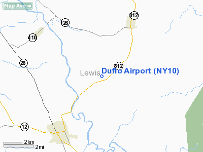
Location & QuickFacts
| FAA Information Effective: | 2008-09-25 |
| Airport Identifier: | NY10 |
| Airport Status: | Operational |
| Longitude/Latitude: | 075-25-50.6650W/43-50-33.2480N
-75.430740/43.842569 (Estimated) |
| Elevation: | 789 ft / 240.49 m (Estimated) |
| Land: | 450 acres |
| From nearest city: | 1 nautical miles NE of New Bremen, NY |
| Location: | Lewis County, NY |
| Magnetic Variation: | 13W (1985) |
Owner & Manager
| Ownership: | Privately owned |
| Owner: | Jeffrey T. Duflo |
| Address: | Rt 3 Box 92
Lowville, NY 13367 |
| Phone number: | 315-376-2155 |
| Manager: | Jeffrey T. Duflo |
| Address: | Rt 3 Box 92
Lowville, NY 13367 |
| Phone number: | 315-376-2155 |
Airport Operations and Facilities
| Airport Use: | Private |
| Wind indicator: | Yes |
| Segmented Circle: | No |
| Control Tower: | No |
| Lighting Schedule: | PHONE REQ
FOR RWY LGTS (FLARE POTS) CALL 315-376-2155. |
| Landing fee charge: | No |
| Sectional chart: | New York |
| Region: | AEA - Eastern |
| Traffic Pattern Alt: | 800 ft |
| Boundary ARTCC: | ZBW - Boston |
| Tie-in FSS: | BTV - Burlington |
| FSS on Airport: | No |
| FSS Toll Free: | 1-800-WX-BRIEF |
Airport Communications
Airport Services
| Fuel available: | 100 |
| Airframe Repair: | MINOR |
| Power Plant Repair: | MINOR |
| Bottled Oxygen: | NONE |
| Bulk Oxygen: | NONE |
Runway Information
Runway 04/22
| Dimension: | 2800 x 30 ft / 853.4 x 9.1 m |
| Surface: | ASPH, |
| Weight Limit: | Single wheel: 12000 lbs. |
| Edge Lights: | Non-standard lighting system
& RWY 08/26 NSTD FLARE POTS. |
| |
Runway 04 |
Runway 22 |
| Traffic Pattern: | Left | Left |
| Runway End Identifier: | No | No |
| Centerline Lights: | No | No |
| Touchdown Lights: | No | No |
|
Runway 08/26
| Dimension: | 2722 x 80 ft / 829.7 x 24.4 m |
| Surface: | TURF, |
| Edge Lights: | Non-standard lighting system
& RWY 08/26 NSTD FLARE POTS. |
| |
Runway 08 |
Runway 26 |
| Traffic Pattern: | Left | Left |
| Runway End Identifier: | No | No |
| Centerline Lights: | No | No |
| Touchdown Lights: | No | No |
|
Radio Navigation Aids
| ID |
Type |
Name |
Ch |
Freq |
Var |
Dist |
| GTB | NDB | Drum | | 257.00 | 13W | 18.9 nm |
| BK | NDB | Plein | | 329.00 | 12W | 37.3 nm |
| CJY | NDB | Clay | | 275.00 | 12W | 48.0 nm |
| GSS | TACAN | Griffiss | 057X | | 12W | 36.7 nm |
| ART | VORTAC | Watertown | 035X | 109.80 | 12W | 28.2 nm |
Remarks
Images and information placed above are from
http://www.airport-data.com/airport/NY10/
We thank them for the data!
| General Info
|
| Country |
United States
|
| State |
NEW YORK
|
| FAA ID |
NY10
|
| Latitude |
43-50-33.248N
|
| Longitude |
075-25-50.665W
|
| Elevation |
789 feet
|
| Near City |
NEW BREMEN
|
We don't guarantee the information is fresh and accurate. The data may
be wrong or outdated.
For more up-to-date information please refer to other sources.
|
|


