 |
|
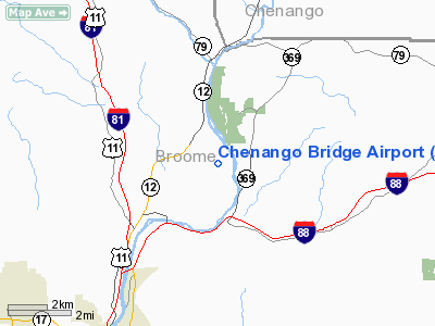
Location & QuickFacts
| FAA Information Effective: | 2008-09-25 |
| Airport Identifier: | 1NK8 |
| Airport Status: | Operational |
| Longitude/Latitude: | 075-50-28.6980W/42-11-30.2730N
-75.841305/42.191742 (Estimated) |
| Elevation: | 940 ft / 286.51 m (Estimated) |
| Land: | 28 acres |
| From nearest city: | 6 nautical miles NE of Binghamton, NY |
| Location: | Broome County, NY |
| Magnetic Variation: | 12W (1985) |
Owner & Manager
| Ownership: | Privately owned |
| Owner: | Laverne Haskell |
| Address: | Rd 3
Binghampton, NY 13901 |
| Phone number: | 607-648-5664 |
| Manager: | John Fako |
| Address: | Fox Lane
Binghamton, NY 13901 |
| Phone number: | 607-648-5143 |
Airport Operations and Facilities
| Airport Use: | Private |
| Wind indicator: | Yes |
| Segmented Circle: | No |
| Control Tower: | No |
| Landing fee charge: | No |
| Sectional chart: | New York |
| Region: | AEA - Eastern |
| Boundary ARTCC: | ZNY - New York |
| Tie-in FSS: | BUF - Buffalo |
| FSS on Airport: | No |
| FSS Toll Free: | 1-800-WX-BRIEF |
Airport Services
| Fuel available: | MOGAS |
| Airframe Repair: | NONE |
| Power Plant Repair: | NONE |
| Bottled Oxygen: | NONE |
| Bulk Oxygen: | NONE |
Runway Information
Runway 09/27
| Dimension: | 2000 x 145 ft / 609.6 x 44.2 m |
| Surface: | TURF, |
| |
Runway 09 |
Runway 27 |
| Traffic Pattern: | Left | Left |
| Runway End Identifier: | No | No |
| Centerline Lights: | No | No |
| Touchdown Lights: | No | No |
|
Runway 18/36
| Dimension: | 1700 x 145 ft / 518.2 x 44.2 m |
| Surface: | TURF, |
| |
Runway 18 |
Runway 36 |
| Traffic Pattern: | Left | Left |
| Runway End Identifier: | No | No |
| Centerline Lights: | No | No |
| Touchdown Lights: | No | No |
|
Radio Navigation Aids
| ID |
Type |
Name |
Ch |
Freq |
Var |
Dist |
| ALP | NDB | Alpine | | 245.00 | 12W | 41.2 nm |
| HNK | VOR/DME | Hancock | 115X | 116.80 | 11W | 24.7 nm |
| RKA | VOR/DME | Rockdale | 073X | 112.60 | 11W | 31.4 nm |
| ITH | VOR/DME | Ithaca | 055X | 111.80 | 10W | 33.0 nm |
| DNY | VOR/DME | De Lancey | 058X | 112.10 | 11W | 39.4 nm |
| CFB | VORTAC | Binghamton | 059X | 112.20 | 10W | 13.3 nm |
| GGT | VORTAC | Georgetown | 125X | 117.80 | 11W | 35.9 nm |
| LHY | VORTAC | Lake Henry | 045X | 110.80 | 10W | 45.9 nm |
Remarks
Images and information placed above are from
http://www.airport-data.com/airport/1NK8/
We thank them for the data!
| General Info
|
| Country |
United States
|
| State |
NEW YORK
|
| FAA ID |
1NK8
|
| Latitude |
42-11-30.273N
|
| Longitude |
075-50-28.698W
|
| Elevation |
940 feet
|
| Near City |
BINGHAMTON
|
We don't guarantee the information is fresh and accurate. The data may
be wrong or outdated.
For more up-to-date information please refer to other sources.
|
|


