 |
|
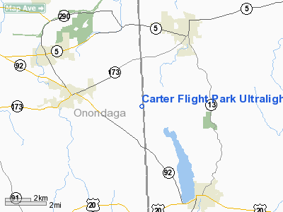
Carter Flight Park Ultralight Airport |
Location & QuickFacts
| FAA Information Effective: | 2008-09-25 |
| Airport Identifier: | NY67 |
| Airport Status: | Operational |
| Longitude/Latitude: | 075-54-42.0000W/42-59-35.0400N
-75.911667/42.993067 (Estimated) |
| Elevation: | 1301 ft / 396.54 m (Estimated) |
| Land: | 12 acres |
| From nearest city: | 4 nautical miles SE of Manlius, NY |
| Location: | Onondaga County, NY |
| Magnetic Variation: | () |
Owner & Manager
| Ownership: | Privately owned |
| Owner: | Gary Carter |
| Address: | 4520 Palmer Road
Manlius, NY 13104 |
| Phone number: | 315-682-8583 |
| Manager: | Gary Carter |
| Address: | 4520 Palmer Road
Manlius, NY 13104 |
| Phone number: | 315-657-3506 |
Airport Operations and Facilities
| Airport Use: | Private |
| Wind indicator: | Yes |
| Control Tower: | No |
| Sectional chart: | New York |
| Region: | AEA - Eastern |
| Boundary ARTCC: | ZNY - New York |
| Tie-in FSS: | BUF - Buffalo |
| FSS Toll Free: | 1-800-WX-BRIEF |
Runway Information
Runway 09U/27U
| Dimension: | 600 x 75 ft / 182.9 x 22.9 m |
| Surface: | TURF, |
| |
Runway 09U |
Runway 27U |
| Traffic Pattern: | Left | Left |
| Obstruction: | 40 ft trees, 100.0 ft from runway | 40 ft trees, 100.0 ft from runway |
|
Runway 17U/35U
| Dimension: | 800 x 75 ft / 243.8 x 22.9 m |
| Surface: | TURF, |
| |
Runway 17U |
Runway 35U |
| Traffic Pattern: | Left | Left |
| Obstruction: | 40 ft trees, 200.0 ft from runway | 60 ft trees, 150.0 ft from runway |
|
Radio Navigation Aids
| ID |
Type |
Name |
Ch |
Freq |
Var |
Dist |
| BK | NDB | Plein | | 329.00 | 12W | 23.3 nm |
| CJY | NDB | Clay | | 275.00 | 12W | 28.7 nm |
| GSS | TACAN | Griffiss | 057X | | 12W | 26.2 nm |
| ITH | VOR/DME | Ithaca | 055X | 111.80 | 10W | 38.5 nm |
| RKA | VOR/DME | Rockdale | 073X | 112.60 | 11W | 43.4 nm |
| GGT | VORTAC | Georgetown | 125X | 117.80 | 11W | 12.8 nm |
| SYR | VORTAC | Syracuse | 117X | 117.00 | 11W | 16.3 nm |
| UCA | VORTAC | Utica | 049X | 111.20 | 12W | 32.9 nm |
Remarks
- PRVDD VFR OPNS & PVT USE.
Images and information placed above are from
http://www.airport-data.com/airport/NY67/
We thank them for the data!
| General Info
|
| Country |
United States
|
| State |
NEW YORK
|
| FAA ID |
NY67
|
| Latitude |
42-54-20.280N
|
| Longitude |
073-25-43.406W
|
| Elevation |
540 feet
|
| Near City |
BUSKIRK
|
We don't guarantee the information is fresh and accurate. The data may
be wrong or outdated.
For more up-to-date information please refer to other sources.
|
|


