 |
|
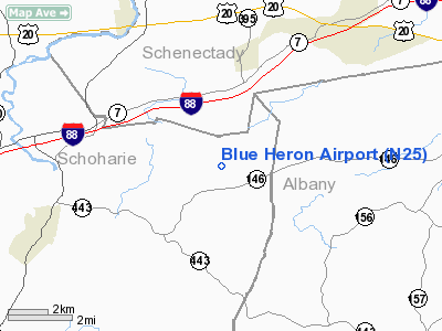
Location & QuickFacts
| FAA Information Effective: | 2008-09-25 |
| Airport Identifier: | N25 |
| Airport Status: | Operational |
| Longitude/Latitude: | 074-11-58.4670W/42-41-50.2720N
-74.199574/42.697298 (Estimated) |
| Elevation: | 1200 ft / 365.76 m (Estimated) |
| Land: | 4 acres |
| From nearest city: | 3 nautical miles NE of Gallupville, NY |
| Location: | Schoharie County, NY |
| Magnetic Variation: | 14W (1985) |
Owner & Manager
| Ownership: | Privately owned |
| Owner: | Nicholas J. Viscio |
| Address: | 686 Knox Cave Road
Altamont, NY 12009 |
| Phone number: | 518-872-2638 |
| Manager: | Nicholas J. Viscio |
| Address: | 686 Knox Cave Road
Altamont, NY 12009 |
| Phone number: | 518-872-2638 |
Airport Operations and Facilities
| Airport Use: | Open to public |
| Wind indicator: | Yes |
| Segmented Circle: | No |
| Control Tower: | No |
| Landing fee charge: | No |
| Sectional chart: | New York |
| Region: | AEA - Eastern |
| Boundary ARTCC: | ZBW - Boston |
| Tie-in FSS: | BTV - Burlington |
| FSS on Airport: | No |
| FSS Toll Free: | 1-800-WX-BRIEF |
| NOTAMs Facility: | (NOTAM-d service avaliable) |
Airport Communications
Runway Information
Runway 09/27
| Dimension: | 2600 x 70 ft / 792.5 x 21.3 m |
| Surface: | TURF, Good Condition |
| |
Runway 09 |
Runway 27 |
| Traffic Pattern: | Left | Left |
| Obstruction: | | 30 ft trees, 300.0 ft from runway |
|
Radio Navigation Aids
| ID |
Type |
Name |
Ch |
Freq |
Var |
Dist |
| PSF | FAN MARKER | Abyss | | | 13W | 46.0 nm |
| HEU | NDB | Hunter | | 356.00 | 14W | 15.0 nm |
| JJH | NDB | Johnstown | | 523.00 | 14W | 19.1 nm |
| PFH | NDB | Philmont | | 272.00 | 13W | 34.0 nm |
| GBR | NDB | Great Barrington | | 395.00 | 14W | 46.9 nm |
| DXT | NDB | Dalton | | 370.00 | 15W | 47.5 nm |
| CAM | VOR/DME | Cambridge | 097X | 115.00 | 14W | 41.7 nm |
| DNY | VOR/DME | De Lancey | 058X | 112.10 | 11W | 45.8 nm |
| RKA | VOR/DME | Rockdale | 073X | 112.60 | 11W | 48.1 nm |
| ALB | VORTAC | Albany | 100X | 115.30 | 13W | 17.8 nm |
| GFL | VORTAC | Glens Falls | 039X | 110.20 | 14W | 46.6 nm |
| UCA | VORTAC | Utica | 049X | 111.20 | 12W | 46.9 nm |
| ALB | VOT | Albany County | | 108.20 | | 16.9 nm |
Remarks
- PROVIDED SPONSOR ASSURES FLIGHT SEPARATION FROM OPERATIONS AT NEARBY AIRPORTS.
Images and information placed above are from
http://www.airport-data.com/airport/N25/
We thank them for the data!
| General Info
|
| Country |
United States
|
| State |
NEW YORK
|
| FAA ID |
N25
|
| Latitude |
44-09-30.190N
|
| Longitude |
073-25-58.456W
|
| Elevation |
276 feet
|
| Near City |
WESTPORT
|
We don't guarantee the information is fresh and accurate. The data may
be wrong or outdated.
For more up-to-date information please refer to other sources.
|
|


