 |
|
Location & QuickFacts
| FAA Information Effective: | 2008-09-25 |
| Airport Identifier: | NM72 |
| Airport Status: | Operational |
| Longitude/Latitude: | 108-17-17.0000W/32-44-31.0000N
-108.288056/32.741944 (Estimated) |
| Elevation: | 6037 ft / 1840.08 m (Estimated) |
| Land: | 60 acres |
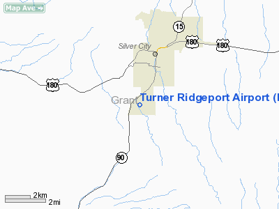
| From nearest city: | 2 nautical miles S of Silver City, NM |
| Location: | Grant County, NM |
| Magnetic Variation: | 11E (1985) |
Owner & Manager
| Ownership: | Privately owned |
| Owner: | Grant Cty Flying Service |
| Address: | P.o. Box 483
Silver City, NM 88062 |
| Phone number: | 505-388-2287 |
| Manager: | William B. Turner |
| Address: | Po Box 483
Silver City, NM 88062 |
| Phone number: | 505-388-2287 |
Airport Operations and Facilities
| Airport Use: | Private |
| Wind indicator: | Yes |
| Segmented Circle: | No |
| Control Tower: | No |
| Landing fee charge: | No |
| Sectional chart: | Albuquerque |
| Region: | ASW - Southwest |
| Boundary ARTCC: | ZAB - Albuquerque |
| Tie-in FSS: | ABQ - Albuquerque |
| FSS on Airport: | No |
| FSS Toll Free: | 1-800-WX-BRIEF |
Airport Services
| Bottled Oxygen: | NONE |
| Bulk Oxygen: | NONE |
Runway Information
Runway 08/26
| Dimension: | 2400 x 35 ft / 731.5 x 10.7 m |
| Surface: | DIRT, Fair Condition |
| |
Runway 08 |
Runway 26 |
| Traffic Pattern: | Left | Left |
| Markings: | None, | None, |
| Runway End Identifier: | No | No |
| Centerline Lights: | No | No |
| Touchdown Lights: | No | No |
| Obstruction: | 15 ft road | 60 ft hill, 1400.0 ft from runway, 23:1 slope to clear |
|
Runway 15/33
| Dimension: | 4000 x 30 ft / 1219.2 x 9.1 m |
| Surface: | ASPH, Fair Condition |
| Weight Limit: | Single wheel: 8000 lbs. |
| |
Runway 15 |
Runway 33 |
| Traffic Pattern: | Left | Left |
| Markings: | None,
15/33 MKD CNTRLN ONLY. | None, |
| Runway End Identifier: | No | No |
| Centerline Lights: | No | No |
| Touchdown Lights: | No | No |
| Obstruction: | 200 ft hill, 5000.0 ft from runway, 625 ft left of centerline, 25:1 slope to clear | , 50:1 slope to clear |
|
Radio Navigation Aids
| ID |
Type |
Name |
Ch |
Freq |
Var |
Dist |
| SVC | VORTAC | Silver City | 045X | 110.80 | 13E | 9.0 nm |
| DMN | VORTAC | Deming | 023X | 108.60 | 12E | 44.5 nm |
Remarks
- RISING TERRAIN NORTH OF AIRPORT.
- RY 08 LANDINGS PROHIBITED.
- RY 08/26 HAS STEEP UP GRADIENT WEST.
- RY 15/33 SOUTH 1/3 HAS MAX GRADIENT 4.5 PERCENT UP NORTH.
Images and information placed above are from
http://www.airport-data.com/airport/NM72/
We thank them for the data!
| General Info
|
| Country |
United States
|
| State |
NEW MEXICO
|
| FAA ID |
NM72
|
| Latitude |
32-44-31.000N
|
| Longitude |
108-17-17.000W
|
| Elevation |
6037 feet
|
| Near City |
SILVER CITY
|
We don't guarantee the information is fresh and accurate. The data may
be wrong or outdated.
For more up-to-date information please refer to other sources.
|
|


