 |
|
Location & QuickFacts
| FAA Information Effective: | 2008-09-25 |
| Airport Identifier: | 62NM |
| Airport Status: | Operational |
| Longitude/Latitude: | 104-25-34.8600W/32-35-55.4090N
-104.426350/32.598725 (Estimated) |
| Elevation: | 3360 ft / 1024.13 m (Estimated) |
| Land: | 6 acres |
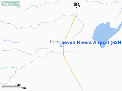
| From nearest city: | 16 nautical miles NW of Carlsbad, NM |
| Location: | Eddy County, NM |
| Magnetic Variation: | 10E (1985) |
Owner & Manager
| Ownership: | Privately owned |
| Owner: | Seven Rivers Inc |
| Address: | Po Box 280
Carlsbad, NM 88220 |
| Phone number: | 505-457-2503 |
| Manager: | H. Gilmoutray |
| Address: | Po Box 280
Carlsbad, NM 88220 |
| Phone number: | 505-457-2503 |
Airport Operations and Facilities
| Airport Use: | Private |
| Wind indicator: | Yes |
| Segmented Circle: | No |
| Control Tower: | No |
| Sectional chart: | Albuquerque |
| Region: | ASW - Southwest |
| Boundary ARTCC: | ZAB - Albuquerque |
| Tie-in FSS: | ABQ - Albuquerque |
| FSS Toll Free: | 1-800-WX-BRIEF |
Runway Information
Runway 04/22
| Dimension: | 2200 x 50 ft / 670.6 x 15.2 m |
| Surface: | DIRT, Poor Condition |
| |
Runway 04 |
Runway 22 |
| Traffic Pattern: | Left | Left |
| Markings: | , | Numbers only, Fair Condition |
| Obstruction: | , 50:1 slope to clear | 40 ft pline, 400.0 ft from runway, 150 ft left of centerline, 10:1 slope to clear |
|
Runway 10/28
| Dimension: | 3210 x 30 ft / 978.4 x 9.1 m |
| Surface: | ASPH, Fair Condition |
| Weight Limit: | Single wheel: 8000 lbs. |
| |
Runway 10 |
Runway 28 |
| Traffic Pattern: | Left | Left |
| Markings: | , | Numbers only, Fair Condition |
| Displaced threshold: | 260.00 ft | 0.00 ft |
| Obstruction: | 12 ft fence, 200.0 ft from runway, 40 ft left of centerline
APCH RATIO 20:1 TO DSPLCD THR.
+5'-10' FENCE AT RWY END; +5' HILL 70' FM RWY END. | , 1600.0 ft from runway, 40:1 slope to clear |
|
Radio Navigation Aids
| ID |
Type |
Name |
Ch |
Freq |
Var |
Dist |
| ATS | NDB | Artesia | | 414.00 | 09E | 15.4 nm |
| RO | NDB | Topan | | 305.00 | 10E | 46.1 nm |
| PIO | VOR/DME | Pinon | 041X | 110.40 | 12E | 44.7 nm |
| CNM | VORTAC | Carlsbad | 110X | 116.30 | 12E | 22.9 nm |
| CME | VORTAC | Chisum | 108X | 116.10 | 12E | 45.5 nm |
Remarks
- TWO CLSD DIRT RWYS MKD WITH YELLOW 'X' ADJACENT TO RWY ENDS.
- EXTENSIVE EROSION AT INTXN OF RY 04/22 & CLSD DIRT RYS; SAFETY AREAS NOT MAINTAINED.
Images and information placed above are from
http://www.airport-data.com/airport/62NM/
We thank them for the data!
| General Info
|
| Country |
United States
|
| State |
NEW MEXICO
|
| FAA ID |
62NM
|
| Latitude |
32-35-55.409N
|
| Longitude |
104-25-34.860W
|
| Elevation |
3360 feet
|
| Near City |
CARLSBAD
|
We don't guarantee the information is fresh and accurate. The data may
be wrong or outdated.
For more up-to-date information please refer to other sources.
|
|


