 |
|
Location & QuickFacts
| FAA Information Effective: | 2008-09-25 |
| Airport Identifier: | NM86 |
| Airport Status: | Operational |
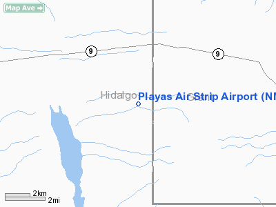
| Longitude/Latitude: | 108-32-12.1750W/31-56-12.3330N
-108.536715/31.936759 (Estimated) |
| Elevation: | 4519 ft / 1377.39 m (Surveyed) |
| Land: | 60 acres |
| From nearest city: | 4 nautical miles SE of Playas, NM |
| Location: | Hidalgo County, NM |
| Magnetic Variation: | 11E (1985) |
Owner & Manager
| Ownership: | Privately owned |
| Owner: | New Mexico Tech Univ / Emrtc |
| Address: | 801 Leroy Place
Socorro, NM 87801 |
| Phone number: | 505-436-0500 |
| Manager: | Kim Kvamme |
| Address: | 1 Plaza
Playas, NM 88009 |
| Phone number: | 505-436-2211 |
Airport Operations and Facilities
| Airport Use: | Private |
| Wind indicator: | Yes |
| Segmented Circle: | No |
| Control Tower: | No |
| Lighting Schedule: | RDO-CTL
|
| Landing fee charge: | No |
| Sectional chart: | El Paso |
| Region: | ASW - Southwest |
| Boundary ARTCC: | ZAB - Albuquerque |
| Tie-in FSS: | ABQ - Albuquerque |
| FSS on Airport: | No |
| FSS Toll Free: | 1-800-WX-BRIEF |
Airport Communications
Runway Information
Runway 06/24
| Dimension: | 4865 x 50 ft / 1482.9 x 15.2 m |
| Surface: | ASPH, Poor Condition
SEVERE ALLIGATOR CRACKING. |
| Edge Lights: | Medium |
| |
Runway 06 |
Runway 24 |
| Traffic Pattern: | Left | Left |
| Obstruction: | 5 ft fence, 257.0 ft from runway | , 162.0 ft from runway |
|
Radio Navigation Aids
| ID |
Type |
Name |
Ch |
Freq |
Var |
Dist |
| CUS | VOR/DME | Columbus | 049X | 111.20 | 12E | 49.6 nm |
| SSO | VORTAC | San Simon | 101X | 115.40 | 13E | 42.0 nm |
| SVC | VORTAC | Silver City | 045X | 110.80 | 13E | 46.3 nm |
Remarks
- ARPT IS USED BY BOTH FIXED WING AND ROTARY WING ACFTS.
- EXERCISE CARE IN THE AREA DUE TO FREQ MILITARY ACTIVITY INCLUDING UNMANNED AERIAL VEHICLE OPNS.
- RAPIDLY RISING TERRAIN TO THE EAST AND FREQ GUSTY WINDS.
Images and information placed above are from
http://www.airport-data.com/airport/NM86/
We thank them for the data!
| General Info
|
| Country |
United States
|
| State |
NEW MEXICO
|
| FAA ID |
NM86
|
| Latitude |
31-56-12.333N
|
| Longitude |
108-32-12.175W
|
| Elevation |
4519 feet
|
| Near City |
PLAYAS
|
We don't guarantee the information is fresh and accurate. The data may
be wrong or outdated.
For more up-to-date information please refer to other sources.
|
|


