 |
|
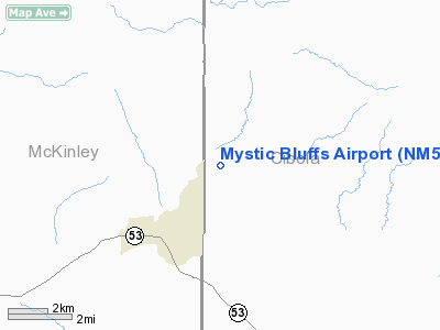
Location & QuickFacts
| FAA Information Effective: | 2008-09-25 |
| Airport Identifier: | NM56 |
| Airport Status: | Operational |
| Longitude/Latitude: | 108-27-32.2640W/35-09-55.1170N
-108.458962/35.165310 (Estimated) |
| Elevation: | 6980 ft / 2127.50 m (Estimated) |
| Land: | 0 acres |
| From nearest city: | 2 nautical miles NE of Ramah, NM |
| Location: | Mc Kinley County, NM |
| Magnetic Variation: | 12E (1985) |
Owner & Manager
| Ownership: | Privately owned |
| Owner: | Cynthia J. Crawford |
| Address: | 229 Deer Meadow Cr
Lafollette, TN 37766 |
| Phone number: | 423-563-7605 |
| Manager: | Cynthia J. Crawford |
| Address: | 229 Deer Meadow Cr
Lafollette, TN 37766 |
| Phone number: | 423-563-7605 |
Airport Operations and Facilities
| Airport Use: | Private |
| Segmented Circle: | No |
| Control Tower: | No |
| Sectional chart: | Albuquerque |
| Region: | ASW - Southwest |
| Boundary ARTCC: | ZAB - Albuquerque |
| Tie-in FSS: | ABQ - Albuquerque |
| FSS Toll Free: | 1-800-WX-BRIEF |
Runway Information
Runway 06/24
| Dimension: | 5100 x 30 ft / 1554.5 x 9.1 m |
| Surface: | DIRT, |
| |
Runway 06 |
Runway 24 |
| Traffic Pattern: | Left | Left |
|
Radio Navigation Aids
| ID |
Type |
Name |
Ch |
Freq |
Var |
Dist |
| AWR | NDB | Window Rock | | 254.00 | 12E | 42.3 nm |
| GUP | VORTAC | Gallup | 098X | 115.10 | 14E | 27.6 nm |
| ZUN | VORTAC | Zuni | 081X | 113.40 | 14E | 36.3 nm |
Images and information placed above are from
http://www.airport-data.com/airport/NM56/
We thank them for the data!
| General Info
|
| Country |
United States
|
| State |
NEW MEXICO
|
| FAA ID |
NM56
|
| Latitude |
35-09-55.117N
|
| Longitude |
108-27-32.264W
|
| Elevation |
6980 feet
|
| Near City |
RAMAH
|
We don't guarantee the information is fresh and accurate. The data may
be wrong or outdated.
For more up-to-date information please refer to other sources.
|
|


