 |
|
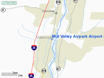
Mid Valley Airpark Airport |
Location & QuickFacts
| FAA Information Effective: | 2008-09-25 |
| Airport Identifier: | E98 |
| Airport Status: | Operational |
| Longitude/Latitude: | 106-44-43.0950W/34-45-35.2020N
-106.745304/34.759778 (Estimated) |
| Elevation: | 4830 ft / 1472.18 m (Estimated) |
| Land: | 90 acres |
| From nearest city: | 3 nautical miles S of Los Lunas, NM |
| Location: | Valencia County, NM |
| Magnetic Variation: | 11E (1985) |
Owner & Manager
| Ownership: | Privately owned |
| Owner: | Mid Valley Property Owners
MID VALLEY PROPERTY OWNERS ASSOCIATION. |
| Address: | 11 East-west Dr
Los Lunas, NM 87031 |
| Phone number: | 505-565-1041 |
| Manager: | Kurt Winker |
| Address: | 330 Luscombe Ln
Los Lunas, NM 87031-6763 |
| Phone number: | 505-610-3676 |
Airport Operations and Facilities
| Airport Use: | Open to public |
| Wind indicator: | Yes |
| Segmented Circle: | No |
| Control Tower: | No |
| Lighting Schedule: | RDO-CTL
ACTVT ROTG BCN - CTAF. |
| Beacon Color: | Clear-Green (lighted land airport) |
| Sectional chart: | Albuquerque |
| Region: | ASW - Southwest |
| Boundary ARTCC: | ZAB - Albuquerque |
| Tie-in FSS: | ABQ - Albuquerque |
| FSS on Airport: | No |
| FSS Toll Free: | 1-800-WX-BRIEF |
| NOTAMs Facility: | ABQ (NOTAM-d service avaliable) |
Airport Communications
Airport Services
| Fuel available: | 100LL
FUEL AVBL 24 HR SELF SERVICE WITH MAJOR CREDIT CARD. |
| Airframe Repair: | MAJOR |
| Power Plant Repair: | MAJOR |
Runway Information
Runway 18/36
| Dimension: | 4340 x 37 ft / 1322.8 x 11.3 m |
| Surface: | ASPH, Good Condition |
| Weight Limit: | Single wheel: 12500 lbs. |
| Edge Lights: | Low
NSTD LIRL; 2 THLD LGTS EACH SIDE OF RY AT DISPLACEMENTS. |
| |
Runway 18 |
Runway 36 |
| Traffic Pattern: | Left | Left |
| Markings: | Basic, Good Condition | Basic, Good Condition |
| Displaced threshold: | 200.00 ft | 535.00 ft |
| Obstruction: | 15 ft road, 200.0 ft from runway, 25 ft left of centerline
+17 FT ROAD AT END; APCH SLOPE 16:1 BASED ON DSPLCD THLD.
ROAD 46 FT FM THLD; +5 FT SIGN AT END 75 FT RIGHT; +14 FT SIGN 45 FT FM END 125 FT RIGHT; +2 FT FENCE 25 FT FM END; FRANGIBLE. | 46 ft trees, 660.0 ft from runway, 150 ft right of centerline, 10:1 slope to clear
APCH RATIO 10:1 FM DSPLCD THLD. +32 FT POWER POLE 319 FT, DSPLCD THLD 135 FT LEFT.
ROAD 10 FT FM RY END; +2 FT FRANGIBLE FENCE 5 FT FM RY END. |
|
Radio Navigation Aids
| ID |
Type |
Name |
Ch |
Freq |
Var |
Dist |
| ILT | NDB | Isleta | | 247.00 | 11E | 15.0 nm |
| FIA | NDB | Florida | | 329.00 | 12E | 40.4 nm |
| OTO | VOR | Otto | | 114.00 | 13E | 44.1 nm |
| ABQ | VORTAC | Albuquerque | 079X | 113.20 | 13E | 17.4 nm |
| ONM | VORTAC | Socorro | 115X | 116.80 | 13E | 25.6 nm |
| ABQ | VOT | Albuquerque Intl | | 111.00 | | 18.3 nm |
Remarks
- PPR FOR GLIDER OPNS CALL 505-565-1041.
- RY 36 PARKED ACFT & BLDGS 65 FT EAST OF RY 36 THLD OBSTRUCT PRIM SFC.
- 6 FT DITCH 60 FT WEST & PARALLEL TO RY 18/36.
- ACFT RADIO REQUIRED.
- +40 FT UNLIGHTED UTILITY POLE 120 FT WEST OF RY 18/36 NEAR MIDPOINT.
- RECOMMENDED NO WIND RY 36.
- RESIDENTAL AIRPARK. UNCONTROLLED VEHICLE & PEDESTRIAN TFC ON & AROUND AIRFIELD.
Images and information placed above are from
http://www.airport-data.com/airport/E98/
We thank them for the data!
| General Info
|
| Country |
United States
|
| State |
NEW MEXICO
|
| FAA ID |
E98
|
| Latitude |
34-45-35.202N
|
| Longitude |
106-44-43.095W
|
| Elevation |
4830 feet
|
| Near City |
LOS LUNAS
|
We don't guarantee the information is fresh and accurate. The data may
be wrong or outdated.
For more up-to-date information please refer to other sources.
|
|


