 |
|
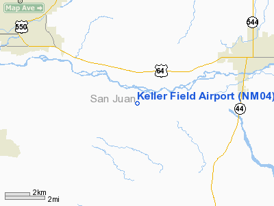
Location & QuickFacts
| FAA Information Effective: | 2008-09-25 |
| Airport Identifier: | NM04 |
| Airport Status: | Operational |
| Longitude/Latitude: | 108-05-02.2510W/36-40-40.0170N
-108.083959/36.677782 (Estimated) |
| Elevation: | 5345 ft / 1629.16 m (Estimated) |
| Land: | 123 acres |
| From nearest city: | 6 nautical miles E of Farmington, NM |
| Location: | San Juan County, NM |
| Magnetic Variation: | 12E (1985) |
Owner & Manager
| Ownership: | Privately owned |
| Owner: | Charles R. Keller, Jr. |
| Address: | 209 Road 5500
Bloomfield, NM 87413 |
| Phone number: | 505-632-3185 |
| Address: |
|
Airport Operations and Facilities
| Airport Use: | Private |
| Wind indicator: | Yes |
| Segmented Circle: | No |
| Control Tower: | No |
| Landing fee charge: | No |
| Sectional chart: | Denver |
| Region: | ASW - Southwest |
| Boundary ARTCC: | ZDV - Denver |
| Tie-in FSS: | ABQ - Albuquerque |
| FSS on Airport: | No |
| FSS Toll Free: | 1-800-WX-BRIEF |
Airport Services
Runway Information
Runway E/W
| Dimension: | 2400 x 65 ft / 731.5 x 19.8 m |
| Surface: | DIRT, |
| |
Runway E |
Runway W |
| Traffic Pattern: | Left | Left |
|
Radio Navigation Aids
| ID |
Type |
Name |
Ch |
Freq |
Var |
Dist |
| DRO | VOR/DME | Durango | 019X | 108.20 | 14E | 32.8 nm |
| CEZ | VOR/DME | Cortez | 021X | 108.40 | 14E | 48.6 nm |
| RSK | VORTAC | Rattlesnake | 100X | 115.30 | 14E | 4.3 nm |
Images and information placed above are from
http://www.airport-data.com/airport/NM04/
We thank them for the data!
| General Info
|
| Country |
United States
|
| State |
NEW MEXICO
|
| FAA ID |
NM04
|
| Latitude |
36-40-40.017N
|
| Longitude |
108-05-02.251W
|
| Elevation |
5345 feet
|
| Near City |
FARMINGTON
|
We don't guarantee the information is fresh and accurate. The data may
be wrong or outdated.
For more up-to-date information please refer to other sources.
|
|


