 |
|
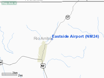
Location & QuickFacts
| FAA Information Effective: | 2008-09-25 |
| Airport Identifier: | NM24 |
| Airport Status: | Operational |
| Longitude/Latitude: | 106-33-37.1240W/36-55-18.0430N
-106.560312/36.921679 (Estimated) |
| Elevation: | 8030 ft / 2447.54 m (Estimated) |
| Land: | 0 acres |
| From nearest city: | 2 nautical miles NE of Chama, NM |
| Location: | Rio Arriba County, NM |
| Magnetic Variation: | 11E (1999) |
Owner & Manager
| Ownership: | Privately owned |
| Owner: | Eastside Group Ltd |
| Address: | 609 E. Clinton Ave #b
Athens, TX 75751 |
| Phone number: | 903-677-1447 |
| Manager: | Harold Katinsky |
| Address: | 609 E. Clinton Ave #b
Athens, TX 75751 |
| Phone number: | 903-677-1447 |
Airport Operations and Facilities
| Airport Use: | Private |
| Segmented Circle: | No |
| Control Tower: | No |
| Sectional chart: | Denver |
| Region: | ASW - Southwest |
| Boundary ARTCC: | ZAB - Albuquerque |
| Tie-in FSS: | ABQ - Albuquerque |
| FSS Toll Free: | 1-800-WX-BRIEF |
Runway Information
Runway 01/19
| Dimension: | 3000 x 45 ft / 914.4 x 13.7 m |
| Surface: | ASPH, |
| |
Runway 01 |
Runway 19 |
| Traffic Pattern: | Left | Left |
|
Radio Navigation Aids
| ID |
Type |
Name |
Ch |
Freq |
Var |
Dist |
| MVI | NDB | Monte Vista | | 311.00 | 11E | 44.0 nm |
| TAS | VORTAC | Taos | 123X | 117.60 | 13E | 36.7 nm |
| ALS | VORTAC | Alamosa | 086X | 113.90 | 13E | 44.0 nm |
Images and information placed above are from
http://www.airport-data.com/airport/NM24/
We thank them for the data!
| General Info
|
| Country |
United States
|
| State |
NEW MEXICO
|
| FAA ID |
NM24
|
| Latitude |
36-55-18.043N
|
| Longitude |
106-33-37.124W
|
| Elevation |
8030 feet
|
| Near City |
CHAMA
|
We don't guarantee the information is fresh and accurate. The data may
be wrong or outdated.
For more up-to-date information please refer to other sources.
|
|


