 |
|
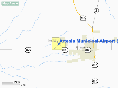
Location & QuickFacts
| FAA Information Effective: | 2008-09-25 |
| Airport Identifier: | ATS |
| Airport Status: | Operational |
| Longitude/Latitude: | 104-28-03.6710W/32-51-09.1010N
-104.467686/32.852528 (Estimated) |
| Elevation: | 3541 ft / 1079.30 m (Surveyed) |
| Land: | 1440 acres |
| From nearest city: | 3 nautical miles W of Artesia, NM |
| Location: | Eddy County, NM |
| Magnetic Variation: | 09E (2000) |
Owner & Manager
| Ownership: | Publicly owned |
| Owner: | City Of Artesia |
| Address: | Po Box 1310
Artesia, NM 88211 |
| Phone number: | 575-746-2122 |
| Manager: | Jimmy Joseph |
| Address: | Po Box 1310
Artesia, NM 88211 |
| Phone number: | 575-748-3206 |
Airport Operations and Facilities
| Airport Use: | Open to public |
| Wind indicator: | Yes |
| Segmented Circle: | Yes |
| Control Tower: | No |
| Lighting Schedule: | DUSK-DAWN
ACTVT MIRL RYS 03/21 & 12/30 - CTAF. |
| Beacon Color: | Clear-Green (lighted land airport) |
| Landing fee charge: | No |
| Sectional chart: | Albuquerque |
| Region: | ASW - Southwest |
| Boundary ARTCC: | ZAB - Albuquerque |
| Tie-in FSS: | ABQ - Albuquerque |
| FSS on Airport: | No |
| FSS Toll Free: | 1-800-WX-BRIEF |
| NOTAMs Facility: | ATS (NOTAM-d service avaliable) |
| Federal Agreements: | NGY3 |
Airport Communications
| CTAF: | 122.800 |
| Unicom: | 122.800 |
Airport Services
| Fuel available: | 100LLA1
FUEL ON CALL AFT HRS CALL 575-457-2399. FEE CHARGED. |
| Airframe Repair: | MAJOR |
| Power Plant Repair: | MAJOR |
| Bulk Oxygen: | NONE |
Runway Information
Runway 03/21
| Dimension: | 6301 x 150 ft / 1920.5 x 45.7 m |
| Surface: | ASPH, |
| Surface Treatment: | Porous Friction Course |
| Weight Limit: | Single wheel: 40000 lbs.
Dual wheel: 57000 lbs. |
| Edge Lights: | Medium |
| |
Runway 03 |
Runway 21 |
| Longitude: | 104-28-30.3310W | 104-27-38.0800W |
| Latitude: | 32-50-45.7410N | 32-51-29.7840N |
| Elevation: | 3541.00 ft | 3520.00 ft |
| Alignment: | 45 | 127 |
| Traffic Pattern: | Left | Left |
| Markings: | Basic, Good Condition | Basic, Good Condition |
| Crossing Height: | 0.00 ft | 25.00 ft |
| VASI: | | pulsating/steady burning on left side |
| Visual Glide Angle: | 0.00° | 3.00° |
| Obstruction: | 38 ft pline, 1600.0 ft from runway, 270 ft right of centerline, 36:1 slope to clear | 15 ft road, 570.0 ft from runway, 150 ft right of centerline, 24:1 slope to clear |
|
Runway 12/30
| Dimension: | 5390 x 150 ft / 1642.9 x 45.7 m |
| Surface: | ASPH, |
| Surface Treatment: | Porous Friction Course |
| Weight Limit: | Single wheel: 40000 lbs.
Dual wheel: 57000 lbs. |
| Edge Lights: | Medium |
| |
Runway 12 |
Runway 30 |
| Longitude: | 104-28-25.3340W | 104-27-40.6930W |
| Latitude: | 32-51-29.5240N | 32-50-51.8040N |
| Elevation: | 3534.00 ft | 3508.00 ft |
| Alignment: | 127 | 127 |
| Traffic Pattern: | Left | Left |
| Markings: | Non-precision instrument, Good Condition | Non-precision instrument, Good Condition |
| Obstruction: | 8 ft brush, 350.0 ft from runway, 18:1 slope to clear | , 50:1 slope to clear |
|
Radio Navigation Aids
| ID |
Type |
Name |
Ch |
Freq |
Var |
Dist |
| ATS | NDB | Artesia | | 414.00 | 09E | 0.3 nm |
| RO | NDB | Topan | | 305.00 | 10E | 30.9 nm |
| PIO | VOR/DME | Pinon | 041X | 110.40 | 12E | 46.6 nm |
| CME | VORTAC | Chisum | 108X | 116.10 | 12E | 30.2 nm |
| CNM | VORTAC | Carlsbad | 110X | 116.30 | 12E | 37.9 nm |
Images and information placed above are from
http://www.airport-data.com/airport/ATS/
We thank them for the data!
| General Info
|
| Country |
United States
|
| State |
NEW MEXICO
|
| FAA ID |
ATS
|
| Latitude |
32-51-09.101N
|
| Longitude |
104-28-03.671W
|
| Elevation |
3541 feet
|
| Near City |
ARTESIA
|
We don't guarantee the information is fresh and accurate. The data may
be wrong or outdated.
For more up-to-date information please refer to other sources.
|
|


