|
|
Alamogordo-white Sands Rgnl Airport |
| Alamogordo-White Sands Regional Airport |
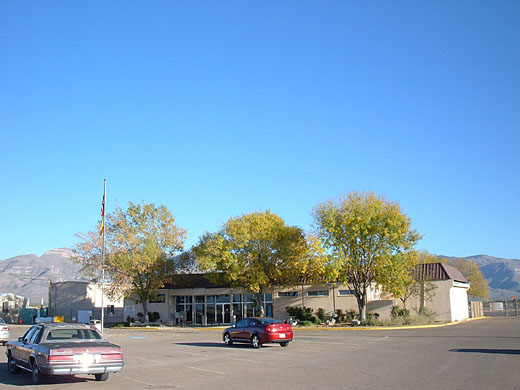 |
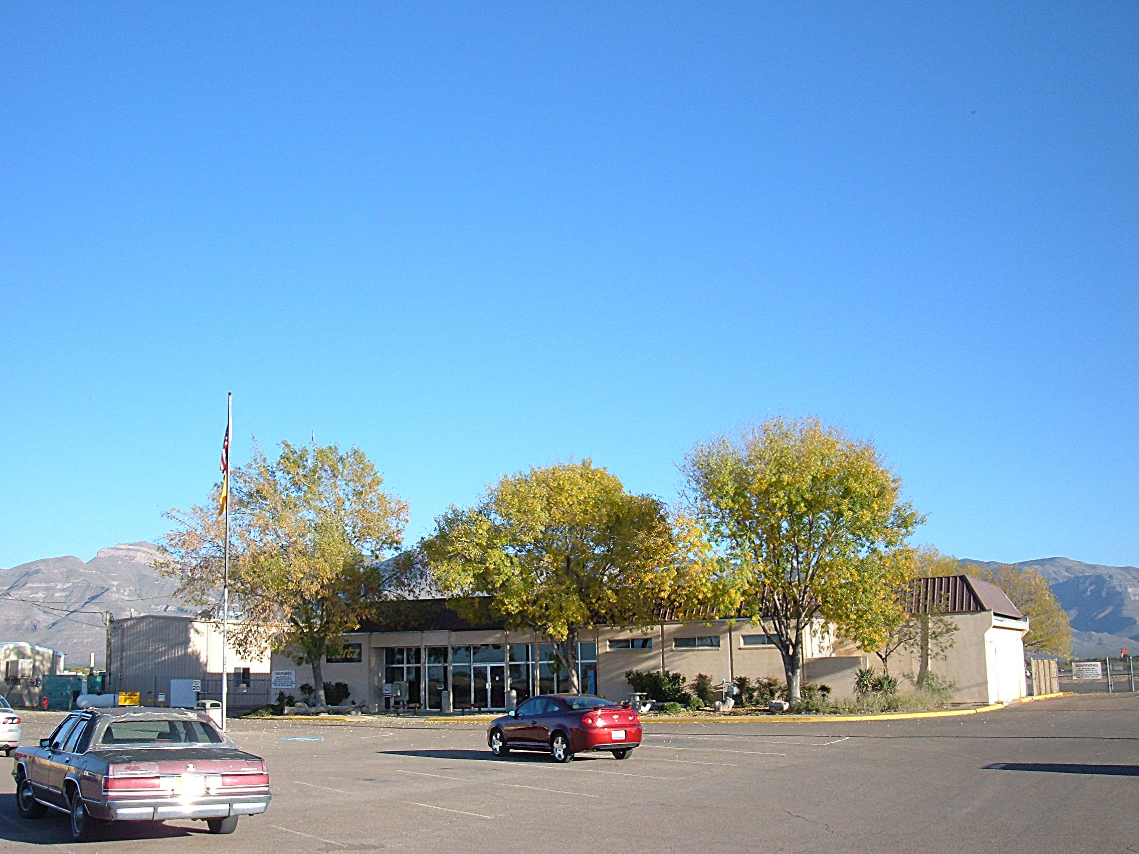
| Airport terminal building |
| IATA: ALM – ICAO: KALM – FAA LID: ALM |
| Summary |
| Airport type |
Public |
| Owner |
City of Alamogordo |
| Serves |
Alamogordo, New Mexico |
| Elevation AMSL |
4,200 ft / 1,280 m |
| Coordinates |
32°50′24″N 105°59′26″W / 32.84°N 105.99056°W / 32.84; -105.99056 |
| Runways |
| Direction |
Length |
Surface |
| ft |
m |
| 3/21 |
7,006 |
2,135 |
Asphalt |
| 16/34 |
3,512 |
1,070 |
Dirt |
| Statistics (2009) |
| Aircraft operations |
34,460 |
| Based aircraft |
86 |
| Source: Federal Aviation Administration |
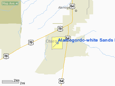
Alamogordo-White Sands Regional Airport (IATA: ALM, ICAO: KALM, FAA LID: ALM) is a city-owned public-use airport located four nautical miles (7 km) southwest of the central business district of Alamogordo, a city in Otero County, New Mexico, United States. It was formerly known as Alamogordo Municipal Airport.
It is served by one commercial airline, with service subsidized by the Essential Air Service program. New Mexico Airlines offers scheduled passenger service, with flights to El Paso and Albuquerque.
The airport installed an 8-kilowatt solar photovoltaic array in November 2008, using a $100,000 grant from the New Mexico Energy, Minerals and Natural Resources Department. The system is estimated to save the airport $100 to $300 per month, and after 2012 when new buyback rate go into effect that amount may rise to $300 to $500 per month in electric costs savings. Facilities and aircraft
Alamogordo-White Sands Regional Airport covers an area of 1,465 acres (593 ha) at an elevation of 4,200 feet (1,280 m) above mean sea level. It has two runways: 3/21 is 7,006 by 150 feet (2,135 x 46 m) with an asphalt surface; 16/34 is 3,512 by 200 feet (1,070 x 61 m) with a dirt surface.
For the 12-month period ending March 31, 2009, the airport had 34,460 aircraft operations, an average of 94 per day: 93% general aviation, 5% air taxi, and 2% military. At that time there were 86 aircraft based at this airport: 88.4% single-engine, 1.2% multi-engine, 1.2% jet, 1.2% helicopter, 5.8% glider and 2.3% ultralight.
Airlines and destinations
| Airlines |
Destinations |
| New Mexico Airlines |
Albuquerque, El Paso, Ruidoso |
The above content comes from Wikipedia and is published under free licenses – click here to read more.
Location & QuickFacts
| FAA Information Effective: | 2008-09-25 |
| Airport Identifier: | ALM |
| Airport Status: | Operational |
| Longitude/Latitude: | 105-59-26.1000W/32-50-23.8000N
-105.990583/32.839944 (Estimated) |
| Elevation: | 4200 ft / 1280.16 m (Surveyed) |
| Land: | 1465 acres |
| From nearest city: | 4 nautical miles SW of Alamogordo, NM |
| Location: | Otero County, NM |
| Magnetic Variation: | 11E (1985) |
Owner & Manager
| Ownership: | Publicly owned |
| Owner: | City Of Alamogordo |
| Address: | 1376 E North Street
Alamogordo, NM 88310 |
| Phone number: | 575-439-4200 |
| Manager: | Pat Mc Court
MR MC COURT IS CITY MGR AND ACTING ARPT MGR. |
| Address: | 1376 E North Street
Alamogordo, NM 88310 |
| Phone number: | 575-439-4200 |
Airport Operations and Facilities
| Airport Use: | Open to public |
| Wind indicator: | Yes |
| Segmented Circle: | Yes |
| Control Tower: | No |
| Lighting Schedule: | DUSK-DAWN
MIRL RY 03/21 PRESET MED INTST; TO INCR INTST & ACTVT VASI RY 21 - CTAF. |
| Beacon Color: | Clear-Green (lighted land airport) |
| Landing fee charge: | No |
| Sectional chart: | Albuquerque |
| Region: | ASW - Southwest |
| Boundary ARTCC: | ZAB - Albuquerque |
| Tie-in FSS: | ABQ - Albuquerque |
| FSS on Airport: | No |
| FSS Toll Free: | 1-800-WX-BRIEF |
| NOTAMs Facility: | ALM (NOTAM-d service avaliable) |
| Federal Agreements: | NGY |
Airport Communications
| CTAF: | 122.800 |
| Unicom: | 122.800 |
Airport Services
| Fuel available: | 100LLA A1+ |
| Airframe Repair: | MAJOR |
| Power Plant Repair: | MAJOR |
| Bottled Oxygen: | NONE |
| Bulk Oxygen: | HIGH |
Runway Information
Runway 03/21
| Dimension: | 7006 x 150 ft / 2135.4 x 45.7 m |
| Surface: | ASPH, Good Condition |
| Surface Treatment: | Porous Friction Course |
| Weight Limit: | Single wheel: 54000 lbs.
Dual wheel: 74000 lbs.
Dual tandem wheel: 120000 lbs. |
| Edge Lights: | Medium |
| |
Runway 03 |
Runway 21 |
| Longitude: | 105-59-55.4420W | 105-58-56.8260W |
| Latitude: | 32-49-59.5230N | 32-50-48.0440N |
| Elevation: | 4143.00 ft | 4200.00 ft |
| Alignment: | 46 | 127 |
| Traffic Pattern: | Right | Left |
| Markings: | Non-precision instrument, Good Condition | Non-precision instrument, Good Condition |
| Crossing Height: | 60.00 ft | 39.00 ft |
| VASI: | 4-light PAPI on right side | 4-box on left side |
| Visual Glide Angle: | 3.00° | 3.00° |
| Runway End Identifier: | Yes | Yes |
| Decleard distances: | Take off run available 7005.00 ft
Take off distance available 7005.00 ft
Actual stop distance available 7005.00 ft
Landing distance available 7005.00 ft
| Take off run available 7005.00 ft
Take off distance available 7005.00 ft
Actual stop distance available 7005.00 ft
Landing distance available 7005.00 ft
|
|
Runway 16/34
| Dimension: | 3512 x 200 ft / 1070.5 x 61.0 m |
| Surface: | DIRT, Fair Condition |
| |
Runway 16 |
Runway 34 |
| Elevation: | 4193.00 ft | 4171.00 ft |
| Alignment: | 127 | 127 |
| Traffic Pattern: | Left | Right |
| Obstruction: | 35 ft pline, 1300.0 ft from runway, 37:1 slope to clear | , 50:1 slope to clear |
|
Radio Navigation Aids
| ID |
Type |
Name |
Ch |
Freq |
Var |
Dist |
| ALM | NDB | Alamogordo | | 341.00 | 11E | 0.8 nm |
| CEP | NDB | Capitan | | 278.00 | 10E | 49.0 nm |
| HMN | TACAN | Holloman | 092X | | 10E | 6.1 nm |
| BWS | VOR/DME | Boles | 033X | 109.60 | 11E | 1.6 nm |
| PIO | VOR/DME | Pinon | 041X | 110.40 | 12E | 39.4 nm |
Remarks
- 8000 FT MOUNTAINS 4 NM EAST OF ARPT.
- USE RY 21 WHEN WINDS LESS THAN 5 KNOTS.
- RECOMMEND THAT VFR FLIGHTS BTN EL PASO & ALAMOGORDO-WHITE SANDS FOLLOW HWY 54 & THE ADJ RR TRACKS REMAINING CLEAR OF RSTRD AIRSPACE.
- GLIDER & ULTRALIGHT ACTIVITY ON & INVOF ARPT.
- IFR STANDBY SVC AVBL ON 30 MIN RECALL 575-572-7575.
Images and information placed above are from
http://www.airport-data.com/airport/ALM/
We thank them for the data!
| General Info
|
| Country |
United States
|
| State |
NEW MEXICO
|
| FAA ID |
ALM
|
| Latitude |
32-50-23.800N
|
| Longitude |
105-59-26.100W
|
| Elevation |
4200 feet
|
| Near City |
ALAMOGORDO
|
We don't guarantee the information is fresh and accurate. The data may
be wrong or outdated.
For more up-to-date information please refer to other sources.
|
|