 |
|
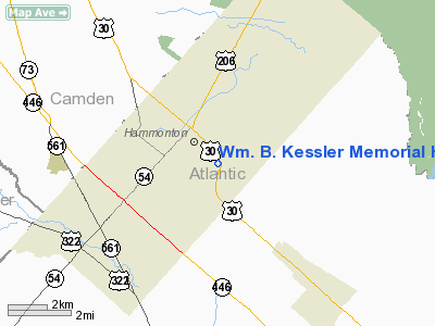
Wm. B. Kessler Memorial Hospital Heliport |
Location & QuickFacts
| FAA Information Effective: | 2008-09-25 |
| Airport Identifier: | 2JY3 |
| Airport Status: | Operational |
| Longitude/Latitude: | 074-46-21.9700W/39-37-53.0900N
-74.772769/39.631414 (Estimated) |
| Elevation: | 71 ft / 21.64 m (Estimated) |
| Land: | 0 acres |
| From nearest city: | 0 nautical miles N of Hammonton, NJ |
| Location: | Atlantic County, NJ |
| Magnetic Variation: | () |
Owner & Manager
| Ownership: | Privately owned |
| Owner: | Wm. B. Kessler Memorial Hospital |
| Address: | 600 S. White Horse Pike
Hammonton, NJ 08037 |
| Phone number: | 609-561-6700 |
| Manager: | Michael J Gonnela, Pres/ceo |
| Address: | 600 S. White Horse Pike
Hammonton, NJ 08037 |
| Phone number: | 609-561-6700 |
Airport Operations and Facilities
| Airport Use: | Private
MEDICAL USE. |
| Wind indicator: | Yes |
| Control Tower: | No |
| Lighting Schedule: | DUSK-DAWN |
| Beacon Color: | Clear-Green-Yellow (heliport) |
| Sectional chart: | Washington |
| Region: | AEA - Eastern |
| Boundary ARTCC: | ZNY - New York |
| Tie-in FSS: | MIV - Millville |
| FSS Toll Free: | 1-800-WX-BRIEF |
Runway Information
Helipad H1
| Dimension: | 30 x 30 ft / 9.1 x 9.1 m |
| Surface: | ASPH, Good Condition |
| |
Runway H1 |
Runway |
| Traffic Pattern: | Left | Left |
|
Radio Navigation Aids
| ID |
Type |
Name |
Ch |
Freq |
Var |
Dist |
| RNB | NDB | Rainbow | | 363.00 | 11W | 21.1 nm |
| NEL | NDB | Lakehurst | | 396.00 | 13W | 32.0 nm |
| NXX | NDB | Willow Grove | | 388.00 | 12W | 37.7 nm |
| ING | NDB | Ambler | | 275.00 | 11W | 38.0 nm |
| DYL | NDB | Doylestown | | 237.00 | 10W | 45.3 nm |
| NEL | TACAN | Lakehurst | 055X | | 11W | 31.1 nm |
| NXX | TACAN | Willow Grove | 061X | | 10W | 38.0 nm |
| DOV | TACAN | Dover | 037X | | 09W | 44.1 nm |
| NEL | UHF/NDB | Lakehurst | | 274.80 | 13W | 32.0 nm |
| PNE | VOR | North Philadelphia | | 112.00 | 10W | 29.2 nm |
| ARD | VOR/DME | Yardley | 019X | 108.20 | 10W | 37.9 nm |
| COL | VOR/DME | Colts Neck | 101X | 115.40 | 11W | 49.7 nm |
| VCN | VORTAC | Cedar Lake | 099X | 115.20 | 10W | 10.6 nm |
| ACY | VORTAC | Atlantic City | 023X | 108.60 | 10W | 13.9 nm |
| CYN | VORTAC | Coyle | 081X | 113.40 | 10W | 19.3 nm |
| GXU | VORTAC | Mc Guire | 043X | 110.60 | 11W | 24.1 nm |
| OOD | VORTAC | Woodstown | 075X | 112.80 | 10W | 24.5 nm |
| SIE | VORTAC | Sea Isle | 095X | 114.80 | 09W | 32.2 nm |
| RBV | VORTAC | Robbinsville | 085X | 113.80 | 10W | 36.6 nm |
| DQO | VORTAC | Dupont | 087X | 114.00 | 10W | 38.7 nm |
| ENO | VORTAC | Smyrna | 051X | 111.40 | 09W | 42.0 nm |
| MXE | VORTAC | Modena | 079X | 113.20 | 09W | 44.9 nm |
| PHL | VOT | Philadelphia Intl | | 109.80 | | 26.1 nm |
Remarks
- PRVDD VFR OPNS, PVT USE, AREA MARKED, WIND INDICATOR IS MAINTAINED, AND INGRESS/EGRESS NW 315/SE 135 OR NE 045/SW 225.
Images and information placed above are from
http://www.airport-data.com/airport/2JY3/
We thank them for the data!
|
|


