|
|
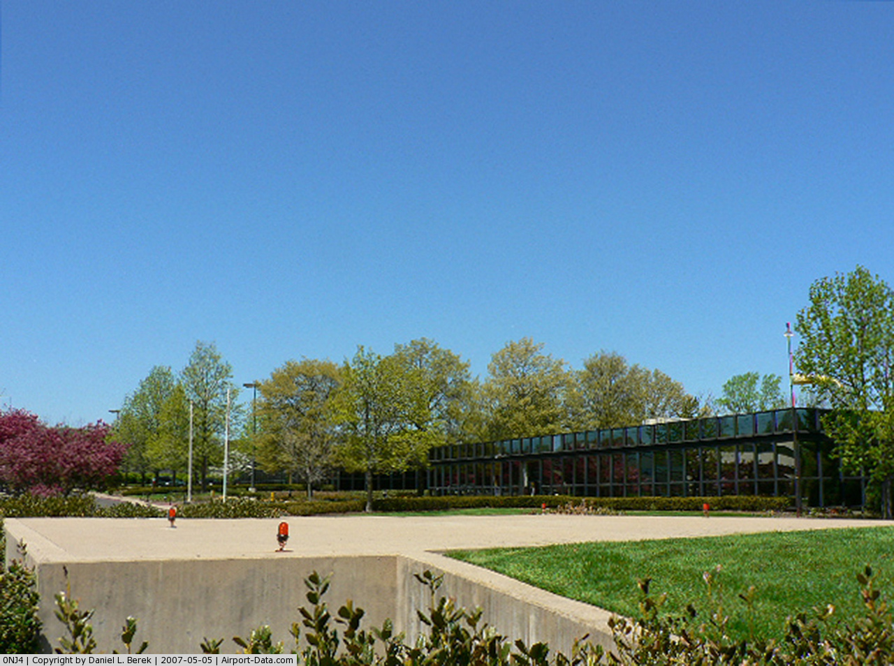
Weichert Headquarters Heliport |
 |
(Click on the photo to enlarge) |
Location & QuickFacts
| FAA Information Effective: | 2008-09-25 |
| Airport Identifier: | 0NJ4 |
| Airport Status: | Operational |
| Longitude/Latitude: | 074-27-41.5550W/40-56-26.3580N
-74.461543/40.940655 (Estimated) |
| Elevation: | 103 ft / 31.39 m (Estimated) |
| Land: | 0 acres |
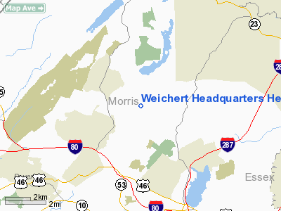
| From nearest city: | 2 nautical miles NE of Morris Plains, NJ |
| Location: | Morris County, NJ |
| Magnetic Variation: | 13W (1990) |
Owner & Manager
| Ownership: | Privately owned |
| Owner: | Dumond Associates, Inc |
| Address: | 1625 Route 10 East
Morris Plains, NJ 07950 |
| Phone number: | 201-267-7777 |
| Manager: | Ron Maas |
| Address: | 1625 Route 10 East
Morris Plains, NJ 07950 |
| Phone number: | 201-267-7777 |
Airport Operations and Facilities
| Airport Use: | Private |
| Wind indicator: | Yes |
| Segmented Circle: | No |
| Control Tower: | No |
| Lighting Schedule: | PHONE REQ
FOR PERIMETER LGTS CALL 201-267-7777. |
| Sectional chart: | New York |
| Region: | AEA - Eastern |
| Boundary ARTCC: | ZNY - New York |
| Tie-in FSS: | MIV - Millville |
| FSS on Airport: | No |
| FSS Toll Free: | 1-800-WX-BRIEF |
Runway Information
Helipad H1
| Dimension: | 40 x 35 ft / 12.2 x 10.7 m |
| Surface: | CONC, |
| |
Runway H1 |
Runway |
| Traffic Pattern: | Left | Left |
|
Radio Navigation Aids
| ID |
Type |
Name |
Ch |
Freq |
Var |
Dist |
| EWR | FAN MARKER | Maryann | | | 11W | 19.0 nm |
| SKU | FAN MARKER | Stanwyck | | | 12W | 40.0 nm |
| CAT | NDB | Chatham | | 254.00 | 11W | 12.1 nm |
| PNJ | NDB | Paterson | | 347.00 | 12W | 14.1 nm |
| SW | NDB | Neely | | 335.00 | 14W | 34.4 nm |
| OGY | NDB | Bridge | | 414.00 | 12W | 34.6 nm |
| SKU | NDB | Stanwyck | | 261.00 | 12W | 40.0 nm |
| PO | NDB | Meier | | 403.00 | 12W | 44.3 nm |
| DYL | NDB | Doylestown | | 237.00 | 10W | 47.2 nm |
| UKT | NDB | Quakertown | | 208.00 | 12W | 49.1 nm |
| BWZ | VOR/DME | Broadway | 089X | 114.20 | 11W | 18.5 nm |
| STW | VOR/DME | Stillwater | 033X | 109.60 | 11W | 18.8 nm |
| TEB | VOR/DME | Teterboro | 021X | 108.40 | 11W | 19.0 nm |
| SBJ | VOR/DME | Solberg | 076X | 112.90 | 10W | 25.0 nm |
| LGA | VOR/DME | La Guardia | 078X | 113.10 | 12W | 28.1 nm |
| HUO | VOR/DME | Huguenot | 108X | 116.10 | 11W | 28.8 nm |
| CRI | VOR/DME | Canarsie | 070X | 112.30 | 11W | 32.5 nm |
| JFK | VOR/DME | Kennedy | 106X | 115.90 | 12W | 36.5 nm |
| COL | VOR/DME | Colts Neck | 101X | 115.40 | 11W | 40.2 nm |
| CMK | VOR/DME | Carmel | 113X | 116.60 | 12W | 44.8 nm |
| ARD | VOR/DME | Yardley | 019X | 108.20 | 10W | 46.1 nm |
| SAX | VORTAC | Sparta | 104X | 115.70 | 11W | 8.4 nm |
| RBV | VORTAC | Robbinsville | 085X | 113.80 | 10W | 44.4 nm |
| FJC | VORTAC | Allentown | 122X | 117.50 | 10W | 47.0 nm |
| JFK | VOT | Kennedy | | 115.10 | | 36.1 nm |
Remarks
- T-LINES SW BE MARKED; COORDINATE USE WITH MORRISTOWN ATCT; INGRESS/EGRESS 255-075 DEGS; USERS ARE AWARE OF OTHER HELIPORTS & NOISE CONSIDERATIONS.
Images and information placed above are from
http://www.airport-data.com/airport/0NJ4/
We thank them for the data!
| General Info
|
| Country |
United States
|
| State |
NEW JERSEY
|
| FAA ID |
0NJ4
|
| Latitude |
40-56-26.358N
|
| Longitude |
074-27-41.555W
|
| Elevation |
103 feet
|
| Near City |
MORRIS PLAINS
|
We don't guarantee the information is fresh and accurate. The data may
be wrong or outdated.
For more up-to-date information please refer to other sources.
|
|