 |
|
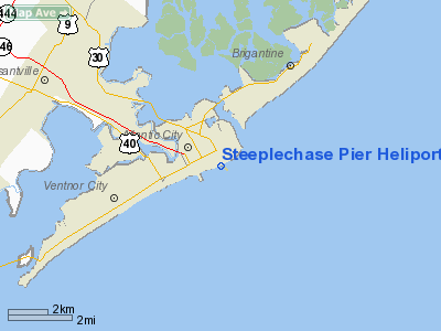
Steeplechase Pier Heliport |
Location & QuickFacts
| FAA Information Effective: | 2008-09-25 |
| Airport Identifier: | NJ57 |
| Airport Status: | Operational |
| Longitude/Latitude: | 074-25-12.5350W/39-21-25.4190N
-74.420149/39.357061 (Estimated) |
| Elevation: | 17 ft / 5.18 m (Estimated) |
| Land: | 0 acres |
| From nearest city: | 0 nautical miles E of Atlantic City, NJ |
| Location: | Atlantic County, NJ |
| Magnetic Variation: | 12W (1985) |
Owner & Manager
| Ownership: | Privately owned |
| Owner: | Resorts Int'l, Inc. |
| Address: | North Carolina & Boardwalk
Atlantic City, NJ 08404 |
| Phone number: | 609-965-6427 |
| Manager: | Dan Andrews |
| Address: | 620 West Tilton Rd
Pomona, NJ 08240 |
| Phone number: | 609-965-6427 |
Airport Operations and Facilities
| Airport Use: | Private |
| Wind indicator: | Yes |
| Segmented Circle: | No |
| Control Tower: | No |
| Lighting Schedule: | RDO-CTL
ACTVT PERIMTER LIGHTS - 128.875. |
| Landing fee charge: | Yes |
| Sectional chart: | Washington |
| Region: | AEA - Eastern |
| Boundary ARTCC: | ZDC - Washington |
| Tie-in FSS: | MIV - Millville |
| FSS on Airport: | No |
| FSS Toll Free: | 1-800-WX-BRIEF |
| NOTAMs Facility: | MIV |
Runway Information
Helipad H1
| Dimension: | 62 x 62 ft / 18.9 x 18.9 m |
| Surface: | WOOD, |
| Weight Limit: | Single wheel: 20000 lbs. |
| |
Runway H1 |
Runway |
| Traffic Pattern: | Left | Left |
|
Radio Navigation Aids
| ID |
Type |
Name |
Ch |
Freq |
Var |
Dist |
| RNB | NDB | Rainbow | | 363.00 | 11W | 33.4 nm |
| NEL | NDB | Lakehurst | | 396.00 | 13W | 41.5 nm |
| NEL | TACAN | Lakehurst | 055X | | 11W | 41.0 nm |
| NEL | UHF/NDB | Lakehurst | | 274.80 | 13W | 41.5 nm |
| ATR | VOR/DME | Waterloo | 073X | 112.60 | 09W | 49.4 nm |
| ACY | VORTAC | Atlantic City | 023X | 108.60 | 10W | 9.4 nm |
| SIE | VORTAC | Sea Isle | 095X | 114.80 | 09W | 23.7 nm |
| VCN | VORTAC | Cedar Lake | 099X | 115.20 | 10W | 27.6 nm |
| CYN | VORTAC | Coyle | 081X | 113.40 | 10W | 27.7 nm |
| GXU | VORTAC | Mc Guire | 043X | 110.60 | 11W | 40.1 nm |
| OOD | VORTAC | Woodstown | 075X | 112.80 | 10W | 44.3 nm |
| PHL | VOT | Philadelphia Intl | | 109.80 | | 49.1 nm |
Images and information placed above are from
http://www.airport-data.com/airport/NJ57/
We thank them for the data!
| General Info
|
| Country |
United States
|
| State |
NEW JERSEY
|
| FAA ID |
NJ57
|
| Latitude |
39-21-25.419N
|
| Longitude |
074-25-12.535W
|
| Elevation |
17 feet
|
| Near City |
ATLANTIC CITY
|
We don't guarantee the information is fresh and accurate. The data may
be wrong or outdated.
For more up-to-date information please refer to other sources.
|
|


