 |
|
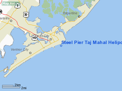
Steel Pier Taj Mahal Heliport |
Location & QuickFacts
| FAA Information Effective: | 2008-09-25 |
| Airport Identifier: | 28NJ |
| Airport Status: | Operational |
| Longitude/Latitude: | 074-25-03.5350W/39-21-17.4190N
-74.417649/39.354839 (Estimated) |
| Elevation: | 29 ft / 8.84 m (Surveyed) |
| Land: | 0 acres |
| From nearest city: | 0 nautical miles E of Atlantic City, NJ |
| Location: | Atlantic County, NJ |
| Magnetic Variation: | 12W (1985) |
Owner & Manager
| Ownership: | Privately owned |
| Owner: | Trump Taj Mahal Realty Corp |
| Address: | Pennsylvania Ave & Boardwalk
Atlantic City, NJ 08401 |
| Phone number: | 201-474-5600 |
| Manager: | Loretta Pickus |
| Address: | Trump Taj Mahal Casino Legal Dept, 1000 Boardwalk
Atlantic City, NJ 08401 |
| Phone number: | 609-449-5541 |
Airport Operations and Facilities
| Airport Use: | Private |
| Wind indicator: | Yes |
| Segmented Circle: | No |
| Control Tower: | No |
| Lighting Schedule: | PHONE REQ
FOR PERIMETER LGTS CALL 609-449-5540. |
| Landing fee charge: | Yes
NO PARKING AVBL. |
| Sectional chart: | Washington |
| Region: | AEA - Eastern |
| Boundary ARTCC: | ZDC - Washington |
| Tie-in FSS: | MIV - Millville |
| FSS Toll Free: | 1-800-WX-BRIEF |
Runway Information
Helipad H1
| Dimension: | 78 x 78 ft / 23.8 x 23.8 m |
| Surface: | CONC, Good Condition |
| Weight Limit: | Single wheel: 50000 lbs. |
| Edge Lights: | High |
| |
Runway H1 |
Runway |
| Traffic Pattern: | Left | Left |
| Markings: | Basic, Good Condition | , |
|
Radio Navigation Aids
| ID |
Type |
Name |
Ch |
Freq |
Var |
Dist |
| RNB | NDB | Rainbow | | 363.00 | 11W | 33.6 nm |
| NEL | NDB | Lakehurst | | 396.00 | 13W | 41.6 nm |
| NEL | TACAN | Lakehurst | 055X | | 11W | 41.1 nm |
| NEL | UHF/NDB | Lakehurst | | 274.80 | 13W | 41.6 nm |
| ATR | VOR/DME | Waterloo | 073X | 112.60 | 09W | 49.4 nm |
| ACY | VORTAC | Atlantic City | 023X | 108.60 | 10W | 9.5 nm |
| SIE | VORTAC | Sea Isle | 095X | 114.80 | 09W | 23.7 nm |
| VCN | VORTAC | Cedar Lake | 099X | 115.20 | 10W | 27.8 nm |
| CYN | VORTAC | Coyle | 081X | 113.40 | 10W | 27.8 nm |
| GXU | VORTAC | Mc Guire | 043X | 110.60 | 11W | 40.2 nm |
| OOD | VORTAC | Woodstown | 075X | 112.80 | 10W | 44.4 nm |
| PHL | VOT | Philadelphia Intl | | 109.80 | | 49.3 nm |
Remarks
- HELIPORT CLSD INDEFLY.
- VFR USE ONLY; ATLANTIC CITY ATCT IS CONTACTED PRIOR TO INITIATING OPNS; USERS ARE MADE AWARE OF THE INCREASING CONCENTRATION OF HELICOPTER & FIXED WING ACFT IN THE AREA.
Images and information placed above are from
http://www.airport-data.com/airport/28NJ/
We thank them for the data!
| General Info
|
| Country |
United States
|
| State |
NEW JERSEY
|
| FAA ID |
28NJ
|
| Latitude |
39-38-14.411N
|
| Longitude |
075-13-12.663W
|
| Elevation |
145 feet
|
| Near City |
WOODSTOWN
|
We don't guarantee the information is fresh and accurate. The data may
be wrong or outdated.
For more up-to-date information please refer to other sources.
|
|


