 |
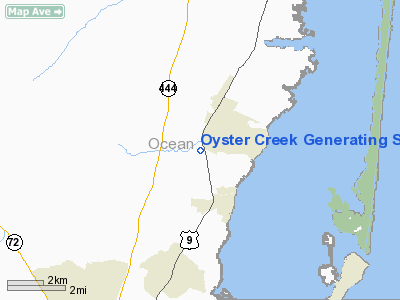
|
Oyster Creek Generating Station Heliport |
Location & QuickFacts
| FAA Information Effective: | 2008-09-25 |
| Airport Identifier: | 5NJ8 |
| Airport Status: | Operational |
| Longitude/Latitude: | 074-12-13.9500W/39-48-57.4200N
-74.203875/39.815950 (Estimated) |
| Elevation: | 19 ft / 5.79 m () |
| Land: | 0 acres |
| From nearest city: | 1 nautical miles S of Forked River, NJ |
| Location: | Ocean County, NJ |
| Magnetic Variation: | 13W (2000) |
Owner & Manager
| Ownership: | Privately owned |
| Owner: | Amergen Energy Company/exclon |
| Address: | P. O. Box 388
Forked River, NJ 08731 |
| Phone number: | 609-971-4034 |
| Manager: | Paul E. Schwartz |
| Address: | P. O. Box 388
Forked River, NJ 08731 |
| Phone number: | 609-971-4034 |
Airport Operations and Facilities
| Airport Use: | Private |
| Wind indicator: | Yes |
| Segmented Circle: | No |
| Control Tower: | No |
| Sectional chart: | New York |
| Region: | AEA - Eastern |
| Boundary ARTCC: | ZNY - New York |
| Tie-in FSS: | MIV - Millville |
| FSS Toll Free: | 1-800-WX-BRIEF |
Runway Information
Helipad H1
| Dimension: | 75 x 75 ft / 22.9 x 22.9 m |
| Surface: | ASPH, Good Condition |
| |
Runway H1 |
Runway |
| Traffic Pattern: | Left | Left |
| Markings: | Basic, Good Condition | , |
|
Radio Navigation Aids
| ID |
Type |
Name |
Ch |
Freq |
Var |
Dist |
| NEL | NDB | Lakehurst | | 396.00 | 13W | 15.0 nm |
| OGY | NDB | Bridge | | 414.00 | 12W | 47.6 nm |
| NXX | NDB | Willow Grove | | 388.00 | 12W | 48.8 nm |
| RNB | NDB | Rainbow | | 363.00 | 11W | 49.3 nm |
| NEL | TACAN | Lakehurst | 055X | | 11W | 15.0 nm |
| NXX | TACAN | Willow Grove | 061X | | 10W | 49.0 nm |
| NEL | UHF/NDB | Lakehurst | | 274.80 | 13W | 15.0 nm |
| PNE | VOR | North Philadelphia | | 112.00 | 10W | 40.4 nm |
| COL | VOR/DME | Colts Neck | 101X | 115.40 | 11W | 29.9 nm |
| ARD | VOR/DME | Yardley | 019X | 108.20 | 10W | 41.7 nm |
| CRI | VOR/DME | Canarsie | 070X | 112.30 | 11W | 49.9 nm |
| CYN | VORTAC | Coyle | 081X | 113.40 | 10W | 10.5 nm |
| GXU | VORTAC | Mc Guire | 043X | 110.60 | 11W | 21.5 nm |
| RBV | VORTAC | Robbinsville | 085X | 113.80 | 10W | 26.8 nm |
| ACY | VORTAC | Atlantic City | 023X | 108.60 | 10W | 27.7 nm |
| VCN | VORTAC | Cedar Lake | 099X | 115.20 | 10W | 39.1 nm |
| PHL | VOT | Philadelphia Intl | | 109.80 | | 48.2 nm |
Remarks
- PRVDD A CLEAR 8:1 INGRESS/EGRESS; APPROPRIATE MKGS FOR INGRESSEGRESS PLACED ON PAD AND A LGTD WINDSOCK FOR NIGHT TIME OPNS; AND OPERATION IN SUCH A MANNER TO MINIMIZE NOISE OVER RESIDENCES NEAR FACILITY.
Images and information placed above are from
http://www.airport-data.com/airport/5NJ8/
We thank them for the data!
| General Info
|
| Country |
United States
|
| State |
NEW JERSEY
|
| FAA ID |
5NJ8
|
| Latitude |
39-48-57.420N
|
| Longitude |
074-12-13.950W
|
| Elevation |
19 feet
|
| Near City |
FORKED RIVER
|
We don't guarantee the information is fresh and accurate. The data may
be wrong or outdated.
For more up-to-date information please refer to other sources.
|
|


