|
|
| Newton Airport |
| IATA: none – ICAO: none – FAA LID: 3N5 |
| Summary |
| Airport type |
Public use |
| Owner |
RRL Group |
| Operator |
Stella Jump |
| Serves |
Newton, New Jersey |
| Location |
Sussex County, New Jersey |
| Elevation AMSL |
620 ft / 189 m |
| Coordinates |
41°01′38″N 074°45′31″W / 41.02722°N 74.75861°W / 41.02722; -74.75861Coordinates: 41°01′38″N 074°45′31″W / 41.02722°N 74.75861°W / 41.02722; -74.75861 |
| Runways |
| Direction |
Length |
Surface |
| ft |
m |
| 6/24 |
2,546 |
776 |
Asphalt |
| Statistics (2008) |
| Aircraft operations |
10,705 |
| Based aircraft |
18 |
| Source: Federal Aviation Administration |
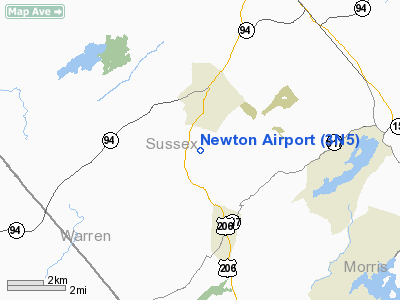
Newton Airport (FAA LID: 3N5) is a privately-owned, public-use airport located three nautical miles (5.556 km) south of the central business district of the town of Newton, in Sussex County, New Jersey, United States.
Facilities and aircraft
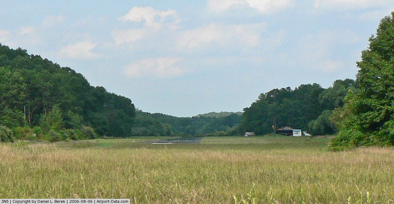
Newton Airport covers an area of 90 acres (36 ha) and has one runway designated 6/24 with a 2,546 x 45 ft (776 x 14 m) asphalt surface. For the 12-month period ending December 31, 2008, the airport had 10,695 general aviation aircraft operations, an average of 29 per day. At that time there were 18 aircraft based at this airport: 56% ultralight, 39% single-engine and 6% helicopter.
The above content comes from Wikipedia and is published under free licenses – click here to read more.
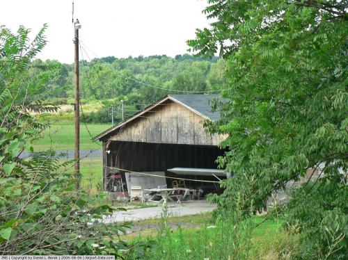 |
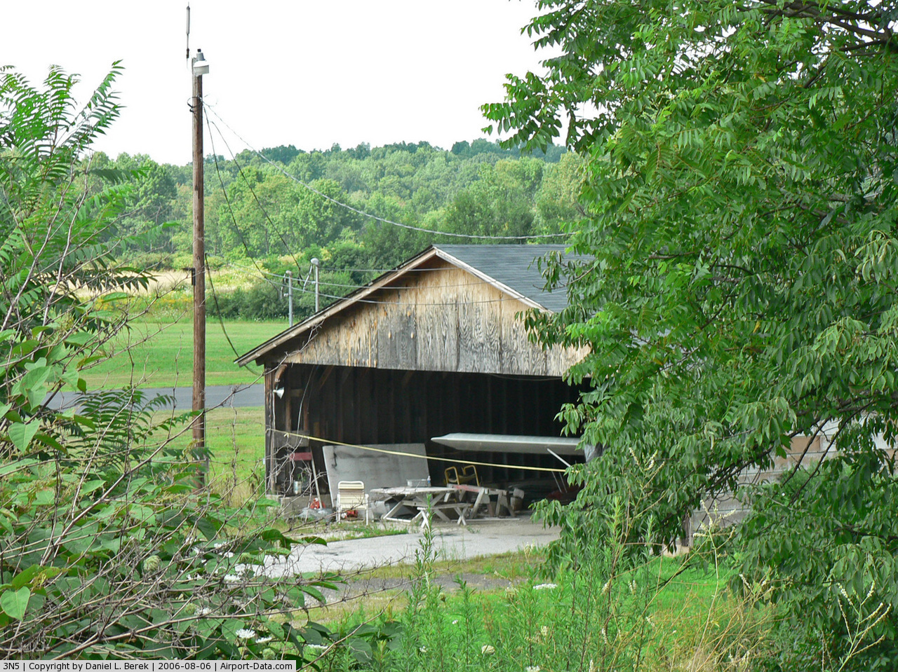
(Click on the photo to enlarge) |
 |
(Click on the photo to enlarge) |
Location & QuickFacts
| FAA Information Effective: | 2008-09-25 |
| Airport Identifier: | 3N5 |
| Airport Status: | Operational |
| Longitude/Latitude: | 074-45-30.5940W/41-01-38.3500N
-74.758498/41.027319 (Estimated) |
| Elevation: | 620 ft / 188.98 m (Estimated) |
| Land: | 90 acres |
| From nearest city: | 3 nautical miles S of Newton, NJ |
| Location: | Sussex County, NJ |
| Magnetic Variation: | 12W (1985) |
Owner & Manager
| Ownership: | Privately owned |
| Owner: | Rrl Group |
| Address: | Box 206
Newton, NJ 07860 |
| Phone number: | 973-383-3549 |
| Manager: | Stella Jump |
| Address: | Po Box 206
Newton, NJ 07860 |
| Phone number: | 973-383-3549 |
Airport Operations and Facilities
| Airport Use: | Open to public |
| Wind indicator: | Yes |
| Segmented Circle: | No |
| Control Tower: | No |
| Landing fee charge: | No |
| Sectional chart: | New York |
| Region: | AEA - Eastern |
| Boundary ARTCC: | ZNY - New York |
| Tie-in FSS: | MIV - Millville |
| FSS on Airport: | No |
| FSS Toll Free: | 1-800-WX-BRIEF |
| NOTAMs Facility: | MIV (NOTAM-d service avaliable) |
Airport Communications
Airport Services
| Bottled Oxygen: | NONE |
| Bulk Oxygen: | NONE |
Runway Information
Runway 06/24
| Dimension: | 2546 x 45 ft / 776.0 x 13.7 m |
| Surface: | ASPH, Good Condition |
| |
Runway 06 |
Runway 24 |
| Traffic Pattern: | Left | Right |
| Markings: | Basic, Good Condition | Basic, Good Condition |
| Obstruction: | 45 ft tree, 400.0 ft from runway, 50 ft right of centerline, 4:1 slope to clear | 35 ft tree, 202.0 ft from runway, 70 ft right of centerline
RY 24 HAS +16 FT TREE 10 FT FM THLD 55 FT L; +65 FT TREES 40 FT FM THLD 120 FT R. |
|
Radio Navigation Aids
| ID |
Type |
Name |
Ch |
Freq |
Var |
Dist |
| EWR | FAN MARKER | Maryann | | | 11W | 32.5 nm |
| SKU | FAN MARKER | Stanwyck | | | 12W | 44.1 nm |
| CAT | NDB | Chatham | | 254.00 | 11W | 22.8 nm |
| PNJ | NDB | Paterson | | 347.00 | 12W | 28.0 nm |
| SW | NDB | Neely | | 335.00 | 14W | 36.5 nm |
| UKT | NDB | Quakertown | | 208.00 | 12W | 43.8 nm |
| SKU | NDB | Stanwyck | | 261.00 | 12W | 44.1 nm |
| MS | NDB | Monga | | 359.00 | 12W | 44.7 nm |
| DYL | NDB | Doylestown | | 237.00 | 10W | 44.8 nm |
| LQX | NDB | Carbon | | 339.00 | 12W | 47.3 nm |
| OGY | NDB | Bridge | | 414.00 | 12W | 48.5 nm |
| PO | NDB | Meier | | 403.00 | 12W | 48.7 nm |
| CYE | NDB | Crystal Lake | | 410.00 | 11W | 49.8 nm |
| STW | VOR/DME | Stillwater | 033X | 109.60 | 11W | 5.4 nm |
| BWZ | VOR/DME | Broadway | 089X | 114.20 | 11W | 14.1 nm |
| HUO | VOR/DME | Huguenot | 108X | 116.10 | 11W | 24.2 nm |
| SBJ | VOR/DME | Solberg | 076X | 112.90 | 10W | 26.7 nm |
| TEB | VOR/DME | Teterboro | 021X | 108.40 | 11W | 33.4 nm |
| LGA | VOR/DME | La Guardia | 078X | 113.10 | 12W | 42.5 nm |
| CKZ | VOR/DME | Pennridge | 025Y | 108.85 | 12W | 45.2 nm |
| CRI | VOR/DME | Canarsie | 070X | 112.30 | 11W | 46.5 nm |
| ARD | VOR/DME | Yardley | 019X | 108.20 | 10W | 47.0 nm |
| ETX | VOR/DME | East Texas | 039X | 110.20 | 09W | 49.9 nm |
| SAX | VORTAC | Sparta | 104X | 115.70 | 11W | 10.3 nm |
| FJC | VORTAC | Allentown | 122X | 117.50 | 10W | 36.4 nm |
| LHY | VORTAC | Lake Henry | 045X | 110.80 | 10W | 42.4 nm |
| LVZ | VORTAC | Wilkes-barre | 053X | 111.60 | 10W | 44.6 nm |
Remarks
- DEER & BIRDS ON & INVOF ARPT.
- VFR USE ONLY.
Images and information placed above are from
http://www.airport-data.com/airport/3N5/
We thank them for the data!
| General Info
|
| Country |
United States
|
| State |
NEW JERSEY
|
| FAA ID |
3N5
|
| Latitude |
41-01-38.350N
|
| Longitude |
074-45-30.594W
|
| Elevation |
620 feet
|
| Near City |
NEWTON
|
We don't guarantee the information is fresh and accurate. The data may
be wrong or outdated.
For more up-to-date information please refer to other sources.
|
|