 |
|
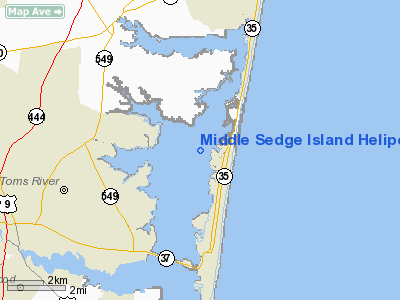
Middle Sedge Island Heliport |
Location & QuickFacts
| FAA Information Effective: | 2008-09-25 |
| Airport Identifier: | 95NJ |
| Airport Status: | Operational |
| Longitude/Latitude: | 074-04-48.4930W/40-00-00.4230N
-74.080137/40.000118 (Estimated) |
| Elevation: | 5 ft / 1.52 m (Estimated) |
| Land: | 5 acres |
| From nearest city: | 6 nautical miles E of Toms River, NJ |
| Location: | Ocean County, NJ |
| Magnetic Variation: | 12W (1985) |
Owner & Manager
| Ownership: | Privately owned |
| Owner: | Joseph Mc Dermott |
| Address: | Box 56
Montville, NJ 07045 |
| Phone number: | 201-334-3733 |
| Manager: | Joseph Mc Dermott |
| Address: | Box 56
Montville, NJ 07045 |
| Phone number: | 201-334-3733 |
Airport Operations and Facilities
| Airport Use: | Private |
| Wind indicator: | Yes |
| Segmented Circle: | No |
| Control Tower: | No |
| Sectional chart: | Washington |
| Region: | AEA - Eastern |
| Boundary ARTCC: | ZNY - New York |
| Tie-in FSS: | MIV - Millville |
| FSS Toll Free: | 1-800-WX-BRIEF |
Runway Information
Helipad H1
| Dimension: | 75 x 75 ft / 22.9 x 22.9 m |
| Surface: | TURF, |
| |
Runway H1 |
Runway |
| Traffic Pattern: | Left | Left |
|
Radio Navigation Aids
| ID |
Type |
Name |
Ch |
Freq |
Var |
Dist |
| EWR | FAN MARKER | Maryann | | | 11W | 42.5 nm |
| NEL | NDB | Lakehurst | | 396.00 | 13W | 12.1 nm |
| OGY | NDB | Bridge | | 414.00 | 12W | 35.3 nm |
| CAT | NDB | Chatham | | 254.00 | 11W | 47.3 nm |
| NEL | TACAN | Lakehurst | 055X | | 11W | 12.8 nm |
| NEL | UHF/NDB | Lakehurst | | 274.80 | 13W | 12.1 nm |
| PNE | VOR | North Philadelphia | | 112.00 | 10W | 43.1 nm |
| COL | VOR/DME | Colts Neck | 101X | 115.40 | 11W | 19.1 nm |
| CRI | VOR/DME | Canarsie | 070X | 112.30 | 11W | 37.8 nm |
| JFK | VOR/DME | Kennedy | 106X | 115.90 | 12W | 40.6 nm |
| ARD | VOR/DME | Yardley | 019X | 108.20 | 10W | 41.0 nm |
| SBJ | VOR/DME | Solberg | 076X | 112.90 | 10W | 46.3 nm |
| LGA | VOR/DME | La Guardia | 078X | 113.10 | 12W | 48.3 nm |
| CYN | VORTAC | Coyle | 081X | 113.40 | 10W | 19.6 nm |
| RBV | VORTAC | Robbinsville | 085X | 113.80 | 10W | 22.6 nm |
| GXU | VORTAC | Mc Guire | 043X | 110.60 | 11W | 23.8 nm |
| ACY | VORTAC | Atlantic City | 023X | 108.60 | 10W | 40.0 nm |
| VCN | VORTAC | Cedar Lake | 099X | 115.20 | 10W | 49.5 nm |
| JFK | VOT | Kennedy | | 115.10 | | 40.6 nm |
Images and information placed above are from
http://www.airport-data.com/airport/95NJ/
We thank them for the data!
| General Info
|
| Country |
United States
|
| State |
NEW JERSEY
|
| FAA ID |
95NJ
|
| Latitude |
40-00-00.423N
|
| Longitude |
074-04-48.493W
|
| Elevation |
5 feet
|
| Near City |
TOMS RIVER
|
We don't guarantee the information is fresh and accurate. The data may
be wrong or outdated.
For more up-to-date information please refer to other sources.
|
|


