 |
|
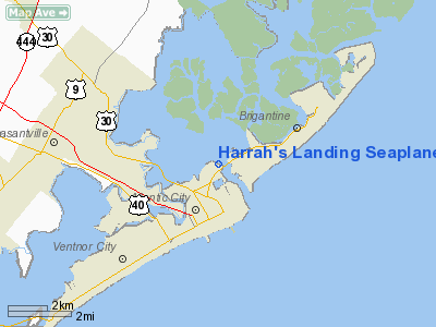
Harrah's Landing Seaplane Base Airport |
Location & QuickFacts
| FAA Information Effective: | 2008-09-25 |
| Airport Identifier: | 58NJ |
| Airport Status: | Operational |
| Longitude/Latitude: | 074-25-33.5360W/39-23-10.4200N
-74.425982/39.386228 (Estimated) |
| Elevation: | 17 ft / 5.18 m (Estimated) |
| Land: | 40 acres |
| From nearest city: | 2 nautical miles S of Atlantic City, NJ |
| Location: | Atlantic County, NJ |
| Magnetic Variation: | 12W (1985) |
Owner & Manager
| Ownership: | Privately owned |
| Owner: | George S. Arslanian, Jr. |
| Address: | 96 S. Chew Rd
Hammonton, NJ 08037 |
| Phone number: | 609-561-7770 |
| Manager: | George S. Arslanian, Jr. |
| Address: | 96 S. Chew Rd
Hammonton, NJ 08037 |
| Phone number: | 609-561-7770 |
Airport Operations and Facilities
| Airport Use: | Private |
| Wind indicator: | Yes |
| Segmented Circle: | No |
| Control Tower: | No |
| Landing fee charge: | Yes |
| Sectional chart: | Washington |
| Region: | AEA - Eastern |
| Boundary ARTCC: | ZDC - Washington |
| Tie-in FSS: | MIV - Millville |
| FSS on Airport: | No |
| FSS Toll Free: | 1-800-WX-BRIEF |
Runway Information
Runway 12/30
| Dimension: | 5000 x 200 ft / 1524.0 x 61.0 m |
| Surface: | WATER, |
| |
Runway 12 |
Runway 30 |
| Traffic Pattern: | Left | Right |
|
Radio Navigation Aids
| ID |
Type |
Name |
Ch |
Freq |
Var |
Dist |
| RNB | NDB | Rainbow | | 363.00 | 11W | 33.0 nm |
| NEL | NDB | Lakehurst | | 396.00 | 13W | 39.8 nm |
| NEL | TACAN | Lakehurst | 055X | | 11W | 39.3 nm |
| NEL | UHF/NDB | Lakehurst | | 274.80 | 13W | 39.8 nm |
| PNE | VOR | North Philadelphia | | 112.00 | 10W | 49.8 nm |
| ACY | VORTAC | Atlantic City | 023X | 108.60 | 10W | 8.1 nm |
| SIE | VORTAC | Sea Isle | 095X | 114.80 | 09W | 24.7 nm |
| CYN | VORTAC | Coyle | 081X | 113.40 | 10W | 25.9 nm |
| VCN | VORTAC | Cedar Lake | 099X | 115.20 | 10W | 26.7 nm |
| GXU | VORTAC | Mc Guire | 043X | 110.60 | 11W | 38.3 nm |
| OOD | VORTAC | Woodstown | 075X | 112.80 | 10W | 43.4 nm |
| RBV | VORTAC | Robbinsville | 085X | 113.80 | 10W | 49.2 nm |
| PHL | VOT | Philadelphia Intl | | 109.80 | | 47.8 nm |
Remarks
- VFR USE ONLY - 1000' - 3 MILES - NO SVFR; CONTACT AIY TOWER IN/OUT WHEN TOWER OPEN; CONTACT ACY APPROACH IN/OUT WHEN AIY TOWER CLOSED; BE AWARE OF CLOSENESS OF AIY; HELICOPTER PIERS & BANNER TOWING.
Images and information placed above are from
http://www.airport-data.com/airport/58NJ/
We thank them for the data!
| General Info
|
| Country |
United States
|
| State |
NEW JERSEY
|
| FAA ID |
58NJ
|
| Latitude |
39-23-10.420N
|
| Longitude |
074-25-33.536W
|
| Elevation |
17 feet
|
| Near City |
ATLANTIC CITY
|
We don't guarantee the information is fresh and accurate. The data may
be wrong or outdated.
For more up-to-date information please refer to other sources.
|
|


