 |
|
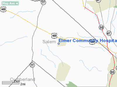
Elmer Community Hospital Heliport |
Location & QuickFacts
| FAA Information Effective: | 2008-09-25 |
| Airport Identifier: | 42NJ |
| Airport Status: | Operational |
| Longitude/Latitude: | 075-10-52.6570W/39-35-18.4120N
-75.181294/39.588448 (Estimated) |
| Elevation: | 95 ft / 28.96 m (Estimated) |
| Land: | 45 acres |
| From nearest city: | 1 nautical miles SW of Elmer, NJ |
| Location: | Salem County, NJ |
| Magnetic Variation: | 12W (1990) |
Owner & Manager
| Ownership: | Privately owned |
| Owner: | Elmer Community Hospital |
| Address: | West Front St
Elmer, NJ 08318 |
| Phone number: | 609-358-2341 |
| Manager: | W. Hunt |
| Address: | West Front St
Elmer, NJ 08318
ELMER COMMUNITY HOSPITAL. |
| Phone number: | 609-358-2341
EXT 200. |
Airport Operations and Facilities
| Airport Use: | Private
MEDICAL USE. |
| Wind indicator: | Yes |
| Segmented Circle: | No |
| Control Tower: | No |
| Lighting Schedule: | DUSK-DAWN |
| Sectional chart: | Washington |
| Region: | AEA - Eastern |
| Boundary ARTCC: | ZDC - Washington |
| Tie-in FSS: | MIV - Millville |
| FSS on Airport: | No |
| FSS Toll Free: | 1-800-WX-BRIEF |
Runway Information
Helipad H1
| Dimension: | 25 x 25 ft / 7.6 x 7.6 m |
| Surface: | CONC, |
| |
Runway H1 |
Runway |
| Traffic Pattern: | Left | Left |
|
Radio Navigation Aids
| ID |
Type |
Name |
Ch |
Freq |
Var |
Dist |
| RNB | NDB | Rainbow | | 363.00 | 11W | 10.4 nm |
| ING | NDB | Ambler | | 275.00 | 11W | 32.7 nm |
| NXX | NDB | Willow Grove | | 388.00 | 12W | 36.2 nm |
| APG | NDB | Aberdeen | | 349.00 | 11W | 43.0 nm |
| DYL | NDB | Doylestown | | 237.00 | 10W | 45.0 nm |
| NEL | NDB | Lakehurst | | 396.00 | 13W | 47.7 nm |
| DOV | TACAN | Dover | 037X | | 09W | 30.5 nm |
| NXX | TACAN | Willow Grove | 061X | | 10W | 36.5 nm |
| NEL | TACAN | Lakehurst | 055X | | 11W | 46.8 nm |
| NEL | UHF/NDB | Lakehurst | | 274.80 | 13W | 47.7 nm |
| PNE | VOR | North Philadelphia | | 112.00 | 10W | 30.7 nm |
| ARD | VOR/DME | Yardley | 019X | 108.20 | 10W | 41.9 nm |
| PPM | VOR/DME | Phillips | 021X | 108.40 | 09W | 46.5 nm |
| ATR | VOR/DME | Waterloo | 073X | 112.60 | 09W | 46.8 nm |
| CKZ | VOR/DME | Pennridge | 025Y | 108.85 | 12W | 48.5 nm |
| OOD | VORTAC | Woodstown | 075X | 112.80 | 10W | 6.3 nm |
| VCN | VORTAC | Cedar Lake | 099X | 115.20 | 10W | 10.4 nm |
| DQO | VORTAC | Dupont | 087X | 114.00 | 10W | 20.4 nm |
| ENO | VORTAC | Smyrna | 051X | 111.40 | 09W | 26.5 nm |
| ACY | VORTAC | Atlantic City | 023X | 108.60 | 10W | 29.2 nm |
| MXE | VORTAC | Modena | 079X | 113.20 | 09W | 30.1 nm |
| SIE | VORTAC | Sea Isle | 095X | 114.80 | 09W | 34.5 nm |
| GXU | VORTAC | Mc Guire | 043X | 110.60 | 11W | 37.0 nm |
| CYN | VORTAC | Coyle | 081X | 113.40 | 10W | 37.3 nm |
| PTW | VORTAC | Pottstown | 112X | 116.50 | 09W | 41.9 nm |
| RBV | VORTAC | Robbinsville | 085X | 113.80 | 10W | 48.6 nm |
| PHL | VOT | Philadelphia Intl | | 109.80 | | 17.2 nm |
Remarks
- FIRE FIGHTING EQUIP ONSITE DURG EGRESS & INGRESS.
- PRVDD HELIPORT IS USED FOR VFR OPNS ONLY.
Images and information placed above are from
http://www.airport-data.com/airport/42NJ/
We thank them for the data!
| General Info
|
| Country |
United States
|
| State |
NEW JERSEY
|
| FAA ID |
42NJ
|
| Latitude |
39-35-18.412N
|
| Longitude |
075-10-52.657W
|
| Elevation |
95 feet
|
| Near City |
ELMER
|
We don't guarantee the information is fresh and accurate. The data may
be wrong or outdated.
For more up-to-date information please refer to other sources.
|
|


