 |
|
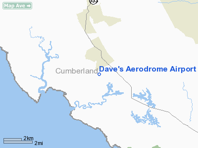
Location & QuickFacts
| FAA Information Effective: | 2008-09-25 |
| Airport Identifier: | 7NJ9 |
| Airport Status: | Operational |
| Longitude/Latitude: | 075-12-22.6740W/39-19-05.4120N
-75.206298/39.318170 (Estimated) |
| Elevation: | 8 ft / 2.44 m (Surveyed) |
| Land: | 43 acres |
| From nearest city: | 1 nautical miles SW of Cedarville, NJ |
| Location: | Cumberland County, NJ |
| Magnetic Variation: | 11W (1985) |
Owner & Manager
| Ownership: | Privately owned |
| Owner: | David A Gidzinski |
| Address: | 354 Jones Island Road
Cedarville, NJ 08311 |
| Manager: | David A Gidzinski |
| Address: | 354 Jones Island Road
Cedarville, NJ 08311 |
| Phone number: | 609-447-4768 |
Airport Operations and Facilities
| Airport Use: | Private |
| Wind indicator: | Yes |
| Segmented Circle: | Yes |
| Control Tower: | No |
| Landing fee charge: | No |
| Sectional chart: | Washington |
| Region: | AEA - Eastern |
| Boundary ARTCC: | ZDC - Washington |
| Tie-in FSS: | MIV - Millville |
| FSS on Airport: | No |
| FSS Toll Free: | 1-800-WX-BRIEF |
Runway Information
Runway 12/30
| Dimension: | 2000 x 60 ft / 609.6 x 18.3 m |
| Surface: | TURF, Good Condition |
| |
Runway 12 |
Runway 30 |
| Traffic Pattern: | Right | Left |
| Displaced threshold: | 600.00 ft | 0.00 ft |
| Obstruction: | 28 ft wires, 600.0 ft from runway | 30 ft trees, 600.0 ft from runway |
|
Radio Navigation Aids
| ID |
Type |
Name |
Ch |
Freq |
Var |
Dist |
| RNB | NDB | Rainbow | | 363.00 | 11W | 6.9 nm |
| APG | NDB | Aberdeen | | 349.00 | 11W | 43.8 nm |
| ING | NDB | Ambler | | 275.00 | 11W | 48.7 nm |
| DOV | TACAN | Dover | 037X | | 09W | 16.5 nm |
| PNE | VOR | North Philadelphia | | 112.00 | 10W | 46.8 nm |
| ATR | VOR/DME | Waterloo | 073X | 112.60 | 09W | 30.6 nm |
| PPM | VOR/DME | Phillips | 021X | 108.40 | 09W | 45.7 nm |
| ENO | VORTAC | Smyrna | 051X | 111.40 | 09W | 15.3 nm |
| VCN | VORTAC | Cedar Lake | 099X | 115.20 | 10W | 17.2 nm |
| OOD | VORTAC | Woodstown | 075X | 112.80 | 10W | 19.6 nm |
| SIE | VORTAC | Sea Isle | 095X | 114.80 | 09W | 23.2 nm |
| DQO | VORTAC | Dupont | 087X | 114.00 | 10W | 28.5 nm |
| ACY | VORTAC | Atlantic City | 023X | 108.60 | 10W | 30.4 nm |
| MXE | VORTAC | Modena | 079X | 113.20 | 09W | 42.0 nm |
| CYN | VORTAC | Coyle | 081X | 113.40 | 10W | 46.8 nm |
| PHL | VOT | Philadelphia Intl | | 109.80 | | 33.2 nm |
Remarks
- PRVDD VFR ONLY, CLEAR 20:1 APCH/DEP PATH, &OPERATE IN A MANNER TO MINIMIZE NOISE.
Images and information placed above are from
http://www.airport-data.com/airport/7NJ9/
We thank them for the data!
| General Info
|
| Country |
United States
|
| State |
NEW JERSEY
|
| FAA ID |
7NJ9
|
| Latitude |
39-19-05.412N
|
| Longitude |
075-12-22.674W
|
| Elevation |
8 feet
|
| Near City |
CEDARVILLE
|
We don't guarantee the information is fresh and accurate. The data may
be wrong or outdated.
For more up-to-date information please refer to other sources.
|
|


