 |
|
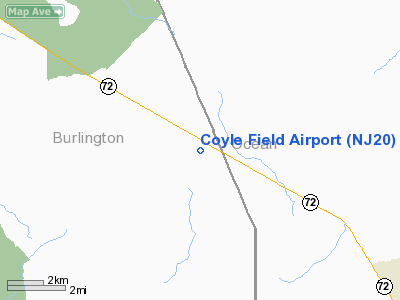
Location & QuickFacts
| FAA Information Effective: | 2008-09-25 |
| Airport Identifier: | NJ20 |
| Airport Status: | Operational |
| Longitude/Latitude: | 074-25-28.5350W/39-48-45.4260N
-74.424593/39.812618 (Estimated) |
| Elevation: | 190 ft / 57.91 m (Estimated) |
| Land: | 640 acres |
| From nearest city: | 5 nautical miles SE of Chatsworth, NJ |
| Location: | Burlington County, NJ |
| Magnetic Variation: | 12W (1985) |
Owner & Manager
| Ownership: | Publicly owned |
| Owner: | Nj Forest Fire Service |
| Address: | Cn 404 501 East State St
Trenton, NJ 08625 |
| Phone number: | 609-292-2977 |
| Manager: | David B. Harrison
STATE FIREWARDEN |
| Address: |
|
| Phone number: | 609-698-0197 |
Airport Operations and Facilities
| Airport Use: | Private |
| Wind indicator: | Yes |
| Segmented Circle: | No |
| Control Tower: | No |
| Landing fee charge: | No |
| Sectional chart: | Washington |
| Region: | AEA - Eastern |
| Boundary ARTCC: | ZNY - New York |
| Tie-in FSS: | MIV - Millville |
| FSS on Airport: | No |
| FSS Toll Free: | 1-800-WX-BRIEF |
Airport Services
| Airframe Repair: | NONE |
| Power Plant Repair: | NONE |
Runway Information
Runway N/S
| Dimension: | 1800 x 100 ft / 548.6 x 30.5 m |
| Surface: | GRAVEL, |
| |
Runway N |
Runway S |
| Traffic Pattern: | Left | Left |
|
Runway NE/SW
| Dimension: | 1800 x 100 ft / 548.6 x 30.5 m |
| Surface: | GRAVEL, |
| |
Runway NE |
Runway SW |
| Traffic Pattern: | Left | Left |
|
Runway NW/SE
| Dimension: | 1800 x 100 ft / 548.6 x 30.5 m |
| Surface: | GRAVEL, |
| |
Runway NW |
Runway SE |
| Traffic Pattern: | Left | Left |
|
Radio Navigation Aids
| ID |
Type |
Name |
Ch |
Freq |
Var |
Dist |
| NEL | NDB | Lakehurst | | 396.00 | 13W | 14.5 nm |
| NXX | NDB | Willow Grove | | 388.00 | 12W | 40.2 nm |
| RNB | NDB | Rainbow | | 363.00 | 11W | 40.6 nm |
| ING | NDB | Ambler | | 275.00 | 11W | 43.9 nm |
| DYL | NDB | Doylestown | | 237.00 | 10W | 44.9 nm |
| NEL | TACAN | Lakehurst | 055X | | 11W | 13.9 nm |
| NXX | TACAN | Willow Grove | 061X | | 10W | 40.4 nm |
| NEL | UHF/NDB | Lakehurst | | 274.80 | 13W | 14.5 nm |
| PNE | VOR | North Philadelphia | | 112.00 | 10W | 31.4 nm |
| COL | VOR/DME | Colts Neck | 101X | 115.40 | 11W | 32.4 nm |
| ARD | VOR/DME | Yardley | 019X | 108.20 | 10W | 34.6 nm |
| SBJ | VOR/DME | Solberg | 076X | 112.90 | 10W | 48.5 nm |
| CYN | VORTAC | Coyle | 081X | 113.40 | 10W | 0.4 nm |
| GXU | VORTAC | Mc Guire | 043X | 110.60 | 11W | 14.2 nm |
| ACY | VORTAC | Atlantic City | 023X | 108.60 | 10W | 22.6 nm |
| RBV | VORTAC | Robbinsville | 085X | 113.80 | 10W | 23.7 nm |
| VCN | VORTAC | Cedar Lake | 099X | 115.20 | 10W | 30.1 nm |
| OOD | VORTAC | Woodstown | 075X | 112.80 | 10W | 42.0 nm |
| SIE | VORTAC | Sea Isle | 095X | 114.80 | 09W | 46.5 nm |
| PHL | VOT | Philadelphia Intl | | 109.80 | | 38.0 nm |
Remarks
- OFC BLDG-M IN APCH TO N/S RWY.
- NJ FOREST FIRE AIR ATTACK BASE.
- VFR USE ONLY
Images and information placed above are from
http://www.airport-data.com/airport/NJ20/
We thank them for the data!
| General Info
|
| Country |
United States
|
| State |
NEW JERSEY
|
| FAA ID |
NJ20
|
| Latitude |
39-48-45.426N
|
| Longitude |
074-25-28.535W
|
| Elevation |
190 feet
|
| Near City |
CHATSWORTH
|
We don't guarantee the information is fresh and accurate. The data may
be wrong or outdated.
For more up-to-date information please refer to other sources.
|
|


