 |
|
Burdette Tomlin Memorial Hospital Heliport |
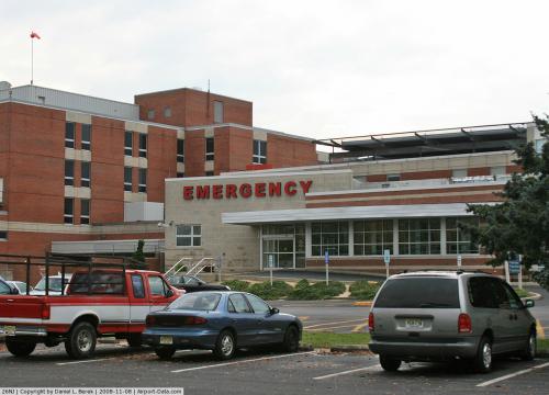 |
(Click on the photo to enlarge) |
Location & QuickFacts
| FAA Information Effective: | 2008-09-25 |
| Airport Identifier: | 26NJ |
| Airport Status: | Operational |
| Longitude/Latitude: | 074-49-00.0000W/39-05-10.0000N
-74.816667/39.086111 (Estimated) |
| Elevation: | 53 ft / 16.15 m (Estimated) |
| Land: | 0 acres |
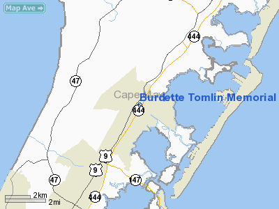
| From nearest city: | 1 nautical miles NE of Cape May Court House, NJ |
| Location: | Cape May County, NJ |
| Magnetic Variation: | 12W (1995) |
Owner & Manager
| Ownership: | Privately owned |
| Owner: | Burdette Tomlin Mem Hospital |
| Address: | Two Stone Harbor Blvd
Cape May Court Hse, NJ 08210 |
| Phone number: | 609-463-2323 |
| Manager: | Adil Osmond |
| Address: | Two Stone Harbor Blvd
Cape May Court Hse, NJ 08210 |
| Phone number: | 609-463-2022 |
Airport Operations and Facilities
| Airport Use: | Private
MEDICAL |
| Wind indicator: | Yes |
| Segmented Circle: | No |
| Control Tower: | No |
| Lighting Schedule: | PHONE REQ
FOR PERIMETER & FLOODLGTS CALL 609-463-2130 10 MINUTES PRIOR TO ETA. |
| Sectional chart: | Washington |
| Region: | AEA - Eastern |
| Boundary ARTCC: | ZDC - Washington |
| Tie-in FSS: | MIV - Millville |
| FSS Toll Free: | 1-800-WX-BRIEF |
Runway Information
Helipad H1
| Dimension: | 45 x 45 ft / 13.7 x 13.7 m |
| Surface: | ROOFTOP, |
| |
Runway H1 |
Runway |
| Traffic Pattern: | Left | Left |
|
Radio Navigation Aids
| ID |
Type |
Name |
Ch |
Freq |
Var |
Dist |
| RNB | NDB | Rainbow | | 363.00 | 11W | 24.9 nm |
| OX | NDB | Landy | | 407.00 | 12W | 47.0 nm |
| DOV | TACAN | Dover | 037X | | 09W | 30.5 nm |
| ATR | VOR/DME | Waterloo | 073X | 112.60 | 09W | 24.8 nm |
| SIE | VORTAC | Sea Isle | 095X | 114.80 | 09W | 0.9 nm |
| ACY | VORTAC | Atlantic City | 023X | 108.60 | 10W | 24.9 nm |
| VCN | VORTAC | Cedar Lake | 099X | 115.20 | 10W | 28.0 nm |
| ENO | VORTAC | Smyrna | 051X | 111.40 | 09W | 33.7 nm |
| OOD | VORTAC | Woodstown | 075X | 112.80 | 10W | 40.0 nm |
| CYN | VORTAC | Coyle | 081X | 113.40 | 10W | 47.4 nm |
Remarks
- FLIGHT PATHS 255 DEG/075 DEG & 150 DEG/330 DEG.
- DAY VFR ONLY; CLEAR 8:1 SLOPE FOR INGRESS/EGRESS; MARK INGRESS/EGRESS ON PAD; MINIMIZE NOISE.
Images and information placed above are from
http://www.airport-data.com/airport/26NJ/
We thank them for the data!
| General Info
|
| Country |
United States
|
| State |
NEW JERSEY
|
| FAA ID |
26NJ
|
| Latitude |
39-05-10.000N
|
| Longitude |
074-49-00.000W
|
| Elevation |
53 feet
|
| Near City |
CAPE MAY COURT HOUSE
|
We don't guarantee the information is fresh and accurate. The data may
be wrong or outdated.
For more up-to-date information please refer to other sources.
|
|


