 |
|
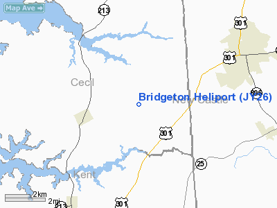
Location & QuickFacts
| FAA Information Effective: | 2008-09-25 |
| Airport Identifier: | JY26 |
| Airport Status: | Operational |
| Longitude/Latitude: | 075-48-58.7600W/39-24-50.4000N
-75.816322/39.414000 (Estimated) |
| Elevation: | 80 ft / 24.38 m (Estimated) |
| Land: | 1 acres |
| From nearest city: | 2 nautical miles SW of Bridgeton, NJ |
| Location: | Cumberland County, NJ |
| Magnetic Variation: | 11W (1995) |
Owner & Manager
| Ownership: | Publicly owned |
| Owner: | Cumberland Co |
| Address: | 790 E Commerce St
Bridgeton, NJ 08302 |
| Phone number: | 609-453-2138 |
| Manager: | David Gray |
| Address: | 790 E Commerce St
Bridgeton, NJ 08302 |
| Phone number: | 609-453-2195 |
Airport Operations and Facilities
| Airport Use: | Private |
| Wind indicator: | Yes |
| Segmented Circle: | No |
| Control Tower: | No |
| Sectional chart: | Washington |
| Region: | AEA - Eastern |
| Boundary ARTCC: | ZDC - Washington |
| Tie-in FSS: | MIV - Millville |
| FSS Toll Free: | 1-800-WX-BRIEF |
Runway Information
Helipad H1
| Dimension: | 300 x 300 ft / 91.4 x 91.4 m |
| Surface: | TURF, Good Condition |
| |
Runway H1 |
Runway |
| Traffic Pattern: | Left | Left |
|
Radio Navigation Aids
| ID |
Type |
Name |
Ch |
Freq |
Var |
Dist |
| APG | NDB | Aberdeen | | 349.00 | 11W | 15.3 nm |
| MTN | NDB | Martin | | 342.00 | 11W | 27.1 nm |
| RNB | NDB | Rainbow | | 363.00 | 11W | 31.6 nm |
| IUB | NDB | Institute | | 404.00 | 08W | 38.4 nm |
| ESN | NDB | Easton | | 212.00 | 10W | 38.5 nm |
| FND | NDB | Ellicott | | 371.00 | 11W | 45.3 nm |
| BUH | NDB | Anne Arundel | | 260.00 | 10W | 48.2 nm |
| ING | NDB | Ambler | | 275.00 | 11W | 49.3 nm |
| DOV | TACAN | Dover | 037X | | 09W | 23.5 nm |
| MTN | TACAN | Martin | 068X | | 11W | 28.1 nm |
| PPM | VOR/DME | Phillips | 021X | 108.40 | 09W | 16.8 nm |
| ATR | VOR/DME | Waterloo | 073X | 112.60 | 09W | 46.0 nm |
| ENO | VORTAC | Smyrna | 051X | 111.40 | 09W | 17.8 nm |
| DQO | VORTAC | Dupont | 087X | 114.00 | 10W | 18.6 nm |
| OOD | VORTAC | Woodstown | 075X | 112.80 | 10W | 27.3 nm |
| MXE | VORTAC | Modena | 079X | 113.20 | 09W | 31.0 nm |
| VCN | VORTAC | Cedar Lake | 099X | 115.20 | 10W | 40.1 nm |
| BAL | VORTAC | Baltimore | 098X | 115.10 | 11W | 41.9 nm |
| LRP | VORTAC | Lancaster | 120X | 117.30 | 09W | 47.8 nm |
| PHL | VOT | Philadelphia Intl | | 109.80 | | 38.1 nm |
Remarks
- PRVDD VFR ONLY, 8:1 INGRESS/EGRESS PER AC 150/5390-2A, CONTROL VEHICULAR TFC, MARK APPROPRIATELY, HELICOPTER OPERATORS MADE AWARE OF WATER TWR CLOSE TO PAD.
Images and information placed above are from
http://www.airport-data.com/airport/JY26/
We thank them for the data!
| General Info
|
| Country |
United States
|
| State |
NEW JERSEY
|
| FAA ID |
JY26
|
| Latitude |
39-24-50.400N
|
| Longitude |
075-48-58.760W
|
| Elevation |
80 feet
|
| Near City |
BRIDGETON
|
We don't guarantee the information is fresh and accurate. The data may
be wrong or outdated.
For more up-to-date information please refer to other sources.
|
|


