 |
|
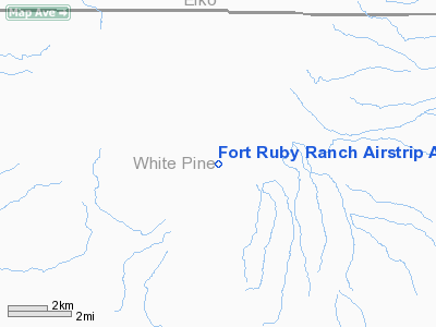
Fort Ruby Ranch Airstrip Airport |
Location & QuickFacts
| FAA Information Effective: | 2008-09-25 |
| Airport Identifier: | NV24 |
| Airport Status: | Operational |
| Longitude/Latitude: | 115-30-21.1620W/40-03-28.7480N
-115.505878/40.057986 (Estimated) |
| Elevation: | 6006 ft / 1830.63 m (Surveyed) |
| Land: | 8 acres |
| From nearest city: | 21 nautical miles SW of Ruby Valley, NV |
| Location: | White Pine County, NV |
| Magnetic Variation: | 15E (1985) |
Owner & Manager
| Ownership: | Privately owned |
| Owner: | Lynn Goodfellow |
| Address: | Lynn Goodfellow Corp
Bolder City, NV 89006 |
| Phone number: | 702-293-7504 |
| Manager: | Kim D. Hanson |
| Address: | Hc 60 Box 860
Ruby Valley, NV 89833 |
| Phone number: | 702-779-2237 |
Airport Operations and Facilities
| Airport Use: | Private |
| Wind indicator: | Yes |
| Segmented Circle: | Yes
SEGMENTED CIRCLE NON-STD SMALLER THAN NORMAL. |
| Control Tower: | No |
| Landing fee charge: | No |
| Sectional chart: | Salt Lake City |
| Region: | AWP - Western-Pacific |
| Boundary ARTCC: | ZLC - Salt Lake City |
| Tie-in FSS: | RNO - Reno |
| FSS on Airport: | No |
| FSS Toll Free: | 1-800-WX-BRIEF |
Airport Services
| Airframe Repair: | NONE |
| Power Plant Repair: | NONE |
| Bottled Oxygen: | NONE |
| Bulk Oxygen: | NONE |
Runway Information
Runway 09/27
| Dimension: | 4500 x 60 ft / 1371.6 x 18.3 m |
| Surface: | DIRT, Fair Condition |
| |
Runway 09 |
Runway 27 |
| Traffic Pattern: | Left | Left |
| Markings: | None, | None, |
| Obstruction: | 25 ft bldg, 500.0 ft from runway, 150 ft right of centerline, 20:1 slope to clear | 250 ft hill, 2500.0 ft from runway, 10:1 slope to clear
+4 FT FENCE POSTS 20-30 FT FM RY EDGE L & R 550 FT. |
|
Radio Navigation Aids
| ID |
Type |
Name |
Ch |
Freq |
Var |
Dist |
| BQU | VOR/DME | Bullion | 092X | 114.50 | 17E | 43.8 nm |
Remarks
- ACFT PARKING WITHIN 6 FT FENCED AREA 40 FT SOUTH OF RY 09 CNTRLN.
- CATTLE ON & INVOF ARPT.
- RWY NOT MAINT DURG WINTER MONTHS.
- EXISTED PRIOR TO DEC 31 1958.
Images and information placed above are from
http://www.airport-data.com/airport/NV24/
We thank them for the data!
| General Info
|
| Country |
United States
|
| State |
NEVADA
|
| FAA ID |
NV24
|
| Latitude |
40-03-28.748N
|
| Longitude |
115-30-21.162W
|
| Elevation |
6006 feet
|
| Near City |
RUBY VALLEY
|
We don't guarantee the information is fresh and accurate. The data may
be wrong or outdated.
For more up-to-date information please refer to other sources.
|
|


