 |
|
| Fallon Municipal Airport |
| IATA: FLX – ICAO: KFLX – FAA LID: FLX |
| Summary |
| Airport type |
Public |
| Owner |
City of Fallon |
| Serves |
Fallon, Nevada |
| Elevation AMSL |
3,963 ft / 1,208 m |
| Coordinates |
39°29′57″N 118°44′56″W / 39.49917°N 118.74889°W / 39.49917; -118.74889 |
| Runways |
| Direction |
Length |
Surface |
| ft |
m |
| 3/21 |
5,703 |
1,738 |
Asphalt |
| 13/31 |
4,207 |
1,282 |
Dirt |
| Statistics (2009) |
| Aircraft operations |
6,300 |
| Based aircraft |
26 |
| Source: Federal Aviation Administration |
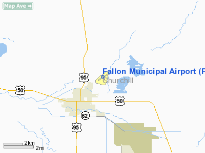
Fallon Municipal Airport (IATA: FLX, ICAO: KFLX, FAA LID: FLX) is a city-owned public-use airport located two nautical miles (3.7 km) northeast of the central business district of Fallon, a city in Churchill County, Nevada, United States.
Facilities and aircraft
Fallon Municipal Airport covers an area of 440 acres (178 ha) at an elevation of 3,963 feet (1,208 m) above mean sea level. It has two runways: 3/21 is 5,703 by 75 feet (1,738 x 23 m) with an asphalt surface; 13/31 is 4,207 by 100 feet (1,282 x 30 m) with a dirt surface.
For the 12-month period ending November 30, 2009, the airport had 6,300 aircraft operations, an average of 17 per day: 67% general aviation, 32% air taxi, and 2% military. At that time there were 26 aircraft based at this airport: 77% single-engine, 4% multi-engine, and 19% ultralight.
The above content comes from Wikipedia and is published under free licenses – click here to read more.
Location & QuickFacts
| FAA Information Effective: | 2008-09-25 |
| Airport Identifier: | FLX |
| Airport Status: | Operational |
| Longitude/Latitude: | 118-44-55.5000W/39-29-56.7000N
-118.748750/39.499083 (Estimated) |
| Elevation: | 3963 ft / 1207.92 m (Surveyed) |
| Land: | 440 acres |
| From nearest city: | 2 nautical miles NE of Fallon, NV |
| Location: | Churchill County, NV |
| Magnetic Variation: | 17E (1980) |
Owner & Manager
| Ownership: | Publicly owned |
| Owner: | City Of Fallon |
| Address: | 55 West Williams Ave
Fallon, NV 89406 |
| Phone number: | 775-423-5107 |
| Manager: | Larry White
CITY ENGINEER. |
| Address: | 55 West Williams Ave
Fallon, NV 89406 |
| Phone number: | 775-423-5107 |
Airport Operations and Facilities
| Airport Use: | Open to public |
| Wind indicator: | Yes |
| Segmented Circle: | Yes |
| Control Tower: | No |
| Lighting Schedule: | DUSK-DAWN |
| Beacon Color: | Clear-Green (lighted land airport) |
| Landing fee charge: | No |
| Sectional chart: | San Francisco |
| Region: | AWP - Western-Pacific |
| Traffic Pattern Alt: | 800 ft |
| Boundary ARTCC: | ZOA - Oakland |
| Tie-in FSS: | RNO - Reno |
| FSS on Airport: | No |
| FSS Toll Free: | 1-800-WX-BRIEF |
| NOTAMs Facility: | RNO (NOTAM-d service avaliable) |
| Federal Agreements: | NGSY |
Airport Communications
| CTAF: | 122.800 |
| Unicom: | 122.800 |
Airport Services
| Fuel available: | 100 A |
| Airframe Repair: | MAJOR |
| Power Plant Repair: | MAJOR |
| Bottled Oxygen: | LOW |
| Bulk Oxygen: | NONE |
Runway Information
Runway 03/21
| Dimension: | 5703 x 75 ft / 1738.3 x 22.9 m |
| Surface: | ASPH, Good Condition |
| Weight Limit: | Single wheel: 17000 lbs. |
| Edge Lights: | Medium |
| |
Runway 03 |
Runway 21 |
| Longitude: | 118-45-23.6998W | 118-44-29.2450W |
| Latitude: | 39-29-39.6738N | 39-30-17.0327N |
| Elevation: | 3966.00 ft | 3961.00 ft |
| Alignment: | 48 | 127 |
| Traffic Pattern: | Left | Left |
| Markings: | Basic, Good Condition | Basic, Good Condition |
| Crossing Height: | 49.00 ft | 40.00 ft |
| Displaced threshold: | 100.00 ft | 0.00 ft |
| VASI: | 2-light PAPI on left side | 2-light PAPI on left side |
| Visual Glide Angle: | 3.00° | 3.00° |
| Obstruction: | 14 ft road, 475.0 ft from runway, 19:1 slope to clear
APCH RATIO 41:1 TO DSPLCD THR. | 66 ft trees, 1900.0 ft from runway, 100 ft right of centerline, 25:1 slope to clear |
|
Runway 13/31
| Dimension: | 4207 x 100 ft / 1282.3 x 30.5 m |
| Surface: | DIRT, Fair Condition |
| |
Runway 13 |
Runway 31 |
| Longitude: | 118-45-09.2812W | 118-44-38.9855W |
| Latitude: | 39-30-11.5715N | 39-29-37.2654N |
| Elevation: | 3959.00 ft | 3959.00 ft |
| Alignment: | 127 | 127 |
| Traffic Pattern: | Left | Left |
| Obstruction: | 50 ft trees, 250.0 ft from runway, 5:1 slope to clear | 5 ft fence, 50.0 ft from runway, 10:1 slope to clear |
|
Radio Navigation Aids
| ID |
Type |
Name |
Ch |
Freq |
Var |
Dist |
| NFL | TACAN | Fallon | 082X | | 16E | 5.3 nm |
| HZN | VORTAC | Hazen | 088X | 114.10 | 17E | 11.6 nm |
| LLC | VORTAC | Lovelock | 112X | 116.50 | 16E | 38.4 nm |
| FMG | VORTAC | Mustang | 126X | 117.90 | 16E | 42.1 nm |
Remarks
- ULTRALIGHT ACTIVITY INVOF ARPT.
Images and information placed above are from
http://www.airport-data.com/airport/FLX/
We thank them for the data!
| General Info
|
| Country |
United States
|
| State |
NEVADA
|
| FAA ID |
FLX
|
| Latitude |
39-29-56.700N
|
| Longitude |
118-44-55.500W
|
| Elevation |
3963 feet
|
| Near City |
FALLON
|
We don't guarantee the information is fresh and accurate. The data may
be wrong or outdated.
For more up-to-date information please refer to other sources.
|
|


