 |
|
Location & QuickFacts
| FAA Information Effective: | 2008-09-25 |
| Airport Identifier: | LCG |
| Airport Status: | Operational |
| Longitude/Latitude: | 096-58-53.1000W/42-14-30.8000N
-96.981417/42.241889 (Estimated) |
| Elevation: | 1431 ft / 436.17 m (Surveyed) |
| Land: | 281 acres |
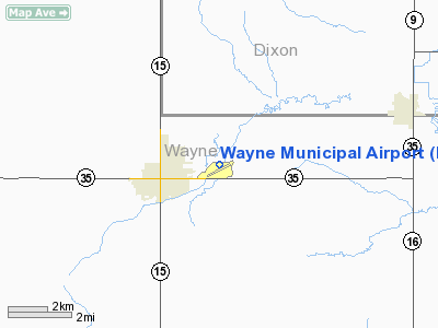
| From nearest city: | 2 nautical miles E of Wayne, NE |
| Location: | Wayne County, NE |
| Magnetic Variation: | 06E (1990) |
Owner & Manager
| Ownership: | Publicly owned |
| Owner: | Wayne Airport Authority |
| Address: | P.o. Box 8
Wayne, NE 68787-1440 |
| Phone number: | 402-375-1733
MITCHELL NISSEN ,CHMN OF ARPT AUTHORITY; RES PHONE 402-375-3880. |
| Manager: | Clay Bode |
| Address: | 2304 East Highway 35
Wayne, NE 68787-8088 |
| Phone number: | 402-375-1984 |
Airport Operations and Facilities
| Airport Use: | Open to public |
| Wind indicator: | Yes |
| Segmented Circle: | Yes |
| Control Tower: | No |
| Lighting Schedule: | DUSK-DAWN
MIRL RYS 17/35; 04/22 OPR SS-2300; AFTER 2300 ACTVT - 122.8. |
| Beacon Color: | Clear-Green (lighted land airport) |
| Landing fee charge: | No |
| Sectional chart: | Omaha |
| Region: | ACE - Central |
| Boundary ARTCC: | ZMP - Minneapolis |
| Tie-in FSS: | OLU - Columbus |
| FSS on Airport: | No |
| FSS Toll Free: | 1-800-WX-BRIEF |
| NOTAMs Facility: | LCG (NOTAM-d service avaliable) |
| Federal Agreements: | NGY |
Airport Communications
| CTAF: | 122.800 |
| Unicom: | 122.800 |
Airport Services
| Fuel available: | 100LL |
| Airframe Repair: | MAJOR |
| Power Plant Repair: | MAJOR |
| Bottled Oxygen: | NONE |
| Bulk Oxygen: | LOW |
Runway Information
Runway 04/22
| Dimension: | 3407 x 60 ft / 1038.5 x 18.3 m |
| Surface: | ASPH, Good Condition |
| Weight Limit: | Single wheel: 12500 lbs. |
| Edge Lights: | Medium |
| |
Runway 04 |
Runway 22 |
| Longitude: | 096-59-16.2890W | 096-58-39.6150W |
| Latitude: | 42-14-15.0610N | 42-14-34.8130N |
| Elevation: | 1431.00 ft | 1426.00 ft |
| Alignment: | 54 | 127 |
| Traffic Pattern: | Left | Left |
| Markings: | Non-precision instrument, Good Condition | Non-precision instrument, Good Condition |
| Obstruction: | 40 ft pole, 1150.0 ft from runway, 23:1 slope to clear | 134 ft hill, 5500.0 ft from runway, 850 ft left of centerline, 39:1 slope to clear |
|
Runway 13/31
| Dimension: | 2000 x 120 ft / 609.6 x 36.6 m |
| Surface: | TURF, Good Condition |
| |
Runway 13 |
Runway 31 |
| Longitude: | 096-59-13.7400W | 096-58-55.2700W |
| Latitude: | 42-14-30.6810N | 42-14-16.4700N |
| Elevation: | 1427.00 ft | 1426.00 ft |
| Alignment: | 127 | 127 |
| Traffic Pattern: | Left | Left |
| Obstruction: | 4 ft fence, 150.0 ft from runway, 37:1 slope to clear | 25 ft road, 860.0 ft from runway, 34:1 slope to clear |
|
Runway 17/35
| Dimension: | 4200 x 75 ft / 1280.2 x 22.9 m |
| Surface: | ASPH, Good Condition |
| Weight Limit: | Single wheel: 12500 lbs. |
| Edge Lights: | Medium |
| |
Runway 17 |
Runway 35 |
| Longitude: | 096-58-48.3800W | 096-58-49.8110W |
| Latitude: | 42-14-56.3600N | 42-14-14.8830N |
| Elevation: | 1427.00 ft | 1431.00 ft |
| Alignment: | 127 | 1 |
| Traffic Pattern: | Left | Left |
| Markings: | Non-precision instrument, Good Condition | Non-precision instrument, Good Condition |
| Crossing Height: | 40.00 ft | 40.00 ft |
| VASI: | 2-light PAPI on left side | 2-light PAPI on left side |
| Visual Glide Angle: | 3.00° | 3.00° |
| Obstruction: | , 50:1 slope to clear | 22 ft road, 660.0 ft from runway, 20:1 slope to clear |
|
Radio Navigation Aids
| ID |
Type |
Name |
Ch |
Freq |
Var |
Dist |
| LCG | NDB | Wayne | | 389.00 | 06E | 0.1 nm |
| OI | NDB | Tommi | | 305.00 | 07E | 26.5 nm |
| GAK | NDB | Sioux Gateway | | 233.00 | 06E | 28.3 nm |
| OF | NDB | Carsy | | 510.00 | 08E | 30.8 nm |
| SU | NDB | Salix | | 414.00 | 07E | 31.2 nm |
| VMR | NDB | Vermillion | | 375.00 | 06E | 31.4 nm |
| PLT | NDB | Platte Center | | 407.00 | 08E | 48.3 nm |
| TQE | VOR | Tekamah | | 108.40 | 07E | 46.1 nm |
| OFK | VOR/DME | Norfolk | 033X | 109.60 | 08E | 25.3 nm |
| SCB | VOR/DME | Scribner | 47X | 111.00 | 06E | 41.4 nm |
| YKN | VOR/DME | Yankton | 051X | 111.40 | 07E | 44.4 nm |
| SUX | VORTAC | Sioux City | 112X | 116.50 | 09E | 29.9 nm |
Remarks
- DEER ON AND INVOF ARPT.
- TAXI LGTS AER 04 ONLY.
- PROVIDED APPROACH TO EACH RUNWY IS MAINTAINED FOR A MINIMUM 20:1 GLIDE SLOPE & THE TRANSITIONAL SURFACE BE MAINTAINED FOR A 7:1 SLOPE.
Images and information placed above are from
http://www.airport-data.com/airport/LCG/
We thank them for the data!
| General Info
|
| Country |
United States
|
| State |
NEBRASKA
|
| FAA ID |
LCG
|
| Latitude |
42-14-30.800N
|
| Longitude |
096-58-53.100W
|
| Elevation |
1431 feet
|
| Near City |
WAYNE
|
We don't guarantee the information is fresh and accurate. The data may
be wrong or outdated.
For more up-to-date information please refer to other sources.
|
|


