 |
|
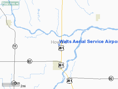
Walts Aerial Service Airport |
Location & QuickFacts
| FAA Information Effective: | 2008-09-25 |
| Airport Identifier: | NE17 |
| Airport Status: | Operational |
| Longitude/Latitude: | 098-27-21.2500W/41-14-55.0450N
-98.455903/41.248624 (Estimated) |
| Elevation: | 1795 ft / 547.12 m (Estimated) |
| Land: | 28 acres |
| From nearest city: | 2 nautical miles N of St Paul, NE |
| Location: | Howard County, NE |
| Magnetic Variation: | 07E (1985) |
Owner & Manager
| Ownership: | Privately owned |
| Owner: | J & R Aviation Inc |
| Address: | Box 66
St Paul, NE 68873 |
| Phone number: | 308-754-5231 |
| Manager: | Joe Rozmiarek |
| Address: | Box 152a
St Paul, NE 68873 |
| Phone number: | 308-754-5231 |
Airport Operations and Facilities
| Airport Use: | Private |
| Wind indicator: | Yes |
| Segmented Circle: | No |
| Control Tower: | No |
| Landing fee charge: | No |
| Sectional chart: | Omaha |
| Region: | ACE - Central |
| Boundary ARTCC: | ZMP - Minneapolis |
| Tie-in FSS: | OLU - Columbus |
| FSS on Airport: | No |
| FSS Toll Free: | 1-800-WX-BRIEF |
Airport Services
| Fuel available: | 100LL |
| Airframe Repair: | NONE |
| Power Plant Repair: | NONE |
| Bottled Oxygen: | NONE |
| Bulk Oxygen: | NONE |
Runway Information
Runway 17/35
| Dimension: | 2200 x 25 ft / 670.6 x 7.6 m |
| Surface: | ASPH, Fair Condition |
| |
Runway 17 |
Runway 35 |
| Traffic Pattern: | Left | Left |
| Obstruction: | 22 ft tower, 750.0 ft from runway, 125 ft right of centerline, 25:1 slope to clear | 36 ft pole, 205.0 ft from runway, 116 ft left of centerline
+4' FENCE 160' FROM THR ON CNTRLN EXTDD. |
|
Radio Navigation Aids
| ID |
Type |
Name |
Ch |
Freq |
Var |
Dist |
| ODX | NDB | Ord | | 356.00 | 07E | 31.6 nm |
| PSS | NDB | Prosser | | 338.00 | 07E | 33.8 nm |
| BVN | NDB | Alaby | | 332.00 | 06E | 34.1 nm |
| JYR | NDB | York | | 257.00 | 06E | 43.5 nm |
| BUB | NDB | Burwell | | 377.00 | 07E | 44.3 nm |
| EAR | VOR | Kearney | | 111.20 | 10E | 40.1 nm |
| HSI | VOR/DME | Hastings | 025X | 108.80 | 07E | 38.7 nm |
| OBH | VORTAC | Wolbach | 095X | 114.80 | 07E | 8.9 nm |
| GRI | VORTAC | Grand Island | 057X | 112.00 | 07E | 17.1 nm |
Remarks
- PROVIDED APPROACH TO EACH RY IS MAINTD FOR A MINIMUM 20:1 GLIDE SLOPE & TRANSITIONAL SURFACE BE MAINTD FOR A 7:1 SLOPE.
Images and information placed above are from
http://www.airport-data.com/airport/NE17/
We thank them for the data!
| General Info
|
| Country |
United States
|
| State |
NEBRASKA
|
| FAA ID |
NE17
|
| Latitude |
41-14-55.045N
|
| Longitude |
098-27-21.250W
|
| Elevation |
1795 feet
|
| Near City |
ST PAUL
|
We don't guarantee the information is fresh and accurate. The data may
be wrong or outdated.
For more up-to-date information please refer to other sources.
|
|


