 |
|
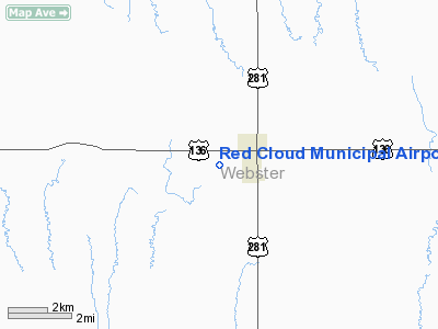
Location & QuickFacts
| FAA Information Effective: | 2008-09-25 |
| Airport Identifier: | 7V7 |
| Airport Status: | Operational |
| Longitude/Latitude: | 098-32-28.9000W/40-04-55.8000N
-98.541361/40.082167 (Estimated) |
| Elevation: | 1744 ft / 531.57 m (Surveyed) |
| Land: | 164 acres |
| From nearest city: | 1 nautical miles W of Red Cloud, NE |
| Location: | Webster County, NE |
| Magnetic Variation: | 08E (1985) |
Owner & Manager
| Ownership: | Publicly owned |
| Owner: | Red Cloud Airport Authority
DAYRE WILLIAMS CHAIRMAN. |
| Address: | Po Box 469
Red Cloud, NE 68970 |
| Phone number: | 402-746-3297 |
| Manager: | Dayre Williams |
| Address: | 241 West 4th Avenue
Red Cloud, NE 68970 |
| Phone number: | 402-746-3297 |
Airport Operations and Facilities
| Airport Use: | Open to public |
| Wind indicator: | Yes |
| Segmented Circle: | Yes |
| Control Tower: | No |
| Lighting Schedule: | DUSK-DAWN
ACTVT MIRL RY 15/33 - CTAF |
| Beacon Color: | Clear-Green (lighted land airport) |
| Landing fee charge: | No |
| Sectional chart: | Omaha |
| Region: | ACE - Central |
| Boundary ARTCC: | ZMP - Minneapolis |
| Tie-in FSS: | OLU - Columbus |
| FSS on Airport: | No |
| FSS Toll Free: | 1-800-WX-BRIEF |
| NOTAMs Facility: | OLU (NOTAM-d service avaliable) |
| Federal Agreements: | NGY |
Airport Communications
Airport Services
| Fuel available: | 100LL
FOR FUEL CALL (402) 746-3297. |
| Airframe Repair: | NONE |
| Power Plant Repair: | NONE |
| Bottled Oxygen: | NONE |
| Bulk Oxygen: | NONE |
Runway Information
Runway 15/33
| Dimension: | 3701 x 60 ft / 1128.1 x 18.3 m |
| Surface: | CONC, Good Condition |
| Weight Limit: | Single wheel: 12500 lbs. |
| Edge Lights: | Medium |
| |
Runway 15 |
Runway 33 |
| Longitude: | 098-32-35.9000W | 098-32-21.8817W |
| Latitude: | 40-05-13.2776N | 40-04-38.3173N |
| Elevation: | 1744.00 ft | 1717.00 ft |
| Traffic Pattern: | Left | Left |
| Markings: | Basic, Good Condition | Basic, Good Condition |
| Obstruction: | 20 ft road, 610.0 ft from runway, 20:1 slope to clear | , 50:1 slope to clear |
|
Radio Navigation Aids
| ID |
Type |
Name |
Ch |
Freq |
Var |
Dist |
| PSS | NDB | Prosser | | 338.00 | 07E | 36.4 nm |
| PHG | NDB | Phillipsburg | | 368.00 | 08E | 41.2 nm |
| HDE | NDB | Holdrege | | 396.00 | 07E | 42.8 nm |
| RPB | NDB | Republican | | 414.00 | 07E | 43.8 nm |
| HJH | NDB | Hebron | | 323.00 | 06E | 44.0 nm |
| EAR | VOR | Kearney | | 111.20 | 10E | 44.1 nm |
| HSI | VOR/DME | Hastings | 025X | 108.80 | 07E | 31.8 nm |
| TKO | VORTAC | Mankato | 035X | 109.80 | 10E | 21.0 nm |
Images and information placed above are from
http://www.airport-data.com/airport/7V7/
We thank them for the data!
| General Info
|
| Country |
United States
|
| State |
NEBRASKA
|
| FAA ID |
7V7
|
| Latitude |
40-05-05.048N
|
| Longitude |
098-32-26.221W
|
| Elevation |
1742 feet
|
| Near City |
RED CLOUD
|
We don't guarantee the information is fresh and accurate. The data may
be wrong or outdated.
For more up-to-date information please refer to other sources.
|
|


