 |
|
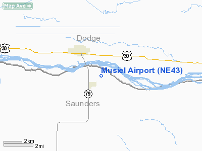
Location & QuickFacts
| FAA Information Effective: | 2008-09-25 |
| Airport Identifier: | NE43 |
| Airport Status: | Operational |
| Longitude/Latitude: | 096-45-15.1000W/41-26-23.0100N
-96.754194/41.439725 (Estimated) |
| Elevation: | 1230 ft / 374.90 m (Estimated) |
| Land: | 0 acres |
| From nearest city: | 2 nautical miles NE of Morse Bluff, NE |
| Location: | Saunders County, NE |
| Magnetic Variation: | 06E (1995) |
Owner & Manager
| Ownership: | Privately owned |
| Owner: | Edward H Musiel |
| Address: | 2940 Co Rd 25
Morse Bluff, NE 68648 |
| Phone number: | 402-663-4468 |
| Manager: | Bub Musiel |
| Address: | 2940 Co Rd 25
Morse Bluff, NE 68648 |
| Phone number: | 402-666-5528 |
Airport Operations and Facilities
| Airport Use: | Private |
| Segmented Circle: | No |
| Control Tower: | No |
| Sectional chart: | Omaha |
| Region: | ACE - Central |
| Boundary ARTCC: | ZMP - Minneapolis |
| Tie-in FSS: | OLU - Columbus |
| FSS on Airport: | No |
| FSS Toll Free: | 1-800-WX-BRIEF |
Airport Services
Runway Information
Runway 18/36
| Dimension: | 1440 x 50 ft / 438.9 x 15.2 m |
| Surface: | TURF, |
| |
Runway 18 |
Runway 36 |
| Traffic Pattern: | Left | Left |
|
Radio Navigation Aids
| ID |
Type |
Name |
Ch |
Freq |
Var |
Dist |
| FET | NDB | Fremont | | 311.00 | 06E | 10.7 nm |
| AHQ | NDB | Wahoo | | 400.00 | 07E | 14.0 nm |
| PLT | NDB | Platte Center | | 407.00 | 08E | 28.5 nm |
| MLE | NDB | Millard | | 371.00 | 06E | 32.4 nm |
| OM | NDB | Gerfi | | 320.00 | 05E | 36.2 nm |
| SWT | NDB | Seward | | 269.00 | 06E | 38.4 nm |
| LN | NDB | Potts | | 385.00 | 06E | 41.6 nm |
| OF | NDB | Carsy | | 510.00 | 08E | 42.3 nm |
| PMV | NDB | Plattsmouth | | 329.00 | 06E | 48.4 nm |
| LCG | NDB | Wayne | | 389.00 | 06E | 49.3 nm |
| OFF | TACAN | Offutt | 054X | | 05E | 43.2 nm |
| TQE | VOR | Tekamah | | 108.40 | 07E | 32.2 nm |
| SCB | VOR/DME | Scribner | 47X | 111.00 | 06E | 11.4 nm |
| OLU | VOR/DME | Columbus | 055X | 111.80 | 08E | 26.4 nm |
| OFK | VOR/DME | Norfolk | 033X | 109.60 | 08E | 44.9 nm |
| LNK | VORTAC | Lincoln | 108X | 116.10 | 09E | 31.0 nm |
| OVR | VORTAC | Omaha | 110X | 116.30 | 08E | 48.8 nm |
| OMA | VOT | Omaha | | 109.00 | | 40.1 nm |
Remarks
- PRVDD MAINTAIN CLEAR 20:1 APCH AND CLEAR 7:1 TRANSITIONAL SFC.
Images and information placed above are from
http://www.airport-data.com/airport/NE43/
We thank them for the data!
| General Info
|
| Country |
United States
|
| State |
NEBRASKA
|
| FAA ID |
NE43
|
| Latitude |
41-26-23.010N
|
| Longitude |
096-45-15.100W
|
| Elevation |
1230 feet
|
| Near City |
MORSE BLUFF
|
We don't guarantee the information is fresh and accurate. The data may
be wrong or outdated.
For more up-to-date information please refer to other sources.
|
|


