 |
|
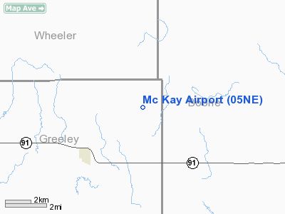
Location & QuickFacts
| FAA Information Effective: | 2008-09-25 |
| Airport Identifier: | 05NE |
| Airport Status: | Operational |
| Longitude/Latitude: | 098-18-32.2500W/41-43-20.0390N
-98.308958/41.722233 (Estimated) |
| Elevation: | 2010 ft / 612.65 m (Estimated) |
| Land: | 0 acres |
| From nearest city: | 3 nautical miles NE of Spalding, NE |
| Location: | Greeley County, NE |
| Magnetic Variation: | 07E (1985) |
Owner & Manager
| Ownership: | Privately owned |
| Owner: | Dennis E. Mc Kay |
| Address: | 50918 821st Rd
Spalding, NE 68665 |
| Phone number: | 308-497-2184 |
| Manager: | Dennis E. Mc Kay |
| Address: | 50918 821st Rd
Spalding, NE 68665 |
| Phone number: | 308-497-2184 |
Airport Operations and Facilities
| Airport Use: | Private |
| Wind indicator: | Yes |
| Segmented Circle: | No |
| Control Tower: | No |
| Landing fee charge: | No |
| Sectional chart: | Omaha |
| Region: | ACE - Central |
| Boundary ARTCC: | ZMP - Minneapolis |
| Tie-in FSS: | OLU - Columbus |
| FSS on Airport: | No |
| FSS Toll Free: | 1-800-WX-BRIEF |
Runway Information
Runway 15/33
| Dimension: | 3210 x 80 ft / 978.4 x 24.4 m |
| Surface: | TURF, |
| |
Runway 15 |
Runway 33 |
| Traffic Pattern: | Right | Left |
| Obstruction: | 40 ft pline, 80.0 ft from runway | 40 ft |
|
Radio Navigation Aids
| ID |
Type |
Name |
Ch |
Freq |
Var |
Dist |
| BVN | NDB | Alaby | | 332.00 | 06E | 11.5 nm |
| ODX | NDB | Ord | | 356.00 | 07E | 29.3 nm |
| BUB | NDB | Burwell | | 377.00 | 07E | 37.6 nm |
| OF | NDB | Carsy | | 510.00 | 08E | 38.4 nm |
| PLT | NDB | Platte Center | | 407.00 | 08E | 43.8 nm |
| OFK | VOR/DME | Norfolk | 033X | 109.60 | 08E | 42.3 nm |
| OLU | VOR/DME | Columbus | 055X | 111.80 | 08E | 46.5 nm |
| OBH | VORTAC | Wolbach | 095X | 114.80 | 07E | 20.9 nm |
| GRI | VORTAC | Grand Island | 057X | 112.00 | 07E | 44.4 nm |
| ONL | VORTAC | O'neill | 086X | 113.90 | 10E | 48.0 nm |
Remarks
- (E111-2) THAT THE APCH TO EACH RWY IS MAINTAINED FOR A MIN 20:1 GLIDE SLOPE AND THAT THE TRANSITIONAL SFC BE MAINTAINED FOR A 7:1 SLOPE.
- OPERATION OF THIS AIRPORT AFFECTS THE SAFE & EFFICIENT UTILIZATION OF AIRSPACE DUE TO CONFLICTING TRAFFIC PATTERNS WITH GLASER AIRPORT. THIS AGREEMENT SHALL REQUIRE THAT USERS OF THESE TWO ARPTS FLY TFC PATS TO THE WEST OF GLASER ARPT AND TO THE EAST OF MCKAY FIELD ARPT;
Images and information placed above are from
http://www.airport-data.com/airport/05NE/
We thank them for the data!
| General Info
|
| Country |
United States
|
| State |
NEBRASKA
|
| FAA ID |
05NE
|
| Latitude |
41-43-20.039N
|
| Longitude |
098-18-32.250W
|
| Elevation |
2010 feet
|
| Near City |
SPALDING
|
We don't guarantee the information is fresh and accurate. The data may
be wrong or outdated.
For more up-to-date information please refer to other sources.
|
|


