 |
|
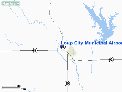
Location & QuickFacts
| FAA Information Effective: | 2008-09-25 |
| Airport Identifier: | 0F4 |
| Airport Status: | Operational |
| Longitude/Latitude: | 098-59-24.7732W/41-17-12.0377N
-98.990215/41.286677 (Estimated) |
| Elevation: | 2071 ft / 631.24 m (Estimated) |
| Land: | 284 acres |
| From nearest city: | 1 nautical miles NW of Loup City, NE |
| Location: | Sherman County, NE |
| Magnetic Variation: | 06E (2005) |
Owner & Manager
| Ownership: | Publicly owned |
| Owner: | Loup City Airport Authority |
| Address: | Po Box 29
Loup City, NE 68853-0029 |
| Phone number: | 308-745-0602 |
| Manager: | Mike King |
| Address: | 635 O Street
Loup City, NE 68853-8003 |
| Phone number: | 308-745-1244 |
Airport Operations and Facilities
| Airport Use: | Open to public |
| Wind indicator: | Yes |
| Segmented Circle: | Yes |
| Control Tower: | No |
| Lighting Schedule: | DUSK-DAWN |
| Beacon Color: | Clear-Green (lighted land airport) |
| Landing fee charge: | No |
| Sectional chart: | Omaha |
| Region: | ACE - Central |
| Boundary ARTCC: | ZMP - Minneapolis |
| Tie-in FSS: | OLU - Columbus |
| FSS on Airport: | No |
| FSS Toll Free: | 1-800-WX-BRIEF |
| NOTAMs Facility: | OLU (NOTAM-d service avaliable) |
| Federal Agreements: | NGY |
Airport Communications
Airport Services
| Fuel available: | 100LL |
| Bottled Oxygen: | NONE |
| Bulk Oxygen: | NONE |
Runway Information
Runway 04/22
| Dimension: | 2040 x 100 ft / 621.8 x 30.5 m |
| Surface: | TURF, Fair Condition |
| |
Runway 04 |
Runway 22 |
| Longitude: | 098-59-37.9970W | 098-59-17.4430W |
| Latitude: | 41-17-07.0720N | 41-17-19.9530N |
| Elevation: | 2068.00 ft | 2069.00 ft |
| Alignment: | 50 | 127 |
| Traffic Pattern: | Left | Left |
| Obstruction: | 38 ft tree, 836.0 ft from runway, 75 ft left of centerline, 22:1 slope to clear | 19 ft road, 380.0 ft from runway, 163 ft left of centerline, 20:1 slope to clear |
|
Runway 16/34
| Dimension: | 3200 x 60 ft / 975.4 x 18.3 m |
| Surface: | ASPH, Good Condition |
| Weight Limit: | Single wheel: 12500 lbs. |
| Edge Lights: | Medium |
| |
Runway 16 |
Runway 34 |
| Longitude: | 098-59-28.0419W | 098-59-17.7473W |
| Latitude: | 41-17-26.4148N | 41-16-55.7801N |
| Elevation: | 2071.00 ft | 2066.00 ft |
| Alignment: | 127 | 127 |
| Traffic Pattern: | Left | Left |
| Markings: | Non-precision instrument, Good Condition | Non-precision instrument, Good Condition |
| Obstruction: | , 50:1 slope to clear | 73 ft trees, 1910.0 ft from runway, 270 ft right of centerline, 23:1 slope to clear |
|
Radio Navigation Aids
| ID |
Type |
Name |
Ch |
Freq |
Var |
Dist |
| ODX | NDB | Ord | | 356.00 | 07E | 20.4 nm |
| BUB | NDB | Burwell | | 377.00 | 07E | 30.2 nm |
| BBW | NDB | Broken Bow | | 265.00 | 08E | 30.4 nm |
| PSS | NDB | Prosser | | 338.00 | 07E | 42.9 nm |
| RRX | NDB | Darr | | 326.00 | 07E | 47.4 nm |
| BVN | NDB | Alaby | | 332.00 | 06E | 49.9 nm |
| EAR | VOR | Kearney | | 111.20 | 10E | 33.7 nm |
| CUZ | VOR/DME | Custer County | 19X | 108.20 | 08E | 33.7 nm |
| HSI | VOR/DME | Hastings | 025X | 108.80 | 07E | 48.3 nm |
| OBH | VORTAC | Wolbach | 095X | 114.80 | 07E | 29.2 nm |
| GRI | VORTAC | Grand Island | 057X | 112.00 | 07E | 35.6 nm |
Images and information placed above are from
http://www.airport-data.com/airport/0F4/
We thank them for the data!
| General Info
|
| Country |
United States
|
| State |
NEBRASKA
|
| FAA ID |
0F4
|
| Latitude |
41-17-25.033N
|
| Longitude |
098-59-26.314W
|
| Elevation |
2070 feet
|
| Near City |
LOUP CITY
|
We don't guarantee the information is fresh and accurate. The data may
be wrong or outdated.
For more up-to-date information please refer to other sources.
|
|


