 |
|
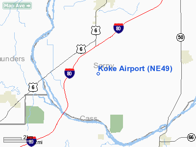
Location & QuickFacts
| FAA Information Effective: | 2008-09-25 |
| Airport Identifier: | NE49 |
| Airport Status: | Operational |
| Longitude/Latitude: | 096-15-01.0590W/41-03-59.9950N
-96.250294/41.066665 (Estimated) |
| Elevation: | 1265 ft / 385.57 m (Estimated) |
| Land: | 0 acres |
| From nearest city: | 5 nautical miles S of Gretna, NE |
| Location: | Sarpy County, NE |
| Magnetic Variation: | 06E (1985) |
Owner & Manager
| Ownership: | Privately owned |
| Owner: | John Koke |
| Address: | 21001 Pflug Road
Gretna, NE 68028 |
| Phone number: | 402-332-4690 |
| Address: |
|
Airport Operations and Facilities
| Airport Use: | Private |
| Wind indicator: | No |
| Segmented Circle: | No |
| Control Tower: | No |
| Landing fee charge: | No |
| Sectional chart: | Omaha |
| Region: | ACE - Central |
| Boundary ARTCC: | ZMP - Minneapolis |
| Tie-in FSS: | OLU - Columbus |
| FSS on Airport: | No |
| FSS Toll Free: | 1-800-WX-BRIEF |
Airport Services
| Airframe Repair: | NONE |
| Power Plant Repair: | NONE |
Runway Information
Runway N/S
| Dimension: | 2400 x 65 ft / 731.5 x 19.8 m |
| Surface: | TURF, |
| |
Runway N |
Runway S |
| Traffic Pattern: | Left | Left |
|
Radio Navigation Aids
| ID |
Type |
Name |
Ch |
Freq |
Var |
Dist |
| MLE | NDB | Millard | | 371.00 | 06E | 9.9 nm |
| PMV | NDB | Plattsmouth | | 329.00 | 06E | 17.0 nm |
| AHQ | NDB | Wahoo | | 400.00 | 07E | 18.9 nm |
| OM | NDB | Gerfi | | 320.00 | 05E | 22.4 nm |
| FET | NDB | Fremont | | 311.00 | 06E | 26.0 nm |
| LN | NDB | Potts | | 385.00 | 06E | 30.2 nm |
| AFK | NDB | Nebraska City | | 347.00 | 05E | 32.9 nm |
| SWT | NDB | Seward | | 269.00 | 06E | 41.0 nm |
| SDA | NDB | Shenandoah | | 411.00 | 05E | 42.7 nm |
| AYB | NDB | Auburn | | 430.00 | 05E | 43.0 nm |
| RDK | NDB | Red Oak | | 230.00 | 04E | 45.3 nm |
| BJU | NDB | Big Blue | | 248.00 | 06E | 49.4 nm |
| OFF | TACAN | Offutt | 054X | | 05E | 16.2 nm |
| TQE | VOR | Tekamah | | 108.40 | 07E | 41.8 nm |
| SCB | VOR/DME | Scribner | 47X | 111.00 | 06E | 36.6 nm |
| LNK | VORTAC | Lincoln | 108X | 116.10 | 09E | 23.9 nm |
| OVR | VORTAC | Omaha | 110X | 116.30 | 08E | 24.0 nm |
| OMA | VOT | Omaha | | 109.00 | | 21.4 nm |
Remarks
- TERRACE BYD END N RWY. TREE TO E SIDE OF N END.
- CATTLE GRAZING CERTAIN TIME OF YEAR. LAND AT YOUR OWN RISK
- EXISTED PRIOR TO 1959.
Images and information placed above are from
http://www.airport-data.com/airport/NE49/
We thank them for the data!
| General Info
|
| Country |
United States
|
| State |
NEBRASKA
|
| FAA ID |
NE49
|
| Latitude |
41-03-59.995N
|
| Longitude |
096-15-01.059W
|
| Elevation |
1265 feet
|
| Near City |
GRETNA
|
We don't guarantee the information is fresh and accurate. The data may
be wrong or outdated.
For more up-to-date information please refer to other sources.
|
|


