 |
|
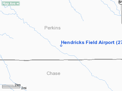
Location & QuickFacts
| FAA Information Effective: | 2008-09-25 |
| Airport Identifier: | 27NE |
| Airport Status: | Operational |
| Longitude/Latitude: | 101-47-44.6200W/40-43-21.9800N
-101.795728/40.722772 (Estimated) |
| Elevation: | 3450 ft / 1051.56 m (Estimated) |
| Land: | 0 acres |
| From nearest city: | 8 nautical miles SW of Grant, NE |
| Location: | Perkins County, NE |
| Magnetic Variation: | () |
Owner & Manager
| Ownership: | Privately owned |
| Owner: | Cecil Hendricks |
| Address: | Rr2 Box 71
Imperial, NE 69033 |
| Phone number: | 308-352-4097 |
| Manager: | Cecil Hendricks |
| Address: | Rr2 Box 71
Imperial, NE 69033 |
| Phone number: | 308-352-4097 |
Airport Operations and Facilities
| Airport Use: | Private |
| Segmented Circle: | No |
| Control Tower: | No |
| Sectional chart: | Cheyenne |
| Region: | ACE - Central |
| Boundary ARTCC: | ZDV - Denver |
| Tie-in FSS: | OLU - Columbus |
| FSS Toll Free: | 1-800-WX-BRIEF |
Runway Information
Runway 14/32
| Dimension: | 2600 x 100 ft / 792.5 x 30.5 m |
| Surface: | TURF, |
| |
Runway 14 |
Runway 32 |
| Traffic Pattern: | Left | Left |
|
Radio Navigation Aids
| ID |
Type |
Name |
Ch |
Freq |
Var |
Dist |
| GGF | NDB | Grant | | 359.00 | 09E | 9.4 nm |
| IML | NDB | Imperial | | 283.00 | 09E | 14.8 nm |
| HEQ | NDB | Heginbotham | | 404.00 | 11E | 23.7 nm |
| CNP | NDB | Chappell | | 383.00 | 10E | 36.9 nm |
| OKS | NDB | Oshkosh | | 233.00 | 09E | 47.9 nm |
| SAE | VOR/DME | Searle | 39X | 110.20 | 11E | 23.8 nm |
| HCT | VORTAC | Hayes Center | 124X | 117.70 | 11E | 43.0 nm |
Remarks
- 60 FT PLINE 500 FT SW OF RY.
- PRVDD CLEAR 20:1 APCH SLOPE & CLEAR 7:1 TRANSITIONAL SLOPE.
Images and information placed above are from
http://www.airport-data.com/airport/27NE/
We thank them for the data!
|
|


