 |
|
Location & QuickFacts
| FAA Information Effective: | 2008-09-25 |
| Airport Identifier: | 4V6 |
| Airport Status: | Operational |
| Longitude/Latitude: | 102-42-04.3392W/42-40-55.9309N
-102.701205/42.682203 (Estimated) |
| Elevation: | 3831 ft / 1167.69 m (Surveyed) |
| Land: | 47 acres |
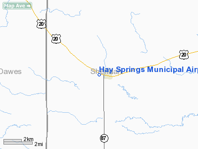
| From nearest city: | 0 nautical miles SW of Hay Springs, NE |
| Location: | Sheridan County, NE |
| Magnetic Variation: | 10E (1985) |
Owner & Manager
| Ownership: | Publicly owned |
| Owner: | City Of Hay Springs |
| Address: | Po Box B
Hay Springs, NE 69347 |
| Phone number: | 308-638-7275 |
| Manager: | Vern Platt |
| Address: | Po Box 410
Hay Springs, NE 69347 |
| Phone number: | 308-638-7379 |
Airport Operations and Facilities
| Airport Use: | Open to public |
| Wind indicator: | Yes |
| Segmented Circle: | No |
| Control Tower: | No |
| Lighting Schedule: | RDO-CTL
FOR MIRL RY 11/29 & ROTG BCN KEY 121.9. |
| Beacon Color: | Clear-Green (lighted land airport) |
| Landing fee charge: | No |
| Sectional chart: | Cheyenne |
| Region: | ACE - Central |
| Boundary ARTCC: | ZDV - Denver |
| Tie-in FSS: | OLU - Columbus |
| FSS on Airport: | No |
| FSS Toll Free: | 1-800-WX-BRIEF |
| NOTAMs Facility: | OLU (NOTAM-d service avaliable) |
| Federal Agreements: | 1 |
Airport Communications
Airport Services
| Airframe Repair: | NONE |
| Power Plant Repair: | NONE |
| Bottled Oxygen: | NONE |
| Bulk Oxygen: | NONE |
Runway Information
Runway 11/29
| Dimension: | 2750 x 300 ft / 838.2 x 91.4 m |
| Surface: | TURF, Good Condition |
| Edge Lights: | Medium |
| |
Runway 11 |
Runway 29 |
| Traffic Pattern: | Left | Left |
| Displaced threshold: | 0.00 ft | 100.00 ft |
| Obstruction: | 40 ft pline, 1000.0 ft from runway, 200 ft left of centerline, 25:1 slope to clear | 38 ft pole, 675.0 ft from runway, 125 ft right of centerline, 17:1 slope to clear
APCH RATIO 20:1 TO DSPLCD THLD. |
|
Radio Navigation Aids
| ID |
Type |
Name |
Ch |
Freq |
Var |
Dist |
| HIN | NDB | Whitney | | 275.00 | 11E | 19.4 nm |
| GRN | NDB | Gordon | | 414.00 | 09E | 24.1 nm |
| ALU | NDB | Alliance | | 380.00 | 11E | 38.7 nm |
| CDR | VOR/DME | Chadron | 081X | 113.40 | 13E | 28.0 nm |
| AIA | VOR/DME | Alliance | 055X | 111.80 | 11E | 37.9 nm |
Images and information placed above are from
http://www.airport-data.com/airport/4V6/
We thank them for the data!
| General Info
|
| Country |
United States
|
| State |
NEBRASKA
|
| FAA ID |
4V6
|
| Latitude |
42-40-44.899N
|
| Longitude |
102-42-16.645W
|
| Elevation |
3831 feet
|
| Near City |
HAY SPRINGS
|
We don't guarantee the information is fresh and accurate. The data may
be wrong or outdated.
For more up-to-date information please refer to other sources.
|
|


